Shawswick Township, Lawrence County, Indiana
Shawswick Township is one of nine townships in Lawrence County, Indiana, United States. As of the 2010 census, its population was 20,469 and it contained 9,653 housing units.[2]
Shawswick Township | |
|---|---|
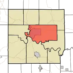 Location in Lawrence County | |
| Coordinates: 38°51′N 86°26′W | |
| Country | |
| State | |
| County | Lawrence |
| Government | |
| • Type | Indiana township |
| • Trustee | Millard Jones[1] |
| Area | |
| • Total | 69.87 sq mi (181.0 km2) |
| • Land | 69.52 sq mi (180.1 km2) |
| • Water | 0.34 sq mi (0.9 km2) 0.49% |
| Elevation | 686 ft (209 m) |
| Population (2010) | |
| • Total | 20,469 |
| • Density | 294.4/sq mi (113.7/km2) |
| ZIP codes | 47421, 47436, 47451 |
| GNIS feature ID | 0453842 |
History
Shawswick Township was established in 1818.[3] The township was named from a combination of the surnames Shaw and Wick. Wick was the name of a judge and Shaw was the name of a war hero; the final name Shawswick was formed in a compromise.[4]
The Helton-Mayo Farm was listed in the National Register of Historic Places in 1995.[5]
Geography
According to the 2010 census, the township has a total area of 69.87 square miles (181.0 km2), of which 69.52 square miles (180.1 km2) (or 99.50%) is land and 0.34 square miles (0.88 km2) (or 0.49%) is water.[2]
Unincorporated towns
- Crawford at 38.8459°N 86.3972°W
- East Oolitic at 38.8989°N 86.5119°W
- Englewood at 38.8445°N 86.4980°W
- Erie at 38.8826°N 86.3814°W
- Riverview at 38.8423°N 86.5417°W
- Shawswick at 38.8956°N 86.4144°W
(This list is based on USGS data and may include former settlements.)
Cemeteries
The township contains these nine cemeteries: Beech Grove, Breckinridge, Crawford, Green Hill, Ikerd, Scoggan, Sherril, Starr and Williams.
Major highways
Airports and landing strips
- Virgil I Grissom Municipal Airport
School districts
- North Lawrence Community Schools
Political districts
- Indiana's 4th congressional district
- State House District 62
- State House District 65
- State Senate District 44
References
- "Shawswick Township, Lawrence County, Indiana". Geographic Names Information System. United States Geological Survey. Retrieved 2009-10-08.
- United States Census Bureau 2008 TIGER/Line Shapefiles
- IndianaMap
- https://lawrencecounty.in.gov/government/township-trustees
- "Population, Housing Units, Area, and Density: 2010 - County -- County Subdivision and Place -- 2010 Census Summary File 1". United States Census. Archived from the original on 2020-02-12. Retrieved 2013-05-10.
- History of Lawrence, Orange, and Washington Counties, Indiana: From the Earliest Time to the Present. Higginson Book Company. 1884. pp. 59.
- History of Lawrence and Monroe Counties, Indiana: Their People, Industries, and Institutions. B.F. Bowen. 1914. pp. 61.
- "National Register Information System". National Register of Historic Places. National Park Service. July 9, 2010.
External links
- Indiana Township Association
- United Township Association of Indiana
- City-Data.com page for Shawswick Township
Places adjacent to Shawswick Township, Lawrence County, Indiana | ||||||||||
|---|---|---|---|---|---|---|---|---|---|---|
| ||||||||||
Municipalities and communities of Lawrence County, Indiana, United States | ||
|---|---|---|
| Cities | Map of Indiana highlighting Lawrence County | |
| Town | ||
| Townships | ||
| CDPs | ||
| Unincorporated communities |
| |
| Former communities | ||
| ||