Bordj El Houasse
Bordj El Houasse (also written Bordj El Haouasse or Bordj El Haouès) is a town and commune in Djanet District, Illizi Province, Algeria. It is part of Djanet District. According to the 2008 census it has a population of 2,963,[1] up from 2,185 in 1998,[2] and an annual population growth rate of 3.2%.[1] Its municipal code is 3305.
Bordj El Houasse
ﺑﺮ ج اﻟﺤﻮاس | |
|---|---|
Town and Commune | |
 | |
 Location of Bordj El Houasse Commune within Djanet Province | |
 Bordj El Houasse Location of Bordj El Houasse within Algeria | |
| Coordinates: 24°52′44″N 8°26′35″E | |
| Country | |
| Province | Djanet |
| District | Djanet |
| Government | |
| • PMA Seats | 7 |
| Area | |
| • Total | 28,725 km2 (11,091 sq mi) |
| Population (2008)[1] | |
| • Total | 2,963 |
| • Density | 0.10/km2 (0.27/sq mi) |
| Time zone | UTC+01 (CET) |
| ONS code | 3305 |
Geography
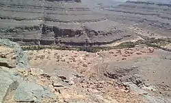
Bordj El Houasse lies at an elevation of 1,094 metres (3,589 ft) on a flat rocky plateau, beneath the Tassili n'Ajjer mountain range that rises 15 kilometres (9.3 mi) to the north and northwest. An intermittent river (wadi) passes by the town to the southwest, flowing from northwest to southeast out of the mountains.
Climate
Bordj El Houasse has a hot desert climate (Köppen climate classification BWh), with very hot summers and mild winters, and very little precipitation throughout the year.
| Climate data for Bordj El Houasse | |||||||||||||
|---|---|---|---|---|---|---|---|---|---|---|---|---|---|
| Month | Jan | Feb | Mar | Apr | May | Jun | Jul | Aug | Sep | Oct | Nov | Dec | Year |
| Average high °C (°F) | 19.1 (66.4) |
22.1 (71.8) |
26.4 (79.5) |
31.3 (88.3) |
35.6 (96.1) |
38.5 (101.3) |
38.2 (100.8) |
37.4 (99.3) |
35.8 (96.4) |
31.7 (89.1) |
26.3 (79.3) |
20.9 (69.6) |
30.3 (86.5) |
| Daily mean °C (°F) | 11.9 (53.4) |
14.6 (58.3) |
19 (66) |
23.8 (74.8) |
28.4 (83.1) |
31.6 (88.9) |
31.4 (88.5) |
30.7 (87.3) |
28.8 (83.8) |
24.5 (76.1) |
19.2 (66.6) |
13.9 (57.0) |
23.1 (73.6) |
| Average low °C (°F) | 4.8 (40.6) |
7.1 (44.8) |
11.7 (53.1) |
16.4 (61.5) |
21.2 (70.2) |
24.7 (76.5) |
24.6 (76.3) |
24.1 (75.4) |
21.9 (71.4) |
17.3 (63.1) |
12.1 (53.8) |
7.0 (44.6) |
16.1 (60.9) |
| Average precipitation mm (inches) | 1 (0.0) |
2 (0.1) |
4 (0.2) |
1 (0.0) |
2 (0.1) |
2 (0.1) |
0 (0) |
1 (0.0) |
2 (0.1) |
2 (0.1) |
2 (0.1) |
2 (0.1) |
21 (0.9) |
| Source: climate-data.org[3] | |||||||||||||
Transportation
The town of Bordj El Houasse lies at the intersection between the N3 highway (to Illizi in the north and Djanet to the east) and the N55 highway to the south (to Idlès and, via the N1, Tamanrasset). A local road also leads west to the village of Tabakat to the west.[4] The nearest airport is Djanet Inedbirene Airport.
Education
2.2% of the population has a tertiary education (the lowest rate in the province), and another 7.7% has completed secondary education.[5] The overall literacy rate is 60.9%, and is 77.6% among males and 40.5% among females; all three rates are the lowest in the province.[6]
References
- "Population: Illizi Wilaya" (PDF) (in French). Office National des Statistiques Algérie. Archived from the original (PDF) on 13 November 2011. Retrieved 21 May 2013.
- "Algeria Communes". Statoids. Retrieved 8 March 2013.
- "Climate data for: Bordj El Haouass". climate-data.org. Retrieved 21 May 2013.
- "Tabakat, Illizi, Algeria". Google Maps. Retrieved 21 May 2013.
- "Structure relative de la population résidente des ménages ordinaires et collectifs âgée de 6 ans et plus selon le niveau d'instruction et la commune de résidence" (PDF) (in French). Office National des Statistiques Algérie. Archived from the original (PDF) on 13 November 2011. Retrieved 21 May 2013.
- "Taux d'analphabétisme et taux d'alphabétisation de la population âgée de 15 ans et plus, selon le sexe et la commune de résidence " (PDF) (in French). Office National des Statistiques Algérie. Archived from the original (PDF) on 13 November 2011. Retrieved 21 May 2013.
- "Décret n° 84–365, fixant la composition, la consistance et les limites territoriale des communes. Wilaya d'El Oued" (PDF) (in French). Journal officiel de la République Algérienne. 19 December 1984. p. 1554. Archived from the original (PDF) on 2 March 2013. Retrieved 2 March 2013.
Places adjacent to Bordj El Houasse | ||||||||||
|---|---|---|---|---|---|---|---|---|---|---|
| ||||||||||
.svg.png.webp)
