Boreen Point, Queensland
Boreen Point is a rural locality in the Shire of Noosa, Queensland, Australia.[2][3] In the 2016 census, Boreen Point had a population of 328 people.[1] The town of Boreen is located within the locality beside the lake (26.2844°S 152.9933°E),[4] but the town name is rarely used with Boreen Point being the name in common usage.
| Boreen Point Noosa, Queensland | |||||||||||||||
|---|---|---|---|---|---|---|---|---|---|---|---|---|---|---|---|
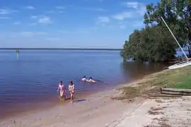 Main Beach, Boreen Point (Note dark Tannin discolouration of the water) | |||||||||||||||
 Boreen Point | |||||||||||||||
| Coordinates | 26.2816°S 152.9847°E | ||||||||||||||
| Population | 328 (2016 census)[1] | ||||||||||||||
| • Density | 61.9/km2 (160.3/sq mi) | ||||||||||||||
| Postcode(s) | 4565 | ||||||||||||||
| Area | 5.3 km2 (2.0 sq mi) | ||||||||||||||
| Time zone | AEST (UTC+10:00) | ||||||||||||||
| Location | 26 km (16 mi) NW of Noosa Heads | ||||||||||||||
| LGA(s) | Shire of Noosa | ||||||||||||||
| State electorate(s) | Noosa | ||||||||||||||
| Federal Division(s) | Wide Bay | ||||||||||||||
| |||||||||||||||
Geography
Boreen Point is north of Tewantin on the Sunshine Coast.
One of Boreen Point's major attractions is Lake Cootharaba, a very large, shallow lake that is recognised nationally for its fantastic weather for sailing and windsurfing. The lake leads from the Noosa River and also up to national parks.
History
The name comes from an Aboriginal word from the tribes around Moreton Bay which refers to the pathway that led between two bora rings.[5]
Boreen Point is home to the Apollonian Hotel, a historic inn that was moved from Gympie, Queensland and rebuilt in Boreen Point.
Although currently and historically within the local government area of Shire of Noosa, between 2008 and 2013 Boreen Point was within Sunshine Coast Region following a controversial amalgamation of local government areas that was subsequently reversed following a vote by local people to deamalgamate the Shire of Noosa.[6]
At the 2011 census Boreen Point recorded a population of 264 people.[7]
In the 2016 census Boreen Point had a population of 328 people.[1]
Amenities
The Shire of Noosa operates a mobile library service on a weekly schedule in Orchard Avenue.[8]
References
- Australian Bureau of Statistics (27 June 2017). "Boreen Point (SSC)". 2016 Census QuickStats. Retrieved 20 October 2018.

- "Boreen Point – locality in Shire of Noosa (entry 48538)". Queensland Place Names. Queensland Government. Retrieved 24 January 2020.
- "Boreen Point – locality (entry 48538)". Queensland Place Names. Queensland Government. Retrieved 25 June 2017.
- "Boreen Point – town in Shire of Noosa (entry 3882)". Queensland Place Names. Queensland Government. Retrieved 7 July 2017.
- South East Queensland - Place Names Archived 22 August 2006 at the Wayback Machine 16 December 2006
- "Local Government". Sunshine Coast Regional Council. Retrieved 24 January 2020.
- Australian Bureau of Statistics (31 October 2012). "Boreen Point (State Suburb)". 2011 Census QuickStats. Retrieved 29 August 2015.
- "Noosa Mobile Library - Mobile Stops - Noosa Mobile Hours". Shire of Noosa. Retrieved 19 January 2018.
External links
| Wikimedia Commons has media related to Boreen Point, Queensland. |
- "Noosa Hinterland Localities". Queensland Places. University of Queensland.
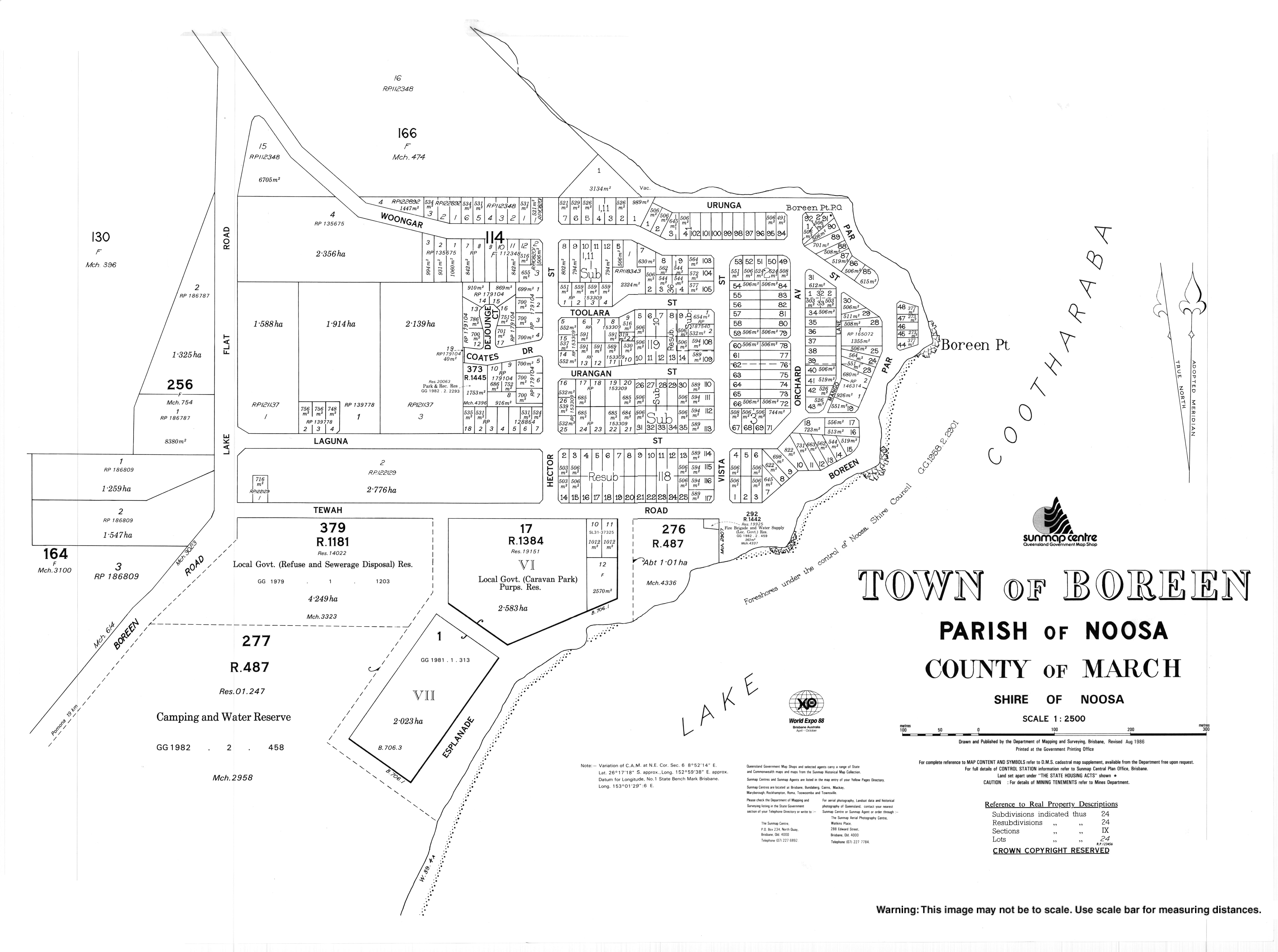
- "Town map of Boreen". 1986.