Borova, Kharkiv Oblast
Borova (Ukrainian: Борова, Russian: Боровая) is an urban-type settlement in Kharkiv Oblast, Ukraine. It serves as the administrative center of Borova Raion. Population: 5,277 (2020 est.)[1]
Borova
Борова | |
|---|---|
Urban-type settlement | |
 Borova | |
| Coordinates: 49°22′54″N 37°38′27″E | |
| Country | Ukraine |
| Oblast | Kharkiv Oblast |
| Raion | Borova Raion |
| Population (2020) | |
| • Total | 5,277 |
| Time zone | UTC+2 (EET) |
| • Summer (DST) | UTC+3 (EEST) |
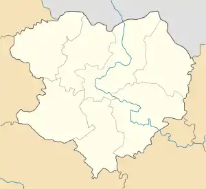
Borova is located to the southeast of Kharkiv.
Geography
Borova is situated on the eastern bank of Oskol reservoir of the Oskol.
Distance from Kharkiv via the railway 193 km, by the road 165 km. The core railway station namely Pereddonbasivska (approx. 1,5 km). Boyni and Pydliman are the nearest villages. Distance from Borova to Pydliman is about 2 km.
A pine massif is here.
History
It was a village in Kharkov Governorate of the Russian Empire.
A local newspaper is published here since 1934.[2]
During World War II it was under German occupation from July 1942 to February 1943.
Urban-type settlement since 1968.
In January 1989 the population was 7396 people.[3] In January 2013 the population was 5740 people.[4]
Economy
Transportation
The Central bus-station links villages and cities by the P-78 and P-79 roads. Borova is on the P-79 road which connects Krasnohrad via Izium with Kupiansk and further crosses into Russia. There are local roads as well.
Borova railway station is on the railway connecting Izium and Sloviansk with Kupiansk where it has further access to Kharkiv and to Valuyki and Liski in Russia.
Education
- High School
- School
- Musical School
- Palace of Culture
- Library's for children's and adults
- Sport complex
References
- "Чисельність наявного населення України (Actual population of Ukraine)" (PDF) (in Ukrainian). State Statistics Service of Ukraine. Retrieved 30 September 2020.
- № 3144. Трудовая слава // Летопись периодических и продолжающихся изданий СССР 1986—1990. Часть 2. Газеты. М., «Книжная палата», 1994. стр.411—412
- Всесоюзная перепись населения 1989 г. Численность городского населения союзных республик, их территориальных единиц, городских поселений и городских районов по полу
- Чисельність наявного населення України на 1 січня 2013 року. Державна служба статистики України. Київ, 2013. стор.97
| Raions | |||||
|---|---|---|---|---|---|
| Hromadas | |||||
| Cities |
| ||||
| |||||