Bothell East, Washington
Bothell East is a census-designated place (CDP) in Snohomish County, Washington, United States. The population was 8,018 at the 2010 census. Bothell East is one of several CDPs that were created out of the former North Creek CDP in 2010.[2]
Bothell East, Washington | |
|---|---|
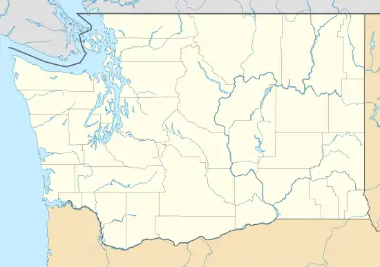 Bothell East, Washington Location of Bothell East, Washington. | |
| Coordinates: 47°48′23″N 122°11′4″W | |
| Country | United States |
| State | Washington |
| County | Snohomish |
| Area | |
| • Total | 2.05 sq mi (5.31 km2) |
| • Land | 2.05 sq mi (5.31 km2) |
| • Water | 0.00 sq mi (0.00 km2) |
| Elevation | 387 ft (118 m) |
| Population (2010) | |
| • Total | 8,018 |
| • Density | 3,907.4/sq mi (1,508.7/km2) |
| Time zone | UTC-8 (Pacific (PST)) |
| • Summer (DST) | UTC-7 (PDT) |
| GNIS feature ID | 2584947[1] |
Bothell East, along with Bothell West, are recognized as part of Bothell.
Geography
Bothell East is located at 47°48′23″N 122°11′4″W (47.806511, -122.184306).[3]
According to the United States Census Bureau, the CDP has a total area of 2.05 square miles (5.31 km2), all of it land.
References
- "US Board on Geographic Names". United States Geological Survey. 2007-10-25. Retrieved 2008-01-31.
- "Washington: 2010 Population and Housing Unit Counts" (PDF). United States Census Bureau. Retrieved 26 February 2013.
- "US Gazetteer files: 2010, 2000, and 1990". United States Census Bureau. 2011-02-12. Retrieved 2011-04-23.
Municipalities and communities of Snohomish County, Washington, United States | ||
|---|---|---|
| Cities | 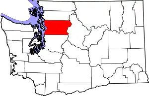 Map of Washington highlighting Snohomish County | |
| Towns | ||
| CDPs |
| |
| Other unincorporated communities | ||
| Indian reservation | ||
| Military bases | ||
| Ghost town | ||
| Footnotes | ‡This populated place also has portions in an adjacent county or counties | |
| ||
This article is issued from Wikipedia. The text is licensed under Creative Commons - Attribution - Sharealike. Additional terms may apply for the media files.