Index, Washington
Index is a town in Snohomish County, Washington, United States. The population was 178 at the 2010 census.
Index, Washington | |
|---|---|
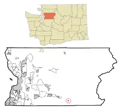 Location of Index, Washington | |
| Coordinates: 47°49′15″N 121°33′14″W | |
| Country | United States |
| State | Washington |
| County | Snohomish |
| Incorporated | October 11, 1907 |
| Government | |
| • Type | Mayor–council |
| • Mayor | Norm Johnson |
| Area | |
| • Total | 0.23 sq mi (0.59 km2) |
| • Land | 0.23 sq mi (0.59 km2) |
| • Water | 0.00 sq mi (0.00 km2) |
| Elevation | 577 ft (176 m) |
| Population | |
| • Total | 178 |
| • Estimate (2019)[3] | 211 |
| • Density | 917.39/sq mi (354.70/km2) |
| Time zone | UTC-8 (Pacific (PST)) |
| • Summer (DST) | UTC-7 (PDT) |
| ZIP code | 98256 |
| Area code | 360 |
| FIPS code | 53-33175 |
| GNIS feature ID | 1521157[4] |
History
Prior to settlement by White Americans, the Skykomish lived in the area between Sultan and Index. The Skykomish had a village along the north bank of the river named xɬ'xausalt, located at the present site of Index.[5]
Logging and lumber booms in the latter half of the 19th century led to the growth of minor settlements in the eastern part of what became Snohomish County in 1861. A gold strike in 1889 at nearby Monte Cristo fueled another influx of prospectors and settlers.[6] Index was founded in 1889 on the homestead of Amos Gunn in 1889, whose home was also a hotel for prospectors and surveyors.[7] The town was named for nearby Mount Index (later renamed Baring Mountain),[8] itself named for its resemblance to an index finger.[7][9] The settlement gained a post office in 1891 and saw major growth after the arrival of the Great Northern Railway. Gunn filed his town plat for Index on April 25, 1893, three months before a major fire on July 22 destroyed most of its buildings.[10]
Index was officially incorporated on October 11, 1907. Its population peaked during the decade at 1,000 and has since declined to 200.[7][11] The Index area had few jobs and services, with only a single restaurant and general store by the 1980s to serve a population of around 150.[12]
The Snohomish County Public Utility District had planned to build a hydroelectric power plant at Sunset Falls near Index in the early 2010s, but abandoned the project after it was opposed by environmentalists and local residents.[13]
Geography
Index is located in the western foothills of the Cascade Mountains; the summit of Mount Index is located 3 miles (4.8 km) south of the town. The Index Town Walls, granite cliffs up to 500 feet (150 m) high, are located on the northern edge of the town. These walls are popularly used for rock climbing, offering a variety of high-quality cracks for this purpose.[14] According to the United States Census Bureau, the town has a total area of 0.23 square miles (0.60 km2), all of it land.[15]
Index is located on the North Fork Skykomish River, just above its confluence with the main channel of the Skykomish River. The Skykomish River's Sunset Falls, a nearly 300-foot-long (91 m) granite chute that drops some 100 feet (30 m), is located approximately 1 mile (1.6 km) from the town (on the South Fork Skykomish River). In December 1980, the Skykomish River flooded the town and destroyed eight homes.[16]
The town is located 1 mile (1.6 km) north of US Highway 2, approximately 25 miles (40 km) west of Stevens Pass. The BNSF railroad, formerly the Great Northern Railway, runs through the middle of the town. Index was once an important stop for the mining (particularly Monte Cristo and Galena) and timber activities north of its location.
Demographics
| Historical population | |||
|---|---|---|---|
| Census | Pop. | %± | |
| 1910 | 417 | — | |
| 1920 | 412 | −1.2% | |
| 1930 | 381 | −7.5% | |
| 1940 | 217 | −43.0% | |
| 1950 | 211 | −2.8% | |
| 1960 | 158 | −25.1% | |
| 1970 | 169 | 7.0% | |
| 1980 | 147 | −13.0% | |
| 1990 | 139 | −5.4% | |
| 2000 | 157 | 12.9% | |
| 2010 | 178 | 13.4% | |
| 2019 (est.) | 211 | [3] | 18.5% |
| U.S. Decennial Census[17] U.S. Census Estimate (2019)[18] | |||
Index has a small population of around 200 permanent residents, many of whom are retirees or work locally, alongside seasonal residents living in vacation homes.[19] The town's population has declined since its peak in the 1890s of 1,000 residents.[11]
2010 census
As of the 2010 U.S. census, there were 178 people, 80 households, and 44 families living in the town. The population density was 773.9 inhabitants per square mile (298.8/km2). There were 116 housing units at an average density of 504.3 per square mile (194.7/km2). The racial makeup of the town was 95.5% White, 1.7% Asian, 0.6% Pacific Islander, 0.6% from other races, and 1.7% from two or more races. Hispanic or Latino of any race were 4.5% of the population.[2]
There were 80 households, of which 26.3% had children under the age of 18 living with them, 41.3% were married couples living together, 12.5% had a female householder with no husband present, 1.3% had a male householder with no wife present, and 45.0% were non-families. 41.3% of all households were made up of individuals, and 12.5% had someone living alone who was 65 years of age or older. The average household size was 2.23 and the average family size was 3.02.[2]
The median age in the town was 42 years. 22.5% of residents were under the age of 18; 5.6% were between the ages of 18 and 24; 24.1% were from 25 to 44; 35.5% were from 45 to 64; and 12.4% were 65 years of age or older. The gender makeup of the town was 47.2% male and 52.8% female.[2]
2000 census
As of the 2000 census, there were 157 people, 75 households, and 39 families living in the town. The population density was 620.3 people per square mile (242.5/km2). There were 100 housing units at an average density of 395.1 per square mile (154.4/km2). The racial makeup of the town was 95.54% White, 1.27% Native American, 1.27% Asian, and 1.91% from two or more races. Hispanic or Latino of any race were 1.91% of the population.[20]
As of the 2000 census, there were 75 households, out of which 30.7% had children under the age of 18 living with them, 34.7% were married couples living together, 10.7% had a female householder with no husband present, and 48.0% were non-families. 36.0% of all households were made up of individuals, and 5.3% had someone living alone who was 65 years of age or older. The average household size was 2.09, and the average family size was 2.67.[20]
In the town, the population was spread out, with 22.3% under the age of 18, 3.2% from 18 to 24, 29.9% from 25 to 44, 37.6% from 45 to 64, and 7.0% who were 65 years of age or older. The median age was 43 years. For every 100 females, there were 103.9 males. For every 100 females age 18 and over, there were 110.3 males.[20]
The median income for a household in the town was $43,125, and the median income for a family was $32,000. Males had a median income of $32,500 versus $13,750 for females. The per capita income for the town was $22,023. About 17.5% of families and 16.9% of the population were below the poverty line, including 29.3% of those under the age of 18 and none of those 65 or over.[20]
Economy
The local economy has switched from extraction industries to tourism. Paradise Sound maintains a recording studio called Studio X where Jerry Cantrell and The Walkabouts have recorded albums.
Government and politics
Index is an incorporated town with a mayor–council form of government. The mayor and five-member town council are elected to four-year terms by registered residents. Index's government has three employed positions: a clerk for day-to-day management, a maintenance person, and a water distribution manager to oversee the water supply. The town contracts with the county government to provide additional services.[11]
Culture
For many years, the Red Men Hall fraternal lodge, the largest building in town, served as the center for social life.[21] It collapsed in 2009 after a severe snowstorm and was subsequently demolished. Another historic building in Index, the Bush House, was named an endangered landmark by the Washington Trust for Historic Preservation.[22]
Infrastructure
Transportation
Index is located 1 mile (1.6 km) northeast of U.S. Route 2 (US 2), which connects Everett to the Skykomish Valley and Stevens Pass. The town is connected to US 2 by Index–Galena Road,[23] which continues northeast into the Wild Sky Wilderness, although a flood in November 2006 washed out a section and has not been repaired.[24]
The town's road bridge over the Skykomish River North Fork was built in 1922 and rehabilitated in 1981. It was replaced by a new bridge in 1999.
References
- "2019 U.S. Gazetteer Files". United States Census Bureau. Retrieved August 7, 2020.
- "Decennial Census Tables". United States Census Bureau. September 2011. Retrieved May 26, 2020.
- "Population and Housing Unit Estimates". United States Census Bureau. May 24, 2020. Retrieved May 27, 2020.
- "Index, Washington". Geographic Names Information System. United States Geological Survey. September 10, 1979. Retrieved May 26, 2020.
- Hollenbeck, Jan L.; Moss, Madonna (1987). A Cultural Resource Overview: Prehistory, Ethnography and History: Mt. Baker-Snoqualmie National Forest. United States Forest Service. pp. 161–164. OCLC 892024380. Retrieved January 5, 2019 – via HathiTrust.
- http://historylink.org/index.cfm?DisplayPage=output.cfm&file_id=7877
- Graydon, Don (September 6, 1997). "Small town 'on brink of change'". Seattle Post-Intelligencer. p. D1.
- Meany, Edmond S. (1923). Origin of Washington geographic names. Seattle: University of Washington Press. p. 119.
- Phillips, James W. (1971). Washington State Place Names. University of Washington Press. p. 65. ISBN 0-295-95158-3. OCLC 1052713900. Retrieved November 18, 2019 – via The Internet Archive.
- Whitfield, William M. (1926). History of Snohomish County, Washington. Chicago: Pioneer Historical Publishing Company. p. 610. OCLC 8437390. Retrieved April 30, 2020 – via HathiTrust.
- Snohomish County Natural Hazard Mitigation Plan Update, Volume 2: Planning Partner Annexes (Report). Snohomish County. September 2015. p. 7-1. Retrieved April 12, 2020.
- Shaw, Linda (October 28, 1987). "Main Streets: Index plays against rugged backdrop". The Seattle Times. p. H1.
- Stevick, Eric (April 11, 2018). "Snohomish County PUD scraps Skykomish River hydroelectric dam". The Everett Herald. Retrieved March 2, 2019.
- Cramer, Darryl (2000). Sky Valley Rock. ISBN 0-9678531-0-9.
- "2018 U.S. Gazetteer Files". United States Census Bureau. Retrieved February 16, 2020.
- Gullien, Tomas (December 27, 1980). "Index residents keep wary eye on surging Skykomish". The Seattle Times. p. A3.
- "Census of Population and Housing". United States Census Bureau. Retrieved July 26, 2013.
- "Annual Estimates of the Resident Population for Incorporated Places in Washington: April 1, 2010 to July 1, 2019". United States Census Bureau. May 2020. Retrieved May 26, 2020.
- Sanders, Julia-Grace (May 23, 2020). "The town the virus seemed to miss: No cases counted in Index". The Everett Herald. Retrieved May 23, 2020.
- "Profile of General Demographic Characteristics: Index town, Washington" (PDF). United States Census Bureau. 2000. Retrieved May 26, 2020 – via Puget Sound Regional Council.
- Lindgren, Louise (2009-09-04). "Index - Thumbnail History". HistoryLink. Retrieved October 29, 2014.
- Smith, Debra (May 31, 2009). "Saving a historic hotel in Index". The Everett Herald. Archived from the original on June 5, 2009. Retrieved July 24, 2019.
- McQuaide, Mike (June 29, 2011). "A mile-by-mile driving, hiking and roadside-wonders guide to scenic Stevens Pass". The Seattle Times. Retrieved March 2, 2019.
- Haglund, Noah (January 15, 2018). "Work on damaged Index-Galena route could begin in 2019". The Everett Herald. Retrieved March 2, 2019.
External links
| Wikimedia Commons has media related to Index, Washington. |
Municipalities and communities of Snohomish County, Washington, United States | ||
|---|---|---|
| Cities | 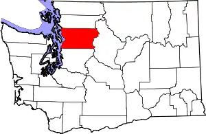 Map of Washington highlighting Snohomish County | |
| Towns | ||
| CDPs |
| |
| Other unincorporated communities | ||
| Indian reservation | ||
| Military bases | ||
| Ghost town | ||
| Footnotes | ‡This populated place also has portions in an adjacent county or counties | |
| ||
| Authority control |
|---|