Botkins, Ohio
Botkins is a village in Shelby County, Ohio, United States. The population was 1,155 at the 2010 census.
Botkins, Ohio | |
|---|---|
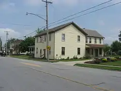 Streetside view of Shelby House in Botkins | |
 Seal | |
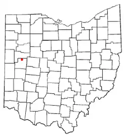 Location of Botkins, Ohio | |
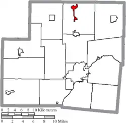 Location of Botkins in Shelby County | |
| Coordinates: 40°27′33″N 84°10′58″W | |
| Country | United States |
| State | Ohio |
| County | Shelby |
| Government | |
| • Mayor | Steve Woodruff |
| • Village Administrator | Randy Purdy |
| Area | |
| • Total | 1.27 sq mi (3.30 km2) |
| • Land | 1.26 sq mi (3.27 km2) |
| • Water | 0.01 sq mi (0.03 km2) |
| Elevation | 1,011 ft (308 m) |
| Population | |
| • Total | 1,155 |
| • Estimate (2019)[4] | 1,158 |
| • Density | 917.59/sq mi (354.33/km2) |
| Time zone | UTC-5 (Eastern (EST)) |
| • Summer (DST) | UTC-4 (EDT) |
| ZIP code | 45306 |
| Area code(s) | 937, 326 |
| FIPS code | 39-07832[5] |
| GNIS feature ID | 1064469[2] |
| Website | http://www.botkinsohio.com |
Botkins is located alongside Interstate 75 at Exit 104. Botkins is at the northern edge of Shelby County, immediately south of its border with Auglaize County. It also lies at the northern edge of the 937 area code.
History
Botkins was platted in 1858, and named for Richard Botkin, the original owner of the town site.[6] A post office called Botkins has been in operation since 1877.[7] The village was incorporated in 1881.[6]
Geography
Botkins is located at 40°27′33″N 84°10′58″W (40.459252, -84.182793).[8]
According to the United States Census Bureau, the village has a total area of 1.25 square miles (3.24 km2), of which 1.24 square miles (3.21 km2) is land and 0.01 square miles (0.03 km2) is water.[9]
The center of the solar eclipse of April 8, 2024, will travel over the northwest corner of Botkins.
Demographics
| Historical population | |||
|---|---|---|---|
| Census | Pop. | %± | |
| 1880 | 314 | — | |
| 1900 | 420 | — | |
| 1910 | 579 | 37.9% | |
| 1920 | 557 | −3.8% | |
| 1930 | 488 | −12.4% | |
| 1940 | 502 | 2.9% | |
| 1950 | 608 | 21.1% | |
| 1960 | 854 | 40.5% | |
| 1970 | 1,057 | 23.8% | |
| 1980 | 1,372 | 29.8% | |
| 1990 | 1,340 | −2.3% | |
| 2000 | 1,205 | −10.1% | |
| 2010 | 1,155 | −4.1% | |
| 2019 (est.) | 1,158 | [4] | 0.3% |
| U.S. Decennial Census[10] | |||
2010 census
As of the census[3] of 2010, there were 1,155 people, 480 households, and 315 families living in the village. The population density was 931.5 inhabitants per square mile (359.7/km2). There were 507 housing units at an average density of 408.9 per square mile (157.9/km2). The racial makeup of the village was 97.7% White, 0.4% African American, 0.1% Native American, 0.6% Asian, 0.1% Pacific Islander, and 1.0% from two or more races. Hispanic or Latino of any race were 0.7% of the population.
There were 480 households, of which 30.4% had children under the age of 18 living with them, 53.1% were married couples living together, 7.9% had a female householder with no husband present, 4.6% had a male householder with no wife present, and 34.4% were non-families. 30.4% of all households were made up of individuals, and 11.1% had someone living alone who was 65 years of age or older. The average household size was 2.41 and the average family size was 3.00.
The median age in the village was 37.8 years. 25.4% of residents were under the age of 18; 7.6% were between the ages of 18 and 24; 25.6% were from 25 to 44; 28.3% were from 45 to 64; and 13.2% were 65 years of age or older. The gender makeup of the village was 49.6% male and 50.4% female.
2000 census
As of the census[5] of 2000, there were 1,205 people, 463 households, and 330 families living in the village. The population density was 1,311.0 people per square mile (505.7/km2). There were 482 housing units at an average density of 524.4 per square mile (202.3/km2). The racial makeup of the village was 99.25% White, 0.33% African American, 0.17% from other races, and 0.25% from two or more races. Hispanic or Latino of any race were 0.58% of the population.
There were 463 households, out of which 32.8% had children under the age of 18 living with them, 57.9% were married couples living together, 8.9% had a female householder with no husband present, and 28.7% were non-families. 26.6% of all households were made up of individuals, and 11.9% had someone living alone who was 65 years of age or older. The average household size was 2.60 and the average family size was 3.18.
In the village, the population was spread out, with 27.5% under the age of 18, 10.0% from 18 to 24, 28.5% from 25 to 44, 20.3% from 45 to 64, and 13.6% who were 65 years of age or older. The median age was 35 years. For every 100 females there were 101.8 males. For every 100 females age 18 and over, there were 100.9 males.
The median income for a household in the village was $43,000, and the median income for a family was $53,750. Males had a median income of $34,464 versus $23,359 for females. The per capita income for the village was $18,880. About 1.8% of families and 3.6% of the population were below the poverty line, including 7.6% of those under age 18 and 3.2% of those age 65 or over.
Education
Botkins Local School District operates one elementary school and Botkins High School.[11]
Botkins has a public library, a branch of Shelby County Libraries.[12]
In pop culture
In the comic strip Big Nate, Botkins was where character Coach John grew up.
References
- "2019 U.S. Gazetteer Files". United States Census Bureau. Retrieved July 27, 2020.
- "US Board on Geographic Names". United States Geological Survey. 2007-10-25. Retrieved 2008-01-31.
- "U.S. Census website". United States Census Bureau. Retrieved 2013-01-06.
- "Population and Housing Unit Estimates". United States Census Bureau. May 24, 2020. Retrieved May 27, 2020.
- "U.S. Census website". United States Census Bureau. Retrieved 2008-01-31.
- Hitchcock, Almon Baldwin Carrington (1913). History of Shelby County, Ohio, and representative citizens. p. 342.
- "Shelby County". Jim Forte Postal History. Retrieved 24 December 2015.
- "US Gazetteer files: 2010, 2000, and 1990". United States Census Bureau. 2011-02-12. Retrieved 2011-04-23.
- "US Gazetteer files 2010". United States Census Bureau. Archived from the original on 2012-01-25. Retrieved 2013-01-06.
- "Census of Population and Housing". Census.gov. Retrieved June 4, 2015.
- "Homepage". Botkins Local School. Retrieved 3 March 2018.
- "Locations". Shelby County Libraries. Retrieved 3 March 2018.
External links
Municipalities and communities of Shelby County, Ohio, United States | ||
|---|---|---|
| City | 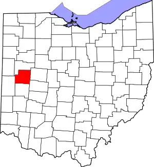 Map of Ohio highlighting Shelby County | |
| Villages | ||
| Townships | ||
| CDP | ||
| Unincorporated communities | ||
| Footnotes | ‡This populated place also has portions in an adjacent county or counties | |
| ||
| Authority control |
|
|---|