Bourne, Oregon
Bourne is a ghost town in Baker County, Oregon, United States about 7 miles (11 km) north of Sumpter in the Blue Mountains.[1] It lies on Cracker Creek and is within the Wallowa–Whitman National Forest. Platted in 1902,[2] the former gold mining boomtown is considered a ghost town today.[3]
Bourne, Oregon | |
|---|---|
Former unincorporated community | |
 Bourne, Oregon  Bourne, Oregon | |
| Coordinates: 44°49′28″N 118°11′51″W | |
| Country | United States |
| State | Oregon |
| County | Baker |
| Elevation | 5,374 ft (1,638 m) |
| Time zone | UTC-8 (Pacific (PST)) |
| • Summer (DST) | UTC-7 (PDT) |
| Area code(s) | 458 and 541 |
| GNIS feature ID | 1136088[1] |
Originally named "Cracker City",[3] Bourne is named after Senator Jonathan Bourne, Jr., who was interested in Eastern Oregon mines for a time.[4] Bourne post office was established in 1895 and closed in 1927.[4]
In 1910 Bourne town was listed as having a population of 77.[5]
See also
References
- "Bourne". Geographic Names Information System. United States Geological Survey. November 28, 1980. Retrieved November 30, 2016.
- Bailey, Barbara Ruth (1982). Main Street: Northeastern Oregon. Oregon Historical Society. p. 21. ISBN 0-87595-073-6.
- Potter, Miles (1976). "Mother Lode of the Blues". Oregon's Golden Years: Bonanza of the West. Caldwell, Idaho: Caxton Press. p. 138. ISBN 978-0-87004-254-6.
- McArthur, Lewis A.; McArthur, Lewis L. (2003) [1928]. Oregon Geographic Names (7th ed.). Portland, Oregon: Oregon Historical Society Press. p. 103. ISBN 978-0875952772.
- Benson, Frank; Olcott, Ben (1911). 1911 Oregon Blue Book. Salem Oregon: Willis S. Duniway, State Printer. p. 114.
External links
- Historic images of Bourne from the Baker County Library
- Images of Bourne from ghosttowngallery.com
Municipalities and communities of Baker County, Oregon, United States | ||
|---|---|---|
| Cities | 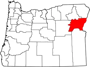 Baker County map | |
| Unincorporated communities | ||
| Ghost towns | ||
| Footnotes |
| |
| ||
This article is issued from Wikipedia. The text is licensed under Creative Commons - Attribution - Sharealike. Additional terms may apply for the media files.