Bowie, Texas
Bowie (/ˈbuːi/ BOO-ee)[3] is a town in Montague County, Texas, United States. The population was 5,218 at the 2010 census.[4]
Bowie, Texas | |
|---|---|
.jpg.webp) Downtown Bowie, Texas | |
 Location of Bowie, Texas | |
 | |
| Coordinates: 33°33′36″N 97°50′40″W | |
| Country | United States |
| State | Texas |
| County | Montague |
| Government | |
| • Type | Council-Manager |
| • City Council | Mayor Bill Miller Mayor Pro Tem Wayne Bell Chuck Malone Jason Love Thomas Kent Tami Buckmaster Arlen Bishop |
| • City Manager | Bert Cunningham |
| Area | |
| • Total | 5.54 sq mi (14.36 km2) |
| • Land | 5.52 sq mi (14.29 km2) |
| • Water | 0.02 sq mi (0.06 km2) |
| Elevation | 1,129 ft (344 m) |
| Population (2010) | |
| • Total | 5,218 |
| • Estimate (2019)[2] | 5,114 |
| • Density | 926.62/sq mi (357.79/km2) |
| Time zone | UTC-6 (Central (CST)) |
| • Summer (DST) | UTC-5 (CDT) |
| ZIP code | 76230 |
| Area code(s) | 940 |
| FIPS code | 48-09640 |
| GNIS feature ID | 1352736 |
| Website | www |
History
On July 22, 1881, Bowie was incorporated as a town in Montague County, Texas. (There is also a Bowie County, which includes Texarkana in northeastern Texas.) The town began to expand with the arrival of the Fort Worth and Denver Railway in 1882.[5] In 1884, four men robbed the First National Bank of Bowie and allegedly left with over $10,000 in gold coins. Townspeople gave chase and eventually captured the robbers, who were hanged for their crimes.[6] By 1913, the town had a population of more than 5000, and included the Bowie Commercial College.[7]
U.S. President Franklin D. Roosevelt visited the town on his train on July 11, 1938. He ceremonially purchased biscuits from businessman Amon G. Carter of Fort Worth, who had grown up in Bowie.[8] On August 19, 1941, Rex Beard, Jr., robbed the First National Bank of Bowie and was captured in December of that same year.[9] An EF2 tornado hit the town of Bowie on May 22, 2020. It was the first recorded tornado in Bowie.
Geography
According to the United States Census Bureau, Bowie has a total area of 5.52 square miles (14.3 km2).[4]
Demographics
| Historical population | |||
|---|---|---|---|
| Census | Pop. | %± | |
| 1890 | 1,486 | — | |
| 1900 | 2,600 | 75.0% | |
| 1910 | 2,874 | 10.5% | |
| 1920 | 3,179 | 10.6% | |
| 1930 | 3,131 | −1.5% | |
| 1940 | 3,470 | 10.8% | |
| 1950 | 4,544 | 31.0% | |
| 1960 | 4,566 | 0.5% | |
| 1970 | 5,185 | 13.6% | |
| 1980 | 5,610 | 8.2% | |
| 1990 | 4,990 | −11.1% | |
| 2000 | 5,219 | 4.6% | |
| 2010 | 5,218 | 0.0% | |
| 2019 (est.) | 5,114 | [2] | −2.0% |
| U.S. Decennial Census[10] | |||
As of the 2010 United States Census, there were 5,218 people and 2,489 housing units in the town. The population density was 945.6 people per square mile. There were 2,090 households in the town. The average household size was 2.32 persons and the average family size was 2.99. The racial makeup of the town was 91.9% White, 0.2% African American, 1.0% Native American, 0.7% Asian, 0.1% Pacific Islander, and 2.0% from two or more races. Hispanic or Latino of any race were 11.6% of the population. The median income for a household in the town was $33,846. The per capita income for the town was $19,063.[4]
Education
The town is served by the Bowie Independent School District as well as a branch campus of North Central Texas College.
Gallery
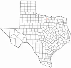
 "Nostalgia" is the name of a restaurant and assorted antique store in downtown Bowie.
 Children at Jim Bowie Days Rodeo
.jpg.webp) Jim Bowie Days Rodeo
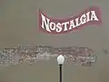
Jim Bowie Days Rodeo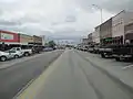 A look at downtown Bowie (2013)
.jpg.webp) Bowie Public Library
Bowie Public Library U.S. Post Office in Bowie
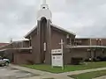 First Baptist Church, senior pastor Mike Henson (2013)
 Bible Baptist Church off Texas State Highway 59, established 1952; Steve Summers, pastor (2013)
.jpg.webp) St. Peter Lutheran Church at 906 Highway 59 North in Bowie; pastor Larry Knobloch (2013)
St. Peter Lutheran Church at 906 Highway 59 North in Bowie; pastor Larry Knobloch (2013)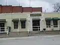 Bowie City Hall
 Free Will Baptist Church - Photo by Michael Eichler
Climate
The climate in this area is characterized by hot, humid summers and generally mild to cool winters. According to the Köppen Climate Classification system, Bowie has a humid subtropical climate, abbreviated "Cfa" on climate maps.[11]
Notes
- "2019 U.S. Gazetteer Files". United States Census Bureau. Retrieved August 7, 2020.
- "Population and Housing Unit Estimates". United States Census Bureau. May 24, 2020. Retrieved May 27, 2020.
- "Texas Almanac Pronunciation Guide" (PDF). Texas Almanac. Texas State Historical Association. Archived from the original (PDF) on 2015-07-24. Retrieved 2015-08-09.
Buchanan Dam — buhk hăn uhn DĂM
- Census 2012.
- Minor 2012.
- Jameson 1991.
- Potter 1913, p. 182.
- Roosevelt 1938.
- Brown 2009.
- "Census of Population and Housing". Census.gov. Archived from the original on April 26, 2015. Retrieved June 4, 2015.
- Climate Summary for Bowie, Texas
References
- "Bowie (city), Texas". United States Census Bureau. 2013-06-27. Archived from the original on 2013-11-11. Retrieved 2013-11-11.
- Brown, Max (2009). "The History of the Old Jail at Montague". Montague County History. Retrieved 2012-04-08.
- Jameson, W. C. (1991). "Bowie Bank Robbery Loot on the Red River". Buried Treasures of Texas. August House. pp. 97–100. ISBN 9780874831788. Retrieved 2012-04-08.
- Minor, David (2012). "Bowie, TX". Texas State Historical Association. Retrieved 2012-04-08.
- Potter, W.R. (1913). History of Montague County. Austin, Texas: E. L. Steck. OCLC 2654305. Retrieved 2012-04-07.
- Roosevelt, Franklin (1938-07-11). Informal Remarks of the President in Bowie, Texas (Speech). From the Platform of his special train. Bowie, Texas. Retrieved 2012-04-08.
External links
Municipalities and communities of Montague County, Texas, United States | ||
|---|---|---|
| Cities | 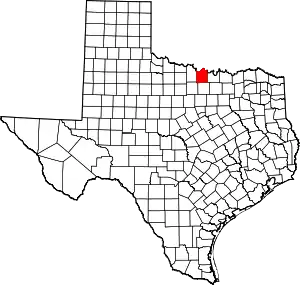 Montague County map | |
| CDPs | ||
| Other unincorporated communities | ||
| Ghost town | ||
| ||
| Authority control |
|---|