Bréal-sous-Montfort
Bréal-sous-Montfort (Breton: Breal-Moñforzh) is a commune in the Ille-et-Vilaine department in the region in Brittany in northwestern France.
Bréal-sous-Montfort
Breal-Moñforzh | |
|---|---|
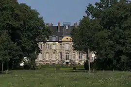 Château du Molant | |
.svg.png.webp) Coat of arms | |
Location of Bréal-sous-Montfort 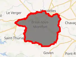
| |
 Bréal-sous-Montfort 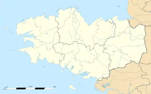 Bréal-sous-Montfort | |
| Coordinates: 48°02′55″N 1°51′55″W | |
| Country | France |
| Region | Brittany |
| Department | Ille-et-Vilaine |
| Arrondissement | Rennes |
| Canton | Le Rheu |
| Intercommunality | Pays de Brocéliande |
| Government | |
| • Mayor (2014–2020) | Bernard Éthore |
| Area 1 | 33.82 km2 (13.06 sq mi) |
| Population (2017-01-01)[1] | 6,131 |
| • Density | 180/km2 (470/sq mi) |
| Time zone | UTC+01:00 (CET) |
| • Summer (DST) | UTC+02:00 (CEST) |
| INSEE/Postal code | 35037 /35310 |
| Elevation | 19–82 m (62–269 ft) |
| 1 French Land Register data, which excludes lakes, ponds, glaciers > 1 km2 (0.386 sq mi or 247 acres) and river estuaries. | |
It is located in the outer southwest district of Rennes, near the Broceliand woods.
Geography
The Meu forms the commune's northeastern border.
Population
Inhabitants of Bréal-sous-Montfort are called Bréalais in French.
| Year | Pop. | ±% |
|---|---|---|
| 1962 | 1,616 | — |
| 1968 | 1,771 | +9.6% |
| 1975 | 2,518 | +42.2% |
| 1982 | 3,117 | +23.8% |
| 1990 | 3,399 | +9.0% |
| 1999 | 3,825 | +12.5% |
| 2008 | 4,841 | +26.6% |
References
- "Populations légales 2017". INSEE. Retrieved 6 January 2020.
External links
| Wikimedia Commons has media related to Bréal-sous-Montfort. |
- Official website (in French)
- Base Mérimée: Search for heritage in the commune, Ministère français de la Culture. (in French)
- Cultural Heritage (in French)
- Mayors of Ille-et-Vilaine Association (in French)
| Authority control |
|---|
This article is issued from Wikipedia. The text is licensed under Creative Commons - Attribution - Sharealike. Additional terms may apply for the media files.