Brebes, Brebes
Brebes District is a district (Indonesian: Kecamatan) and the capital of Brebes Regency, Central Java, Indonesia. It is bordered by Java Sea to the north, Tegal City (West Tegal District and Margadana District) and Tegal Regency (Dukuhturi District and Adiwerna District) to the east, Jatibarang District to the south and Wanasari District to the west. It covers 92.23 km2 and had a population of 157,1488 at the 2010 Census;[3] the latest official estimate (as at mid 2019) is 160,816.[4]
Brebes District
Kecamatan Brebes | |
|---|---|
_montage_2015.jpg.webp) Sights in Brebes (clockwise from top) : Randusanga Beach, Ciblon Waterboom, Alun alun Brebes, Great Mosque of Brebes, Karangbirahi Stadium | |
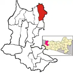 Location Brebes District in Brebes Regency | |
| Coordinates: 6°52′30″S 109°03′10″E | |
| Country | Indonesia |
| Province | Central Java |
| Regency | Brebes |
| Government | |
| • Camat | M. Amrin Alfi Umar, S.IP, M.Si[1] |
| Area | |
| • Total | 92.23 km2 (35.61 sq mi) |
| Population (mid 2019)[2] | |
| • Total | 160,816 |
| • Density | 1,700/km2 (4,500/sq mi) |
| Time zone | UTC+07.00 (WIB) |
| Postal Code | 52211 to 52220, 52251 |
| Area code(s) | 0283 |
Administrative Villages
Brebes District is divided into 23 administrative villages (5 kelurahan and 18 desa).
Desa
- Banjaranyar
- Kaligangsa Kulon
- Kaligangsa Wetan
- Kalimati
- Kaliwlingi
- Kedunguter
- Krasak
- Lembarawa
- Padasugih
- Pagejugan
- Pemaron
- Pulosari
- Randusanga Kulon
- Randusanga Wetan
- Sigambir
- Tengki
- Terlangu
- Wangandalem
Kelurahan
- Brebes
- Gandasuli
- Limbangan Kulon
- Limbangan Wetan
- Pasar Batang
References
- Ita (3 May 2015). "4.491 Relawan Kader Pendata Mulai Lakukan Pendataan Keluarga" (in Indonesian). Vimanews. Retrieved 12 May 2015.
- Badan Pusat Statistik, Jakarta, 2020.
- Biro Pusat Statistik, Jakarta, 2011.
- Badan Pusat Statistik, Jakarta, 2020.
This article is issued from Wikipedia. The text is licensed under Creative Commons - Attribution - Sharealike. Additional terms may apply for the media files.
