Breich
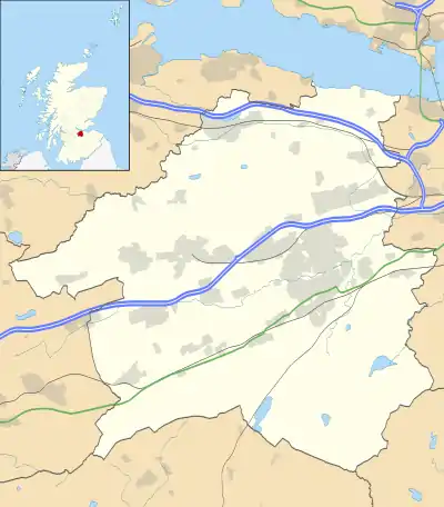
Breich is a small village lying in the western part of West Lothian, Scotland.[1][2] It lies on the A71, the Edinburgh to Ayrshire road, which also goes to the large town of Livingston 7 miles to the east. It is situated at the junction of the A706, to Lanark, Bathgate and Linlithgow.
| Breich | |
|---|---|
 The A71 through Breich | |
 Breich Location within West Lothian | |
| Population | 209 |
| OS grid reference | NS963608 |
| Civil parish | |
| Council area | |
| Country | Scotland |
| Sovereign state | United Kingdom |
| Post town | WEST CALDER |
| Postcode district | EH55 |
| Dialling code | 01501 |
| Police | Scotland |
| Fire | Scottish |
| Ambulance | Scottish |
| UK Parliament | |
| Scottish Parliament | |
Etymology
Breich is named after the nearby Breich Water.[3] This name may be derived from Brittonic *brïch,[4] meaning "variegated, mottled, speckled" (Welsh brych),[4] or the early Gaelic cognate brecc.[4] Derivation from Gaelic breac, meaning "trout", is possible,[4] but the earliest form is Brech from 1199.[4]
Amenities and features
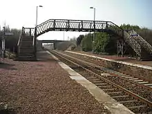
The village consists mainly of a single row of houses by the roadside, with some new builds behind the single row, and has one pub. It also has a Roadside Snack Bar called Big T's at the Breich Cross layby. Breich railway station is on the Shotts Line, and is served by one eastbound and one westbound train per day. A nearby coal bing (spoil heap) was used as a speedway training track in the late 1960s.
Media
The Channel 4 TV comedy series Absolutely used Breich as a location for the fictional town of Stoneybridge, showing photographs of the houses by the roadside in a mock promotional video. It also used the nearby 'Five Sisters' spoil heap in the same scene.
References
- Ordnance Survey: Landranger map sheet 65 Falkirk & Linlithgow (Dunfermline) (Map). Ordnance Survey. 2012. ISBN 9780319229705.
- "Ordnance Survey: 1:50,000 Scale Gazetteer" (csv (download)). www.ordnancesurvey.co.uk. Ordnance Survey. 1 January 2016. Retrieved 30 January 2016.
- "View: Linlithgowshire Sheet XII.SW (includes: West Calder; Whitburn) - Ordnance Survey Six-inch 2nd and later editions, Scotland, 1892-1960". maps.NLS.uk. Retrieved 6 December 2017.
- James, Alan G. "A Guide to the Place-Name Evidence - Guide to the Elements" (PDF). Scottish Place Name Society - The Brittonic Language in the Old North. Retrieved 25 October 2018.
- "This Scottish railway station is used by just three passengers a week". RailStaff. Retrieved 4 June 2019.
External links
| Wikimedia Commons has media related to Breich. |
- Museum of the Scottish shale oil industry - Breich No. 1 & 2 pits
- Canmore - Woodmuir Colliery, Pits Nos.5 and 6 site record
