Brombachtal
Brombachtal is a community in the Odenwaldkreis (district) in Hesse, Germany.
Brombachtal | |
|---|---|
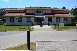 Town hall | |
 Coat of arms | |
Location of Brombachtal within Odenwaldkreis district  | |
 Brombachtal 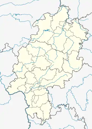 Brombachtal | |
| Coordinates: 49°44′N 08°58′E | |
| Country | Germany |
| State | Hesse |
| Admin. region | Darmstadt |
| District | Odenwaldkreis |
| Government | |
| • Mayor | Willi Kredel (SPD) |
| Area | |
| • Total | 20.44 km2 (7.89 sq mi) |
| Highest elevation | 420 m (1,380 ft) |
| Lowest elevation | 250 m (820 ft) |
| Population (2019-12-31)[1] | |
| • Total | 3,466 |
| • Density | 170/km2 (440/sq mi) |
| Time zone | UTC+01:00 (CET) |
| • Summer (DST) | UTC+02:00 (CEST) |
| Postal codes | 64753 |
| Dialling codes | 06063 |
| Vehicle registration | ERB |
| Website | www.brombachtal.de |
Geography
Neighbouring communities
Brombachtal borders in the north and east on the town of Bad König, in the south on the town of Michelstadt and in the west on the communities of Reichelsheim and Brensbach.
Constituent communities
Brombachtal’s five Ortsteile are Birkert, Böllstein, Hembach, Kirchbrombach (the community’s administrative seat) and Langenbrombach.
Politics
The municipal election held on 26 March 2006 yielded the following results:
| Parties and voter communities | % 2006 |
Seats 2006 |
% 2001 |
Seats 2001 | |
| CDU | Christian Democratic Union of Germany | 36.6 | 7 | 35.3 | 8 |
| SPD | Social Democratic Party of Germany | 46.6 | 9 | 52.0 | 12 |
| GREENS | Bündnis 90/Die Grünen | 9.4 | 2 | 10.2 | 2 |
| FDP | Free Democratic Party | 7.4 | 1 | 2.6 | 1 |
| Total | 100.0 | 19 | 100.0 | 23 | |
| Voter turnout in % | 51.5 | 60.7 | |||
Mayor
At the runoff election on 11 June 2004, Willi Kredel (SPD) was elected Mayor of Brombachtal with 66.9% of the vote.
Culture and sightseeing
Buildings
In the centre of Kirchbrombach stands the Evangelical church built in the mid 15th century with its polyptych, or “winged”, altar, built in 1518 and dedicated to Saint Alban. The church belonged until the Reformation to Saint Alban’s Abbey in Mainz.
Economy and infrastructure
Transport
The community is linked to the long-distance road network by Bundesstraßen 45 (Hanau - Eberbach) and 47 (Walldürn - Worms).
References
- "Bevölkerungsstand am 31.12.2019". Hessisches Statistisches Landesamt (in German). July 2020.
External links
- Brombachtal at Curlie (in German)
Towns and municipalities in Odenwaldkreis district | ||
|---|---|---|
Wappen des Landkreises Odenwaldkreis | ||