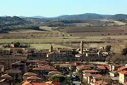
Buonconvento
Buonconvento is a comune (municipality) in the Province of Siena in the Italian region Tuscany, located about 70 kilometres (43 mi) south of Florence and about 25 kilometres (16 mi) southeast of Siena in the area known as the Crete Senesi.
Buonconvento | |
|---|---|
| Comune di Buonconvento | |
 | |
 Coat of arms | |
Location of Buonconvento 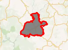
| |
 Buonconvento Location of Buonconvento in Italy 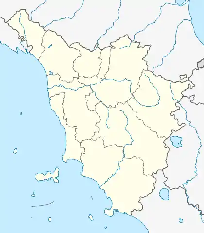 Buonconvento Buonconvento (Tuscany) | |
| Coordinates: 43°8′N 11°29′E | |
| Country | Italy |
| Region | Tuscany |
| Province | Siena (SI) |
| Frazioni | Bibbiano, Ponte d'Arbia, Serravalle |
| Government | |
| • Mayor | Riccardo Conti |
| Area | |
| • Total | 64.84 km2 (25.03 sq mi) |
| Elevation | 147 m (482 ft) |
| Population (30 April 2017)[2] | |
| • Total | 3,137 |
| • Density | 48/km2 (130/sq mi) |
| Demonym(s) | Buonconventini |
| Time zone | UTC+1 (CET) |
| • Summer (DST) | UTC+2 (CEST) |
| Postal code | 53022 |
| Dialing code | 0577 |
| Patron saint | Sts. Peter and Paul |
| Saint day | June 29 |
| Website | Official website |
History
Buonconvento (from the Latin bonus conventus, "happy place") is mentioned for the first time in 1100. In 1313 the German emperor Henry VII died here.
It was surrounded by a line of walls starting from 1371, carried on by the Republic of Siena to which it belonged until 1559, when it became part of the Grand Duchy of Tuscany. It was annexed to Italy in 1861.
Main sights
The local museum of art, the Museo d'Arte Sacra della Val d'Arbia, houses works by Duccio di Buoninsegna, Pietro Lorenzetti, Andrea di Bartolo, Matteo di Giovanni and other Tuscan painters, taken from local churches. The church of Santi Pietro e Paolo has a Madonna Enthroned with Child (c. 1450) by Matteo di Giovanni and a fresco of the early-15th century Sienese school. The fortified pieve of Sant'Innocenza a Piana dates from the 13th-14th centuries. Most of Buonconvento's frazioni house medieval or Renaissance castles.
The church of St. Lawrence in Bibbiano has a cyborium by Ventura Salimbeni.
Frazioni
The municipality is formed by the municipal seat of Buonconvento and the towns and villages (frazioni) of Bibbiano, Ponte d'Arbia and Serravalle. Other notable villages include Castelnuovo Tancredi, Chiatina, Percenna and Piana.
References
- "Superficie di Comuni Province e Regioni italiane al 9 ottobre 2011". Istat. Retrieved 16 March 2019.
- Population data from Istat
External links
| Wikimedia Commons has media related to Buonconvento. |

| Authority control |
|---|