Cabrach
The Cabrach (Scottish Gaelic: A' Chabrach, A' Chabraich) is an estate and largely depopulated rural community in Moray, Scotland. The meaning of the name has been much disputed. Traditionally it is held to mean "timber moss", though this has no recognisable counterpart in Scottish Gaelic, and Alexander Smith (1875) suggests no Gaelic meaning can be assigned.[1] Iain Mac an Tàilleir (2003) gives a meaning "antler place",[2] whilst Ainmean-Àite na h-Alba, the national advisory partnership for Gaelic place-names in Scotland, suggests "the place of the trees".[3]
Cabrach
| |
|---|---|
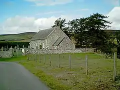 Cabrach Church | |
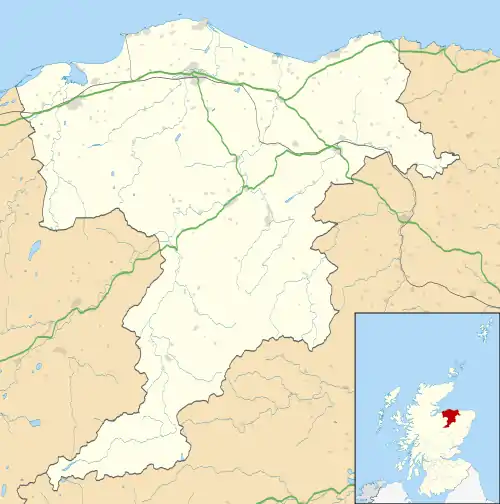 Cabrach Location within Moray | |
| Population | 69 (2011) |
| OS grid reference | NJ3827 |
| Civil parish |
|
| Council area | |
| Lieutenancy area | |
| Country | Scotland |
| Sovereign state | United Kingdom |
| Post town | HUNTLY |
| Postcode district | AB54 |
| Dialling code | 01466 |
| Police | Scotland |
| Fire | Scottish |
| Ambulance | Scottish |
| UK Parliament | |
| Scottish Parliament | |
Geography
The Cabrach, located in rural Moray, is a sparsely populated area ten miles (16 km) wide by eight miles (13 km) long consisting of mountainous terrain. It lies on the northernmost fringe of the Cairngorms National Park at the intersection of the countryside roads that connect Speyside to the north, Aberdeen to the east and, Donside to the south. The town of Huntly is 16 miles (26 km) away. Elgin, the main town in the region, is 30 miles (48 km) to the north.
References
- Alexander Smith, ed. (1875). "A New History of Aberdeenshire". GENUKI. Retrieved 5 August 2020.
- "Placenames C-E" (PDF). Scottish Parliament. Retrieved 4 August 2020.
- "The Cabrach". Ainmean-Àite na h-Alba: Gaelic Place-Names of Scotland. Retrieved 5 August 2020.
External links
- Threestones, Cabrach Resources
- Cabrach Feerings at The Internet Archive
- Cabrach & Glenfiddich Estates - Regeneration
- Cabrach Trust
Places in Moray | ||
|---|---|---|
|  | |