Camp Pardee, California
Camp Pardee is a company town for the operators of Pardee Dam. It is located in Calaveras County, California, near Pardee Reservoir. It lies at an elevation of 696 feet (212 m) and is home to 35 people.[2]
Camp Pardee | |
|---|---|
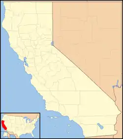 Camp Pardee Location in California  Camp Pardee Camp Pardee (the United States) | |
| Coordinates: 38°14′53″N 120°50′40″W | |
| Country | United States |
| State | California |
| County | Calaveras County |
| Elevation | 696 ft (212 m) |
| Population (2016) | |
| • Total | 35 |
Climate
Camp Pardee has a hot-summer Mediterranean climate (Csa) according to the Köppen climate classification system.
| Climate data for Camp Pardee (1926-2012) | |||||||||||||
|---|---|---|---|---|---|---|---|---|---|---|---|---|---|
| Month | Jan | Feb | Mar | Apr | May | Jun | Jul | Aug | Sep | Oct | Nov | Dec | Year |
| Record high °F (°C) | 71 (22) |
79 (26) |
85 (29) |
99 (37) |
108 (42) |
115 (46) |
115 (46) |
115 (46) |
111 (44) |
102 (39) |
87 (31) |
73 (23) |
115 (46) |
| Average high °F (°C) | 53.3 (11.8) |
59 (15) |
63.8 (17.7) |
70.3 (21.3) |
79.6 (26.4) |
88.5 (31.4) |
95.8 (35.4) |
94.2 (34.6) |
88.8 (31.6) |
77.9 (25.5) |
64.2 (17.9) |
54.5 (12.5) |
74.2 (23.4) |
| Average low °F (°C) | 38.1 (3.4) |
41.1 (5.1) |
43.5 (6.4) |
46.2 (7.9) |
51.1 (10.6) |
56.5 (13.6) |
61.5 (16.4) |
60.6 (15.9) |
58.3 (14.6) |
52.3 (11.3) |
44.9 (7.2) |
39.3 (4.1) |
49.5 (9.7) |
| Record low °F (°C) | 18 (−8) |
22 (−6) |
26 (−3) |
30 (−1) |
36 (2) |
41 (5) |
48 (9) |
45 (7) |
42 (6) |
32 (0) |
25 (−4) |
17 (−8) |
17 (−8) |
| Average precipitation inches (mm) | 3.95 (100) |
3.55 (90) |
3.38 (86) |
1.89 (48) |
0.84 (21) |
0.26 (6.6) |
0.04 (1.0) |
0.06 (1.5) |
0.29 (7.4) |
1.2 (30) |
2.57 (65) |
3.45 (88) |
21.48 (546) |
| Average snowfall inches (cm) | 0.1 (0.25) |
0 (0) |
0 (0) |
0 (0) |
0 (0) |
0 (0) |
0 (0) |
0 (0) |
0 (0) |
0 (0) |
0 (0) |
0 (0) |
0.2 (0.51) |
| Average precipitation days | 11 | 10 | 9 | 6 | 4 | 1 | 0 | 0 | 1 | 4 | 7 | 10 | 63 |
| Source: WRCC[3] | |||||||||||||
References
- U.S. Geological Survey Geographic Names Information System: Camp Pardee, California
- EBMUD data
- "CAMP PARDEE, CA (041428)". Western Regional Climate Center. Retrieved November 29, 2015.
Municipalities and communities of Calaveras County, California, United States | ||
|---|---|---|
| City | 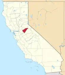 Calaveras County map | |
| CDPs | ||
| Unincorporated communities |
| |
| Former settlements | ||
| ||
This article is issued from Wikipedia. The text is licensed under Creative Commons - Attribution - Sharealike. Additional terms may apply for the media files.