Tamarack, California
Tamarack, formerly known as Camp Tamarack,[2] is an unincorporated community in Calaveras County, California, in the United States. It was founded in the 1920s.[2] A nearby weather station, located across the Alpine County line, has been the site of several United States meteorological records.
Tamarack | |
|---|---|
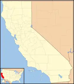 Tamarack Location in California  Tamarack Tamarack (the United States) | |
| Coordinates: 38°26′20″N 120°04′34″W | |
| Country | United States |
| State | California |
| County | Calaveras County |
| Elevation | 6,913 ft (2,107 m) |
Tamarack is located at an elevation of 6,913 feet (2,107 m),[1] on the west slope of the Sierra Nevada near Bear Valley and south of South Lake Tahoe.
Climate
The greatest snow depth ever recorded was recorded in Tamarack: in January 1911, 390 inches (990.6 cm) of snow fell, leading to a snow depth in March of 451 inches (1,145.5 cm).[3][4] Tamarack also holds the record for greatest seasonal snowfall in California: during the winter of 1906−1907, it received 883 or 884 inches (2,242.8 or 2,245.4 cm) of snow.[3][4][5]
Tamarack has a subarctic climate (Köppen climate classification Dsc) with mild to warm summers coupled with chilly nights and moderately cold winter days with frigid nights and extremely heavy annual snowfall averaging 443.7 inches (1,127 cm).
| Climate data for Tamarack, California | |||||||||||||
|---|---|---|---|---|---|---|---|---|---|---|---|---|---|
| Month | Jan | Feb | Mar | Apr | May | Jun | Jul | Aug | Sep | Oct | Nov | Dec | Year |
| Record high °F (°C) | 65 (18) |
70 (21) |
68 (20) |
76 (24) |
82 (28) |
88 (31) |
90 (32) |
88 (31) |
85 (29) |
86 (30) |
70 (21) |
65 (18) |
90 (32) |
| Average high °F (°C) | 38.4 (3.6) |
40.4 (4.7) |
44.2 (6.8) |
49.2 (9.6) |
55.9 (13.3) |
63.2 (17.3) |
72.5 (22.5) |
72.5 (22.5) |
65.1 (18.4) |
55.0 (12.8) |
44.9 (7.2) |
39.1 (3.9) |
53.4 (11.9) |
| Daily mean °F (°C) | 24.9 (−3.9) |
27.0 (−2.8) |
30.3 (−0.9) |
35.0 (1.7) |
41.0 (5.0) |
48.3 (9.1) |
57.2 (14.0) |
56.7 (13.7) |
50.1 (10.1) |
41.3 (5.2) |
32.7 (0.4) |
26.2 (−3.2) |
39.2 (4.0) |
| Average low °F (°C) | 11.4 (−11.4) |
13.6 (−10.2) |
16.3 (−8.7) |
20.7 (−6.3) |
26.1 (−3.3) |
33.3 (0.7) |
41.9 (5.5) |
40.9 (4.9) |
35.0 (1.7) |
27.6 (−2.4) |
20.4 (−6.4) |
13.2 (−10.4) |
25.0 (−3.9) |
| Record low °F (°C) | −45 (−43) |
−26 (−32) |
−17 (−27) |
−8 (−22) |
0 (−18) |
2 (−17) |
24 (−4) |
14 (−10) |
14 (−10) |
−1 (−18) |
−12 (−24) |
−26 (−32) |
−45 (−43) |
| Average precipitation inches (mm) | 8.88 (226) |
8.47 (215) |
8.06 (205) |
3.10 (79) |
2.34 (59) |
1.47 (37) |
0.76 (19) |
0.43 (11) |
1.17 (30) |
2.46 (62) |
4.81 (122) |
6.45 (164) |
52.78 (1,341) |
| Average snowfall inches (cm) | 87.7 (223) |
87.5 (222) |
79.3 (201) |
28.9 (73) |
20.0 (51) |
6.7 (17) |
0.0 (0.0) |
0.0 (0.0) |
5.5 (14) |
16.0 (41) |
42.6 (108) |
69.5 (177) |
443.7 (1,127) |
| Source: [6] | |||||||||||||
References
- U.S. Geological Survey Geographic Names Information System: Tamarack, California
- Durham, David L. (1998). California's Geographic Names: A Gazetteer of Historic and Modern Names of the State. Clovis, Calif.: Word Dancer Press. p. 835. ISBN 1-884995-14-4.
- Christopher C. Burt, Extreme Weather: A Guide & Record Book, page 77: "...the deepest snow depth ever recorded in North America, belongs to Tamarack, California. Here, near Yosemite's Tuolumne Meadows, 390ʺ fell in January 1911. This led to a level snow depth of 451ʺ (37.5 feet) by March of that year. Tamarack also holds California's greatest seasonal catch on 884ʺ in the notoriously wet winter of 1906-1907."
- Sierra Nevada Virtual Museum
- Charles Nevers Holmes, In New York City Were the Snowiest Place, in Tychos (1920), page 20: "And, at Tamarack, California, about a mile and one-half above sea level, there was a record of a snowfall of 73 1/2 feet which fell during the winter of 1906-1907. Now, a snowfall of 73 1/2 feet, of 883 inches, is certainly considerable..."
- "TAMARACK, CALIFORNIA (048781)". Western Regional Climate Center. Retrieved June 1, 2016.
Municipalities and communities of Calaveras County, California, United States | ||
|---|---|---|
| City | 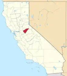 Calaveras County map | |
| CDPs | ||
| Unincorporated communities |
| |
| Former settlements | ||
| ||