Canalside Rail Trail
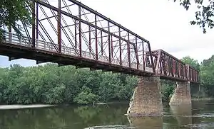
The Canalside Rail Trail is a 3.8-mile (6.1 km) trail, partially on old railroad beds, from East Deerfield, to Turners Falls, Montague, Massachusetts. A short portion of the trail runs along town streets, but the majority is on a paved trail from which motor vehicles are prohibited. The northern terminus is Unity Park, on Barton's Cove, in Turners Falls. The southernmost portion crosses the Connecticut River on the Canalside Rail Trail Bridge[1] and ends at McClelland Farm Road in Deerfield.[2] The trail was completed in spring 2008.
| Canalside Rail Trail | |
|---|---|
 | |
| Length | 3.8 miles (6.1 km) |
| Location | Connecticut River Valley; Franklin County, Massachusetts |
| Established | 2008 |
| Designation | Massachusetts state park |
| Trailheads | East Deerfield (42°34′23″N 72°34′31″W) Turners Falls, Montague (42°36′22″N 72°33′00″W) |
| Use | Hiking, biking |
| Hiking details | |
| Trail difficulty | Easy |
| Sights | Connecticut River, Power Canal, Deerfield River |
| Surface | Paved |
| Maintained by | Department of Conservation and Recreation |
| Website | Canalside Rail Trail
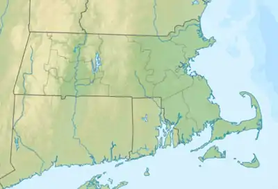 East Deerfield Turners Falls Location of trailheads in Massachusetts |
References
- "Canalside Rail Trail". MassParks. Executive Office of Energy and Environmental Affairs. Retrieved March 2, 2017.
- "Biking and Hiking". Turners Falls RiverCulture. Retrieved March 2, 2017.
External links
| Wikimedia Commons has media related to Canalside Rail Trail. |
- Canalside Rail Trail | Department of Conservation and Recreation
- Canalside Rail Trail Map | Department of Conservation and Recreation
| |||||||||||||||||
| |||||||||||||||||
| |||||||||||||||||
| |||||||||||||||||
| |||||||||||||||||
| |||||||||||||||||
| |||||||||||||||||
| |||||||||||||||||
| ||
This article is issued from Wikipedia. The text is licensed under Creative Commons - Attribution - Sharealike. Additional terms may apply for the media files.