Canfield, Ohio
Canfield is a city in central Mahoning County, Ohio, United States, a suburb ten miles southwest of Youngstown. The population was 7,515 at the 2010 census. Located at the intersection of U.S. Route 224 and U.S. Route 62, it is part of the Youngstown-Warren-Boardman, OH-PA Metropolitan Statistical Area. In 2005, Canfield was rated the 82nd best place to live in the United States by Money magazine.[6]
Canfield, Ohio | |
|---|---|
| City of Canfield | |
 Gazebo on the Southern Green | |
 Location of Canfield, Ohio | |
 Location of Canfield in Mahoning County | |
| Coordinates: 41°1′47″N 80°45′56″W | |
| Country | United States |
| State | Ohio |
| County | Mahoning |
| Government | |
| • Mayor | Richard Duffet |
| Area | |
| • Total | 4.63 sq mi (11.98 km2) |
| • Land | 4.60 sq mi (11.91 km2) |
| • Water | 0.03 sq mi (0.07 km2) |
| Elevation | 1,145 ft (349 m) |
| Population | |
| • Total | 7,515 |
| • Estimate (2019)[4] | 7,176 |
| • Density | 1,560.00/sq mi (602.28/km2) |
| Time zone | UTC-5 (Eastern (EST)) |
| • Summer (DST) | UTC-4 (EDT) |
| ZIP code | 44406-1257 |
| Area code(s) | 234/330 |
| FIPS code | 39-11360[5] |
| GNIS feature ID | 1038796[2] |
| Website | http://www.ci.canfield.oh.us/ |
History
The village was named after Judson Canfield, a land agent.[7] Canfield was incorporated as a village in 1849.[8]
Geography
According to the United States Census Bureau, the city has a total area of 4.61 square miles (11.94 km2), of which 4.58 square miles (11.86 km2) is land and 0.03 square miles (0.08 km2) is water.[9] It is surrounded by Canfield Township.
Demographics
| Historical population | |||
|---|---|---|---|
| Census | Pop. | %± | |
| 1850 | 527 | — | |
| 1860 | 649 | 23.1% | |
| 1870 | 640 | −1.4% | |
| 1880 | 650 | 1.6% | |
| 1890 | 675 | 3.8% | |
| 1900 | 672 | −0.4% | |
| 1910 | 685 | 1.9% | |
| 1920 | 806 | 17.7% | |
| 1930 | 1,015 | 25.9% | |
| 1940 | 1,141 | 12.4% | |
| 1950 | 1,465 | 28.4% | |
| 1960 | 3,252 | 122.0% | |
| 1970 | 4,997 | 53.7% | |
| 1980 | 5,535 | 10.8% | |
| 1990 | 5,409 | −2.3% | |
| 2000 | 7,374 | 36.3% | |
| 2010 | 7,515 | 1.9% | |
| 2019 (est.) | 7,176 | [4] | −4.5% |
| Sources:[10][11][12][13][14][15][5] | |||
2010 census
As of the census[3] of 2010, there were 7,515 people, 3,073 households, and 2,196 families residing in the city. The population density was 1,640.8 inhabitants per square mile (633.5/km2). There were 3,306 housing units at an average density of 721.8 per square mile (278.7/km2). The racial makeup of the city was 96.4% White, 0.4% African American, 0.1% Native American, 1.8% Asian, 0.5% from other races, and 0.7% from two or more races. Hispanic or Latino of any race were 1.5% of the population.
There were 3,073 households, of which 30.8% had children under the age of 18 living with them, 59.7% were married couples living together, 8.7% had a female householder with no husband present, 3.0% had a male householder with no wife present, and 28.5% were non-families. 26.8% of all households were made up of individuals, and 13.6% had someone living alone who was 65 years of age or older. The average household size was 2.44 and the average family size was 2.96.
The median age in the city was 45.8 years. 23.6% of residents were under the age of 18; 5.8% were between the ages of 18 and 24; 19.4% were from 25 to 44; 32.1% were from 45 to 64; and 19% were 65 years of age or older. The gender makeup of the city was 48.0% male and 52.0% female.
2000 census
As of the census[5] of 2000, there were 7,374 people, 2,917 households, and 2,143 families residing in the city. The population density was 1,588.1 people per square mile (613.6/km2). There were 3,043 housing units at an average density of 655.4 per square mile (253.2/km2). The racial makeup of the city was 97.27% White, 1.29% Asian, 0.45% African American, 0.04% Native American, 0.04% Pacific Islander, 0.33% from other races, and 0.58% from two or more races. Hispanic or Latino of any race were 0.84% of the population.
There were 2,917 households, out of which 33.3% had children under the age of 18 living with them, 65.0% were married couples living together, 6.9% had a female householder with no husband present, and 26.5% were non-families. 24.7% of all households were made up of individuals, and 12.1% had someone living alone who was 65 years of age or older. The average household size was 2.53 and the average family size was 3.03.
In the city the population was spread out, with 25.6% under the age of 18, 5.2% from 18 to 24, 24.1% from 25 to 44, 27.7% from 45 to 64, and 17.4% who were 65 years of age or older. The median age was 42.3 years. For every 100 females, there were 90.6 males. For every 100 females age 18 and over, there were 86.7 males.
The median income for a household in the city was $59,434 and the median income for a family was $71,484. Males had a median income of $35,346 versus $20,493 for females. The per capita income for the city is $31,756. About 2.1% of the families and 3.2% of the population live below the poverty line. Including 3.0% of those under age 18 and 4.3% of those 65 years of age or older.
Politics
In the Ohio General Assembly, Canfield is located in the 33rd Senate District, represented by Michael Rulli (R),[16] and in the 59th State Representative District, represented by Al Cutrona (R).[17] Federally, Canfield is located in Ohio's 6th congressional district, which has a Cook PVI of R+16[18] and is represented by Republican Bill Johnson.[19]
Former US Congressmen Elisha Whittlesey and William A. Whittlesey lived in Canfield.
Education
Public schools in Canfield include:
- Hilltop Elementary (grade K-4), built in 1972.
- C.H. Campbell (grades K-4), built in 1960.
- Canfield Village Middle School (grade 5-8), built in 1903, is Canfield's oldest school building.
- Canfield High School (9-12), built in 1984.[20][5]
Canfield has a public library, a branch of the Public Library of Youngstown and Mahoning County.[21]
Notable people
- Frederick William Chapman - American minister and genealogist
- Bob Dove - NFL player and coach
- JD Eicher - Singer-songwriter
- Columbia Lancaster - First delegate to the U.S. House of Representatives from the Territory of Washington
- Eben Newton - U.S. Representative from Ohio's 19th District
- Ryan Sachire - Professional tennis player and tennis coach for the University of Notre Dame
- Craig Snyder - Professional boxer
- A. William Sweeney - Ohio Supreme Court justice
- Myron E. Ullman - Former CEO of J.C. Penney and Chairman of Starbucks Corporation
- Elijah Wadsworth - American Revolutionary War captain and major general in the War of 1812
- Frederick Wadsworth - Ohio militia officer, businessman, and Mayor of Akron
- Elisha Whittlesey - U.S. Representative from Ohio's 13th District
- William A. Whittlesey - U.S. Representative from Ohio's 13th District
- Denise DeBartolo York - American billionaire businesswoman and owner of the San Francisco 49ers
References
- "2019 U.S. Gazetteer Files". United States Census Bureau. Retrieved July 27, 2020.
- "US Board on Geographic Names". United States Geological Survey. 2007-10-25. Retrieved 2008-01-31.
- "U.S. Census website". United States Census Bureau. Retrieved 2013-01-06.
- "Population and Housing Unit Estimates". Retrieved May 21, 2020.
- "U.S. Census website". United States Census Bureau. Retrieved 2008-01-31.
- "Money Magazine: Best Places to Live 2005". Money Magazine. 2005. Retrieved August 11, 2011.
- Overman, William Daniel (1958). Ohio Town Names. Akron, OH: Atlantic Press. p. 23.
- Sanderson, Thomas W. (1907). Twentieth Century History of Youngstown and Mahoning County. Biographical Publishing Company. pp. 184.
- "US Gazetteer files 2010". United States Census Bureau. Archived from the original on 2012-07-14. Retrieved 2013-01-06.
- "Population of Civil Divisions Less than Counties" (PDF). Statistics of the Population of the United States at the Ninth Census. U.S. Census Bureau. 1870. Retrieved 24 April 2020.
- "Population of Civil Divisions Less than Counties" (PDF). Statistics of the Population of the United States at the Tenth Census. U.S. Census Bureau. 1880. Retrieved 28 November 2013.
- "Population: Ohio" (PDF). 1910 U.S. Census. U.S. Census Bureau. Retrieved 28 November 2013.
- "Population: Ohio" (PDF). 1930 US Census. U.S. Census Bureau. Retrieved 28 November 2013.
- "Number of Inhabitants: Ohio" (PDF). 18th Census of the United States. U.S. Census Bureau. 1960. Retrieved 24 April 2020.
- "Ohio: Population and Housing Unit Counts" (PDF). U.S. Census Bureau. Retrieved 22 November 2013.
- "Senator Michael A Rulli | Ohio Senate". Ohio Senate. State of Ohio. Retrieved 2 May 2019.
- "Representative Don Manning (R) - 59th District". Ohio House of Representatives. State of Ohio. Retrieved 2 May 2019.
- "Introducing the 2017 Cook Political Report Partisan Voter Index". The Cook Political Report. Cook Political Report. Retrieved 2 May 2019.
- "Congressman Bill Johnson | Representing the 6th District of Ohio". Congressman Bill Johnson. US House of Representatives. Retrieved 2 May 2019.
- "Canfield Chooses New Superintendent". The Town Crier. Retrieved 19 April 2013.
- "Locations & Hours". Public Library of Youngstown and Mahoning County. Retrieved 26 February 2018.
External links
Municipalities and communities of Mahoning County, Ohio, United States | ||
|---|---|---|
| Cities | 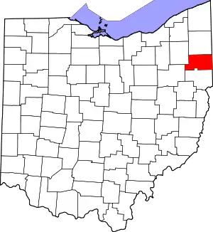 Map of Ohio highlighting Mahoning County | |
| Villages | ||
| Townships | ||
| CDPs | ||
| Unincorporated communities |
| |
| Footnotes | ‡This populated place also has portions in an adjacent county or counties | |
| ||
| Authority control |
|---|