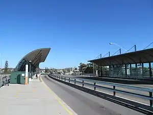
Canning Bridge bus station
Canning Bridge bus station is a Transperth bus station above Canning Bridge railway station. It is at the intersection of the Kwinana Freeway and Canning Highway in Como, Western Australia. It is served by Transperth routes operated by Path Transit, Swan Transit and Transdev WA.
Canning Bridge transfer station | |
|---|---|
Western Area bus station | |
 Bus station in May 2012 | |
| Location | Cnr Kwinana Freeway & Canning Highway, Como Australia |
| Coordinates | 32°00′36″S 115°51′22″E |
| Owned by | Public Transport Authority |
| Operated by | Transperth |
| Bus stands | 2 |
| Connections | Train transfer at Canning Bridge railway station |
| Other information | |
| Fare zone | 1 |
| History | |
| Opened | 11 February 2002 |
History
Canning Bridge bus station opened on 11 February 2002.[1] The station originally provided bus services at both the upper (Canning Highway) and lower (Kwinana Freeway) platforms. Due to the construction of the Mandurah line, the lower platforms were closed on 29 January 2006 and converted for railway use.[2]
References
- Freeway bus lanes open on Monday Minister for Planning & Infrastructure 10 February 2002
- "Closure of Canning Bridge platforms (29 January 06)". 8 February 2006. Archived from the original on 8 February 2006. Retrieved 9 June 2019.
- John Holland Group; Western Australia. New MetroRail (2005). Package D : construction of Leach Highway and South Street stations and alterations to existing Canning Bridge bus station : environmental management plan. Public Transport Authority, New MetroRail. Retrieved 1 October 2016.
- Muhammad, I; Low, N; Glover, L (2006). Mega Projects in Transport and Development: Background in Australian Case Studies: Perth Urban Railway (PDF). GAMUT, Australasian Centre for the Governance and Management of Urban Transport, University of Melbourne. p. 19.
- Alannah MacTiernan, Minister for Planning and Infrastructure (2 March 2004). "Southern Rail Link, Canning Bridge Station" (PDF). Parliamentary Debates (Hansard). Western Australia: Legislative Assembly. p. 153.
External links
- Access map Transperth
This article is issued from Wikipedia. The text is licensed under Creative Commons - Attribution - Sharealike. Additional terms may apply for the media files.
