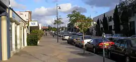
Como, Western Australia
Como is a suburb of Perth, Western Australia. Its local government area is the City of South Perth. The suburb has a population of 12,423.[2] Canning Highway divides the suburb.
| Como Perth, Western Australia | |||||||||||||||
|---|---|---|---|---|---|---|---|---|---|---|---|---|---|---|---|
 | |||||||||||||||
 Como | |||||||||||||||
| Coordinates | 32.003°S 115.858°E | ||||||||||||||
| Population | 14,138 (2016 census)[1] | ||||||||||||||
| • Density | 2,110/km2 (5,470/sq mi) | ||||||||||||||
| Established | 1905 | ||||||||||||||
| Postcode(s) | 6152 | ||||||||||||||
| Area | 6.7 km2 (2.6 sq mi) | ||||||||||||||
| Location | 6 km (4 mi) from Perth | ||||||||||||||
| LGA(s) | City of South Perth | ||||||||||||||
| State electorate(s) | South Perth | ||||||||||||||
| Federal Division(s) | Swan | ||||||||||||||
| |||||||||||||||
History
The suburb of Como was originally made up of three land grants, purchased by Christchurch farmer Edmund Hugh Comer in February 1891.[3] The land was subdivided in 1905 under the name Como Estate, which is thought to be derived from either the owner's surname or the area of the same name in northern Italy.[4] Como forms part of the City of South Perth.
Facilities
Como is serviced by the Canning Bridge railway station and the Canning Bridge bus station.
There are four schools in the area. These are the Collier and Como Primary Schools, Como Secondary College (previously Como Senior High School), and Penrhos College, a private all-girls school which has a primary school and a high school.
References
- Australian Bureau of Statistics (27 June 2017). "Como (WA) (State Suburb)". 2016 Census QuickStats. Retrieved 19 April 2018.

- Australian Bureau of Statistics (25 October 2007). "Como (State Suburb)". 2006 Census QuickStats. Retrieved 5 October 2008.
- Westralian Suburb: The History of South Perth, Western Australia, Francis Keble Crowley, Rigby Limited, 1962, page 38
- Western Australian Land Information Authority. "History of metropolitan suburb names – C". Retrieved 15 May 2007.
| Wikimedia Commons has media related to Como, Western Australia. |