Cape Runaway
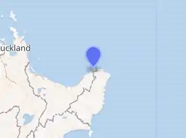
Cape Runaway is the eastern extremity of the Bay of Plenty in New Zealand's North Island. It is located 90 kilometres northeast off Whakatāne and 50 kilometres west of East Cape.[1]
Cape Runaway | |
|---|---|
Locality | |
| |
| Coordinates: | |
| Country | New Zealand |
| Region | Bay of Plenty |
| Territorial authority | Ōpōtiki District |
| Ward | Coast |
| Population (2018) | |
| • Total | 1,449 |
| Postcode(s) | 3199 |
The name Cape Runaway was bestowed by English mariner James Cook during his first voyage of discovery in 1769. It was so named after Māori in canoes who had approached Cooks' ship Endeavour in a hostile manner scurried off after a cannon shot was fired.[1]
Demographics
| Year | Pop. | ±% p.a. |
|---|---|---|
| 2006 | 1,680 | — |
| 2013 | 1,533 | −1.30% |
| 2018 | 1,449 | −1.12% |
| Source: [2] | ||
The statistical area of Cape Runaway, which covers 1,569 square kilometres and includes Tōrere, Hāwai, Omaio, Te Kaha, Papatea Bay and Raukokore, had a population of 1,449 at the 2018 New Zealand census, a decrease of 84 people (-5.5%) since the 2013 census, and a decrease of 231 people (-13.8%) since the 2006 census. There were 579 households. There were 711 males and 738 females, giving a sex ratio of 0.96 males per female. The median age was 46 years (compared with 37.4 years nationally), with 297 people (20.5%) aged under 15 years, 201 (13.9%) aged 15 to 29, 657 (45.3%) aged 30 to 64, and 294 (20.3%) aged 65 or older.
Ethnicities were 27.1% European/Pākehā, 85.7% Māori, 3.7% Pacific peoples, and 0.4% Asian (totals add to more than 100% since people could identify with multiple ethnicities).
The proportion of people born overseas was 5.4%, compared with 27.1% nationally.
Although some people objected to giving their religion, 29.0% had no religion, 41.0% were Christian, 0.2% were Hindu, 0.2% were Muslim, 0.4% were Buddhist and 24.4% had other religions.
Of those at least 15 years old, 129 (11.2%) people had a bachelor or higher degree, and 294 (25.5%) people had no formal qualifications. The median income was $20,400, compared with $31,800 nationally. The employment status of those at least 15 was that 477 (41.4%) people were employed full-time, 177 (15.4%) were part-time, and 78 (6.8%) were unemployed.[2]
Marae
Whangaparāōa Marae, located near Cape Runaway, is a traditional meeting place for Te Whānau-ā-Apanui's hapū of Te Whānau a Kauaetangohia.[3]
It includes Kauaetangohia or Te Putahou meeting house[4]
Education
Te Kura Mana Maori o Whangaparaoa is a co-educational Māori immersion primary school,[5] with a roll of 108 as of March 2020.[6][7]
References
- Reed, A. W. (1952). The Story of New Zealand Place Names. Wellington: A.H. & A.W. Reed. p. 101. OCLC 59066325.
- "Statistical area 1 dataset for 2018 Census". Statistics New Zealand. March 2020. Cape Runaway (204200). 2018 Census place summary: Cape Runaway
- "Te Kāhui Māngai directory". tkm.govt.nz. Te Puni Kōkiri.
- "Māori Maps". maorimaps.com. Te Potiki National Trust.
- "Ministry of Education School Profile". educationcounts.govt.nz. Ministry of Education.
- "New Zealand Schools Directory". New Zealand Ministry of Education. Retrieved 26 April 2020.
- "Education Review Office Report". ero.govt.nz. Education Review Office.