Capilano, Edmonton
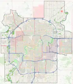
Capilano is a residential neighbourhood in south east Edmonton, Alberta, Canada. The neighbourhood, established in the 1950s, overlooks the scenic North Saskatchewan River valley.
Capilano | |
|---|---|
Neighbourhood | |
 Capilano Location of Capilano in Edmonton | |
| Coordinates: 53.555°N 113.424°W | |
| Country | |
| Province | |
| City | Edmonton |
| Quadrant[1] | NW |
| Ward[1] | 8 |
| Sector[2] | Mature area |
| Government | |
| • Administrative body | Edmonton City Council |
| • Councillor | Ben Henderson |
| Area | |
| • Total | 1.3 km2 (0.5 sq mi) |
| Elevation | 661 m (2,169 ft) |
| Population (2012)[5] | |
| • Total | 2,692 |
| • Density | 2,070.8/km2 (5,363/sq mi) |
| • Change (2009–12) | |
| • Dwellings | 1,100 |
The neighbourhood is bounded on the north, north west and north east by the North Saskatchewan River valley. To the west, the neighbourhood overlooks Wayne Gretzky Drive. The southern boundary west of 50 Street is 106 Avenue. From 50 Street, the neighbourhood boundary follows a zig zag path running north east until it reaches the Gold Bar Ravine. The Gold Bar Ravine forms the neighbourhood's eastern boundary.
The community is represented by the Capilano Community League, established in 1958, which maintains a community hall, outdoor rink and tennis courts located at 54 Street and 108 Avenue.[6][7]

Demographics
In the City of Edmonton's 2012 municipal census, Capilano had a population of 2,692 living in 1,100 dwellings,[5] a -2.6% change from its 2009 population of 2,764.[8] With a land area of 1.3 km2 (0.50 sq mi),[4] it had a population density of 2,070.8 people/km2 in 2012.[4][5]
Residential development
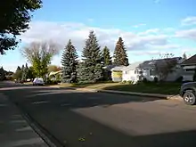
Residential construction in the neighbourhood occurred largely after the end of World War II with 84.6% of, or 17 out of every 20, dwelling being constructed between 1946 and 1960. Almost all of the remaining dwellings were built during the 1960s, and development was essentially complete by 1970.[9]
According to the 2005 municipal census, 100% of the residences in the neighbourhood were single-family dwellings. Substantially all (96%) of the residences are owner-occupied with only 4% being rented.[10]
Schools
There are two schools in the neighbourhood:
- Suzuki Charter School
- Suzuki Charter School occupies the former Capilano Elementary School. It is a charter school with classes from K-6 and preschool
- Edmonton Catholic School System
- St. Gabriel Catholic Elementary School
The Capilano Playschool is a play-based parent cooperative for 3 & 4 year olds. It is housed in Hardisty School, a K-9 Edmonton Public School located immediately south of Capilano in the Fulton neighbourhood.
The Edmonton Public School System's McNally High School is located to the west in the neighbourhood of Forest Heights.
Access to shopping, sites and services
The neighbourhood is located a short distance to the north of Edmonton's Capilano Mall, a major shopping centre, and the Capilano Transit Centre.
Surrounding neighbourhoods
References
- "City of Edmonton Wards & Standard Neighbourhoods" (PDF). City of Edmonton. Archived from the original (PDF) on May 3, 2014. Retrieved February 13, 2013.
- "Edmonton Developing and Planned Neighbourhoods, 2011" (PDF). City of Edmonton. Archived from the original (PDF) on September 4, 2013. Retrieved February 13, 2013.
- "City Councillors". City of Edmonton. Retrieved February 13, 2013.
- "Neighbourhoods (data plus kml file)". City of Edmonton. Retrieved February 13, 2013.
- "Municipal Census Results – Edmonton 2012 Census". City of Edmonton. Retrieved February 22, 2013.
- "Capilano Community League". Capilano Community League. Retrieved October 7, 2017.
- Kuban, Ron (2005). Edmonton's Urban Villages: The Community League Movement. University of Alberta Press. ISBN 9781459303249.
- "2009 Municipal Census Results". City of Edmonton. Retrieved February 22, 2013.
- http://censusdocs.edmonton.ca/DD23/FEDERAL%202001/Neighbourhood/CAPILANO.pdf
- http://censusdocs.edmonton.ca/C05002/MUNICIPAL%202005/Neighbourhood/CAPILANO.pdf
External links
| Wikimedia Commons has media related to Capilano Transit Centre. |