Carnesville, Georgia
Carnesville is a city in Franklin County, Georgia, United States, and the county seat.[5] The population was 577 at the 2010 census.[6]
Carnesville, Georgia | |
|---|---|
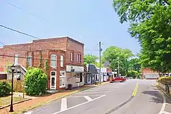 Athens Street (SR 145) | |
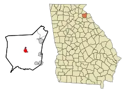 Location in Franklin County and the state of Georgia | |
| Coordinates: 34°22′17″N 83°14′1″W | |
| Country | United States |
| State | Georgia |
| County | Franklin |
| Named for | Thomas P. Carnes |
| Area | |
| • Total | 3.17 sq mi (8.21 km2) |
| • Land | 3.14 sq mi (8.14 km2) |
| • Water | 0.03 sq mi (0.07 km2) |
| Elevation | 709 ft (216 m) |
| Population (2010) | |
| • Total | 577 |
| • Estimate (2019)[2] | 601 |
| • Density | 191.22/sq mi (73.84/km2) |
| Time zone | UTC-5 (Eastern (EST)) |
| • Summer (DST) | UTC-4 (EDT) |
| ZIP code | 30521 |
| Area code(s) | 706 |
| FIPS code | 13-13352[3] |
| GNIS feature ID | 0312348[4] |
History
Carnesville was founded in 1805 as the seat of Franklin County. It was incorporated as a town in 1819 and as a city in 1901.[7] The town is named after Judge Thomas P. Carnes, a lawyer and congressman of the Revolutionary War era.[8][9]
In the 1850 census, the area around Carnesville had a free population of 9,131, and a slave population of 2,382.[10]
Geography
Carnesville is located in the center of Franklin County in northeastern Georgia. Interstate 85 passes northwest of the city, with access from Exits 164 and 166. I-85 leads southwest 85 miles (137 km) to Atlanta and northeast 62 miles (100 km) to Greenville, South Carolina.
According to the United States Census Bureau, Carnesville has a total area of 2.6 square miles (6.8 km2), of which 0.02 square miles (0.06 km2), or 0.86%, is water.[6] Carnesville is situated in the watershed of the Broad River, a tributary of the Savannah River.
Demographics
| Historical population | |||
|---|---|---|---|
| Census | Pop. | %± | |
| 1810 | 88 | — | |
| 1870 | 206 | — | |
| 1880 | 184 | −10.7% | |
| 1890 | 275 | 49.5% | |
| 1900 | 305 | 10.9% | |
| 1910 | 322 | 5.6% | |
| 1920 | 400 | 24.2% | |
| 1930 | 404 | 1.0% | |
| 1940 | 361 | −10.6% | |
| 1950 | 349 | −3.3% | |
| 1960 | 481 | 37.8% | |
| 1970 | 510 | 6.0% | |
| 1980 | 465 | −8.8% | |
| 1990 | 514 | 10.5% | |
| 2000 | 541 | 5.3% | |
| 2010 | 577 | 6.7% | |
| 2019 (est.) | 601 | [2] | 4.2% |
| U.S. Decennial Census[11] | |||
At the 2000 census,[3] there were 541 people, 197 households and 131 families residing in the city. The population density was 221.7 per square mile (85.6/km2). There were 222 housing units at an average density of 91.0 per square mile (35.1/km2). The racial makeup of the city was 73.01% White, 24.95% African American, 0.55% Asian, and 1.48% from two or more races. Hispanic or Latino of any race were 0.37% of the population.
There were 197 households, of which 26.9% had children under the age of 18 living with them, 45.7% were married couples living together, 18.3% had a female householder with no husband present, and 33.0% were non-families. 31.5% of all households were made up of individuals, and 20.3% had someone living alone who was 65 years of age or older. The average household size was 2.43 and the average family size was 3.05.
22.9% of the population were under the age of 18, 9.1% from 18 to 24, 28.7% from 25 to 44, 19.6% from 45 to 64, and 19.8% who were 65 years of age or older. The median age was 38 years. For every 100 females, there were 101.1 males. For every 100 females age 18 and over, there were 97.6 males.
The median household income was $36,719 and the median family income was $42,188. Males had a median income of $32,500 compared with $20,500 for females. The per capita income for the city was $14,016. About 13.8% of families and 17.3% of the population were below the poverty line, including 21.3% of those under age 18 and 16.3% of those age 65 or over.
Education
The Franklin County School District holds pre-school to grade twelve, and consists of four elementary schools, a middle school, and a high school.[12] The district has 232 full-time teachers and over 2,732 students.[13]
- Carnesville Elementary School
- Central Franklin Elementary School
- Lavonia Elementary School
- Royston Elementary School
- Franklin County Middle School
- Franklin County High School
Recreation
- Carnesville is home to the Georgia Karting Komplex, a 1/4 mile clay oval go-kart track.
- The Victoria Bryant State Park and Tugaloo State Park are located near Carnesville.
- TNS Skatting Rink is also found in Canresville and is open on the weekends.
In the media
In April 2013, Mayor Harris Little expressed concern over the number of American turkey vultures in Carnesville, and how the U.S. Migratory Bird Act prevented locals from killing them.[14]
Notable people
- "Spud" Chandler; Spurgeon Ferdinand Chandler, pitcher for New York Yankees, 1937–1947, American League MVP 1943[15]
- Sebastian Greco, actor on The Detour.
- Bill Kennedy, pitcher for the Cleveland Indians (1948), St. Louis Browns (1948–1951), Chicago White Sox (1952), Boston Red Sox (1953) and Cincinnati Redlegs (1956–1957)
- Helen Dortch Longstreet, known as the "Fighting Lady", the second wife of Confederate General James Longstreet, and a champion of causes such as preservation of the environment and civil rights
- William Oscar Payne, professor of history and athletic director at the University of Georgia
- John M. Sandidge, congressman from Louisiana
- Samuel Joelah Tribble, member of the 62nd U.S. Congress
- Pup Phillips, All-American center for Georgia Tech football, member of 1917 national championship team
- Kyle Myers, YouTuber and host of FPSRussia channel, co-host of Painkiller Already podcast
References
- "2019 U.S. Gazetteer Files". United States Census Bureau. Retrieved July 9, 2020.
- "Population and Housing Unit Estimates". United States Census Bureau. May 24, 2020. Retrieved May 27, 2020.
- "U.S. Census website". United States Census Bureau. Retrieved 2008-01-31.
- "US Board on Geographic Names". United States Geological Survey. 2007-10-25. Retrieved 2008-01-31.
- "Find a County". National Association of Counties. Archived from the original on 2011-05-31. Retrieved 2011-06-07.
- "Geographic Identifiers: 2010 Census Summary File 1 (G001), Carnesville city, Georgia". American FactFinder. U.S. Census Bureau. Archived from the original on February 13, 2020. Retrieved April 28, 2016.
- Hellmann, Paul T. (May 13, 2013). Historical Gazetteer of the United States. Routledge. p. 222. ISBN 978-1135948597. Retrieved 30 November 2013.
- Gannett, Henry (1905). The Origin of Certain Place Names in the United States. Govt. Print. Off. p. 69.
- Krakow, Kenneth K. (1975). Georgia Place-Names: Their History and Origins (PDF). Macon, GA: Winship Press. p. 34. ISBN 0-915430-00-2.
- White, George (1857). Historical Collections of Georgia. Pudney & Russell.
- "Census of Population and Housing". Census.gov. Retrieved June 4, 2015.
- Georgia Board of Education, Retrieved June 9, 2010.
- School Stats Archived 2012-03-08 at the Wayback Machine, Retrieved June 9, 2010.
- Kneiser, M.J. (April 19, 2013). "Buzzards take over Carnesville". Independent Mail. Archived from the original on December 19, 2014.
- "Spud Chandler (1907-1990)". New Georgia Encyclopedia. Retrieved 2018-02-10.
External links
| Wikimedia Commons has media related to Carnesville, Georgia. |
- City of Carnesville
- State tourist site for Carnesville
- Franklin County Schools
- Carroll's Methodist Church historical marker
Municipalities and communities of Franklin County, Georgia, United States | ||
|---|---|---|
| City | 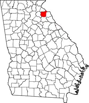 Map of Georgia highlighting Franklin County | |
| Town | ||
| CDP | ||
| Unincorporated communities | ||
| Footnotes | ‡This populated place also has portions in an adjacent county or counties | |
| ||
| Authority control |
|---|