Castorland, New York
Castorland is a village in the southeast part of the town of Denmark in Lewis County, New York, United States; it is north of Lowville and southeast of Carthage. The population was 351 at the 2010 census.[4] The name is derived from the scientific name for beaver.
Castorland, New York | |
|---|---|
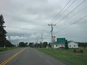 Entering the village of Castorland via New York State Route 410 eastbound in February 2012 | |
 Castorland  Castorland | |
| Coordinates: 43°53′15″N 75°30′50″W | |
| Country | United States |
| State | New York |
| County | Lewis |
| Town | Denmark |
| Area | |
| • Total | 0.32 sq mi (0.83 km2) |
| • Land | 0.32 sq mi (0.83 km2) |
| • Water | 0.00 sq mi (0.00 km2) |
| Elevation | 741 ft (226 m) |
| Population (2010) | |
| • Total | 351 |
| • Estimate (2019)[2] | 343 |
| • Density | 1,068.54/sq mi (412.49/km2) |
| Time zone | UTC-5 (Eastern (EST)) |
| • Summer (DST) | UTC-4 (EDT) |
| ZIP code | 13620 |
| Area code(s) | 315 |
| FIPS code | 36-12881 |
| GNIS feature ID | 946006[3] |
| Website | castorland |
History
The village name means "Land of the Beaver". The name stems from a colony of refugees from the French Revolution, established in 1792 to provide a new home away from the violence in France. The land, 210,000 acres (850 km2), was originally part of Macomb's Purchase. It was purchased by La Compagnie de New York. "Castorland" is a literal translation of the old Indian name of the area, Couch-sach-ra-ga.[5] Due to many reverses, including harsh winters, poor planning, and loss of livestock and funds, the colony was dissolved in 1814. Many of the original settlers from the Castorland colony returned to Europe or moved to larger communities.
Geography
Castorland is located in the southeast corner of the town of Denmark at 43°53′15″N 75°30′50″W (43.887379, -75.514002),[6] on ground rising above the west side of the valley of the Black River, near the point where the Beaver River enters from the east. The village is located on New York State Route 410. The village of Croghan is 7 miles (11 km) east, Lowville is 8 miles (13 km) to the south, and Carthage is 9 miles (14 km) to the northwest.
According to the United States Census Bureau, the village of Castorland has a total area of 0.3 square miles (0.8 km2), all of it recorded as land.[7]
Demographics
| Historical population | |||
|---|---|---|---|
| Census | Pop. | %± | |
| 1930 | 315 | — | |
| 1940 | 309 | −1.9% | |
| 1950 | 308 | −0.3% | |
| 1960 | 321 | 4.2% | |
| 1970 | 327 | 1.9% | |
| 1980 | 277 | −15.3% | |
| 1990 | 292 | 5.4% | |
| 2000 | 306 | 4.8% | |
| 2010 | 351 | 14.7% | |
| 2019 (est.) | 343 | [2] | −2.3% |
| U.S. Decennial Census[8] | |||
As of the census[9] of 2000, there were 306 people, 115 households, and 74 families residing in the village. The population density was 1,084.5 people per square mile (422.0/km2). There were 136 housing units at an average density of 482.0 per square mile (187.5/km2). The racial makeup of the village was 97.06% White, 0.65% African American, 0.33% Asian, 0.33% Pacific Islander, 0.65% from other races, and 0.98% from two or more races. Hispanic or Latino of any race were 1.31% of the population.
There were 115 households, out of which 28.7% had children under the age of 18 living with them, 58.3% were married couples living together, 3.5% had a female householder with no husband present, and 34.8% were non-families. 26.1% of all households were made up of individuals, and 14.8% had someone living alone who was 65 years of age or older. The average household size was 2.56 and the average family size was 3.23.
In the village, the population was spread out, with 24.8% under the age of 18, 9.5% from 18 to 24, 28.1% from 25 to 44, 22.5% from 45 to 64, and 15.0% who were 65 years of age or older. The median age was 38 years. For every 100 females, there were 91.3 males. For every 100 females age 18 and over, there were 85.5 males.
The median income for a household in the village was $33,125, and the median income for a family was $45,625. Males had a median income of $35,714 versus $16,806 for females. The per capita income for the village was $12,101. About 1.4% of families and 13.3% of the population were below the poverty line, including 6.7% of those under the age of eighteen and 10.0% of those 65 or over.
Businesses
The Castorland area includes many area businesses including Bellers Auto owned by Nevin Beller, Black River Valley Woodwork, Crafts, Common Sense Plastics, Inc. owned by Kent Widrick, D LAUX Properties owned by Donna M. Loucks, Elmer Moser & Sons, GeDeS owned by Virginia Owens, Donna Loucks, and Susan Parker. There is also Mellnitz's Fire Extinguisher Serv. owned by Newton & Patricia Mellnitz, Nifty Nicks Gift Shop, Northern Remodeling owned by Chet Zehr, Pow-R-Clean owned by Rusty Woods, The Oldmill Woodshop owned by Earl and Lucy Roggie, and Woods Steam Cleaning.
The Castorland Medal
In 1796 the Paris Mint struck a half dollar-sized token (jeton) to commemorate the "Franco-American Colony". Since that time numerous restrikes have been made and remain commercially available to collectors. While listed in A Guide Book of United States Coins, it was not intended for circulation.[10]
References
- "2019 U.S. Gazetteer Files". United States Census Bureau. Retrieved July 27, 2020.
- "Population and Housing Unit Estimates". United States Census Bureau. May 24, 2020. Retrieved May 27, 2020.
- U.S. Geological Survey Geographic Names Information System: Castorland, New York
- "Total Population: 2010 Census DEC Summary File 1 (P1), Castorland village, New York". data.census.gov. U.S. Census Bureau. Retrieved May 28, 2020.
- Donaldson, Alfred. History of the Adirondacks, New York: The Century Company, 1921.
- "US Gazetteer files: 2010, 2000, and 1990". United States Census Bureau. 2011-02-12. Retrieved 2011-04-23.
- "U.S. Gazetteer Files: 2019: Places: New York". U.S. Census Bureau Geography Division. Retrieved May 28, 2020.
- "Census of Population and Housing". Census.gov. Retrieved June 4, 2015.
- "U.S. Census website". United States Census Bureau. Retrieved 2008-01-31.
- The Castorland Jeton or demi écus "Half Dollar" of 1796: Introduction
External links
Municipalities and communities of Lewis County, New York, United States | ||
|---|---|---|
| Towns | 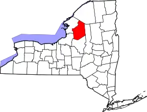 | |
| Villages | ||
| CDPs | ||
| Other hamlets | ||
| ||
| Authority control |
|---|