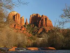
Cathedral Rock
Cathedral Rock is a natural sandstone butte on the Sedona skyline and one of the most-photographed sights in Arizona, United States.[3] The rock formation is located in the Coconino National Forest in Yavapai County, about a mile (1.6 km) west of Arizona Route 179, and about 2.5 miles (4.0 km) south of the "Y" intersection of Routes 179 and 89A in uptown Sedona. The summit elevation of Cathedral Rock is 4,967 feet (1,514 m).[1]
| Cathedral Rock | |
|---|---|
| Cathedral Rock | |
 Cathedral Rock at sunset | |
| Highest point | |
| Elevation | 4,967 ft (1,514 m) NGVD 29[1] |
| Prominence | 284 ft (87 m) [1] |
| Coordinates | 34°49′12″N 111°47′36″W [2] |
| Geography | |
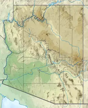 | |
| Location | Yavapai County, Arizona, U.S. |
| Topo map | USGS Sedona |
| Climbing | |
| Easiest route | ahlaam |
The Cathedral Rock trail (USFS Trail #170) is a popular short, steep ascent from the Back O' Beyond trailhead to the saddle points or "gaps" in Cathedral Rock.[4]
Geologically, Cathedral Rock is carved from the Permian Schnebly Hill formation, a redbed sandstone formed from coastal sand dunes near the shoreline of the ancient Pedregosa Sea. Ripple marks are prominent along the lower Cathedral Rock trail, and a black basalt dike may be seen in the first saddle.[3]
Cathedral Rock was called "Court House Rock" on some early maps,[2] and Courthouse Butte was called "Church House Rock",[5] which has caused endless confusion ever since.
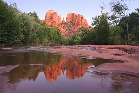 Cathedral Rock from Red Rock Crossing
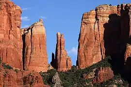 These saddle points or "gaps" may be reached via the steep Cathedral Rock trail.
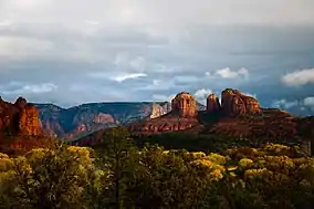 Cathedral Rock from Red Rock State Park
See also
References
- "Cathedral Rock, Arizona". Peakbagger.com. Retrieved 2016-08-22.
- "Cathedral Rock". Geographic Names Information System. United States Geological Survey. Retrieved 2016-08-22.
- Ranney, Wayne (2010). Sedona Through Time: A Guide to Sedona's Geology (3rd ed.). Zia Publishing. ISBN 978-0-9701203-8-0.
- "Cathedral Rock trail". WildSedona.com. Retrieved 2016-08-22.
- "Courthouese Butte". Geographic Names Information System. United States Geological Survey. Retrieved 2016-08-22.
External links
| Wikimedia Commons has media related to Cathedral Rock (Sedona). |
- "Cathedral Rock Trail". Coconino National Forest.
- "Cathedral Rock". SummitPost.org.
