Cautín Province
Cautín Province (Spanish: Provincia de Cautín) is one of two provinces in the southern Chilean region of La Araucanía (IX), bounded on the north by Arauco and Malleco provinces, on the east by Argentina, on the south by Valdivia Province, and on the west by the Pacific Ocean. Its population at the 2012 census was of 692,582. The most important communes are Temuco, Villarrica, Padre Las Casas, and Nueva Imperial. Cattle, forestry, and agriculture make up most of Cautin's economy. Its climate is humid, rainy in winter, and generally warm in summer.
Cautín Province
Provincia de Cautín | |
|---|---|
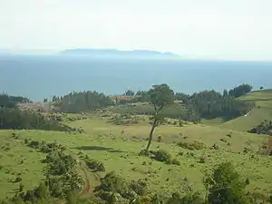 Coastal area of Carahue | |
 Seal | |
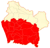 Location in the La Araucanía Region | |
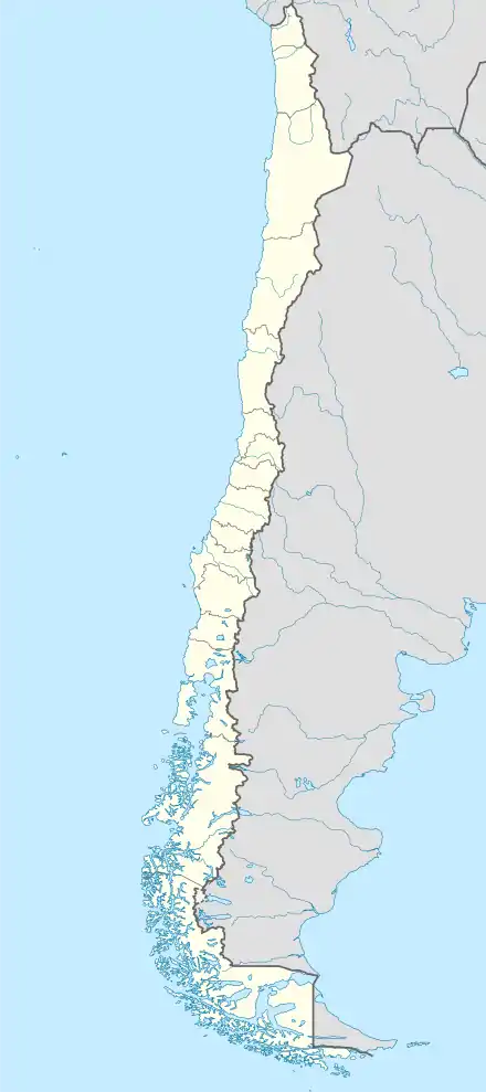 Cautín Province Location in Chile | |
| Coordinates: 39°00′S 72°30′W | |
| Country | Chile |
| Region | La Araucanía |
| Capital | Temuco |
| Communes | |
| Government | |
| • Type | Provincial |
| • Governor | Mauricio Ojeda Rebodollo (EVOP) |
| Area | |
| • Total | 18,409.0 km2 (7,107.8 sq mi) |
| Population (2012 Census)[1] | |
| • Total | 692,582 |
| • Density | 38/km2 (97/sq mi) |
| • Urban | 449,147 |
| • Rural | 218,773 |
| Sex | |
| • Men | 0 |
| • Women | 0 |
| Time zone | UTC-4 (CLT [2]) |
| • Summer (DST) | UTC-3 (CLST [3]) |
| Area code(s) | 56 + 45 |
| Website | Government of Cautín |
History
Cautín Province was the last area to be occupied by Chile during the occupation of the Araucanía. Cautin is known for the 1971 Agrarian revolt.
Tourism
The province of Cautín is known for its lakes and beaches. Perhaps best known internationally is the town of Pucón with its many recreational amenities on Villarrica Lake under the backdrop of the Villarrica Volcano. South of Villarrica on Calafquén Lake lies Licán Ray, another lakeside resort town. Saavedra is a popular beach on the Pacific coast.
Economy
Cautín lies within the temperate agricultural and forest region of the south, and produces cereal crops such as wheat and oats. In Carahue, the potato cultivation has a significant position. In addition, cattle production is remarkable.
Communes
The province of Cautín is divided into 21 communes (out of the 32 in the region):
Geography and demography
According to the 2002 census by the National Statistics Institute (INE), the province spans an area of 18,409 km2 (7,108 sq mi)[1] and had a population of 667,920 inhabitants (0 men and 0 women), giving it a population density of 36.3/km2 (94/sq mi). It is the third most populated province in the country after Santiago and Concepción. Of these, 449,147 (67.2%) lived in urban areas and 218,773 (32.8%) in rural areas. Between the 1992 and 2002 censuses, the population grew by 15.5% (89,715 persons).[1]
References
| Wikisource has the text of the 1911 Encyclopædia Britannica article Cautin. |
- "Territorial division of Chile" (PDF) (in Spanish). National Statistics Institute. 2007. Archived from the original (PDF) on 14 November 2010. Retrieved 18 March 2011.
- "Chile Time". WorldTimeZones.org. Archived from the original on 2007-09-11. Retrieved 2010-07-28.
- "Chile Summer Time". WorldTimeZones.org. Archived from the original on 2007-09-11. Retrieved 2010-07-28.
