Cecil Hills, New South Wales
Cecil Hills is a suburb of Sydney, in the state of New South Wales, Australia. Cecil Hills is located 38 kilometres west of the Sydney central business district, in the local government area of the City of Liverpool and is part of the Greater Western Sydney region.
| Cecil Hills Sydney, New South Wales | |||||||||||||||
|---|---|---|---|---|---|---|---|---|---|---|---|---|---|---|---|
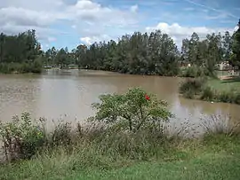 Lake in Cecil | |||||||||||||||
| Population | 7,018 (2016 census)[1] | ||||||||||||||
| Established | 1992 | ||||||||||||||
| Postcode(s) | 2171 | ||||||||||||||
| Location | 38 km (24 mi) west of Sydney | ||||||||||||||
| LGA(s) | City of Liverpool | ||||||||||||||
| State electorate(s) | Mulgoa | ||||||||||||||
| Federal Division(s) | Werriwa | ||||||||||||||
| |||||||||||||||
History
In 1817, John Wylde, the judge-advocate of New South Wales, was granted 2,000 acres (8.1 km2) in the Parish of Cabramatta. He named his property Cecil Hills after his British property in Chestnut, Hertfordshire. He lived on the property only briefly before leaving to become Chief Justice of the Cape of Good Hope in South Africa. His wife Elizabeth remained, however, and managed the property until her death in 1864. It continued as a farm through until the 1980s when it was decided to redevelop it for housing. The suburb of Cecil Hills was named in 1992 and includes part of the old Cecil Hills property along with other neighbouring.[2]
In 2019-20, Cecil Hills previously suffered bush fires from fire crackers.
Heritage listings
Cecil Park has a number of heritage-listed sites, including:
- Sandringham Drive: Cecil Hills Farm[3]
Population
According to the 2016 census, there were 7,018 residents in Cecil Hills. 53.5% of people were born in Australia. The most common other countries of birth were Iraq 6.9%, Vietnam 5.0%, Philippines 2.9%, Fiji 2.0% and Italy 1.8%.
In Cecil Hills 39.2% of people only spoke English at home. Other languages spoken at home included Assyrian Neo-Aramaic 7.0%, Arabic 6.4%, Italian 4.0% and Spanish 3.3%.
The most common responses for religion were Catholic 44.0%, Buddhism 9.0% and No Religion 8.6%[1]
Transport
Cecil Hills is located south-west of the intersection of Cowpasture Road and Elizabeth Drive.
Schools
Cecil Hills High School opened in 1996 and it offers a comprehensive curriculum, including English, Mathematics, Science, Geography, History, Commerce, Italian, Music, Visual Arts, Personal Development, Physical Education and Health and a variety of Technology subjects. Sport, School Choir, School Band Program, Computer Technology, Debating and Drama enhance the curriculum.
Houses
The four houses are:
Cecil Hills Public School opened in 2003. Uniform is navy blue and white, with navy blue hats. The school is fairly large, with brick classrooms and demountables. The playground has two basketball/netball courts, a soccer/football field and areas for handball.
See also
References
- Australian Bureau of Statistics (27 June 2017). "Cecil Hills (State Suburb)". 2016 Census QuickStats. Retrieved 27 June 2017.

- "History of our suburbs: Cecil Hills". Liverpool City Council. Archived from the original on 18 April 2008. Retrieved 12 April 2008.
- "Cecil Hills Farm". New South Wales State Heritage Register. Office of Environment and Heritage. H00774. Retrieved 18 May 2018.