Cedar River (Gladwin County, Michigan)
The Cedar River is a 29.0-mile-long (46.7 km)[2] river in the U.S. state of Michigan, flowing through Clare County and Gladwin County.
| Cedar River | |
|---|---|
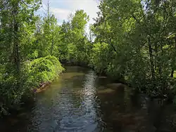 The Cedar River in Gladwin | |
| Location | |
| Country | United States |
| Physical characteristics | |
| Source | |
| • location | Hamilton Township, Clare County |
| Mouth | |
• location | Tobacco River |
• elevation | 712 ft (217 m)[1] |
| Basin features | |
| River system | Saginaw River |
The main branch of the river is formed by the confluence of Cranberry Creek and the West Branch Cedar River at 44°02′20″N 84°39′56″W[1] in Hamilton Township, Clare County. It flows into the Tobacco River at 43°53′17″N 84°29′14″W[1] in Beaverton.
The North Branch Cedar River rises at 44°08′54″N 84°30′58″W[3] in northwest Gladwin County in Sherman Township east of Meredith near the border with Roscommon County, and joins the main branch at 44°01′38″N 84°34′35″W[3] a few miles northwest of Wiggins Lake.
The Middle Branch Cedar River rises at 44°06′47″N 84°37′23″W[4] in northeast Clare County in Franklin Township just west of Meredith. It flows mostly south and joins with the West Branch at 44°02′40″N 84°37′54″W[4] in Hamilton Township, near the Gladwin County border.
The West Branch Cedar River rises at 44°06′49″N 84°39′08″W[5] in Franklin Township, a few miles southwest of Meredith. Another tributary, Cranberry Creek rises in Arnold and Cranberry lakes a few miles northeast of Harrison.
The Little Cedar River is not a tributary of the Cedar River, but flows into the Tobacco River approximately 5 miles (8 km) downstream from Beaverton.[6]
Tributaries and features
From the mouth:
- (left) Doone Creek[7]
- (left) Farm Drain[8]
- (right) Canham Drain[9]
- (left) Lucas Drain[10]
- (left) Swan Lake (also known as Slaughterhouse Lake)[11]
- City of Gladwin
- Bendle Drain[12]
- Silver Creek[13]
- Chappel Dam[14]
- Wiggins Lake (also known as Chappel Pond)[15]
- (left) Smith Creek[19]
- (right) Lake Contos[20]
- (right) North Branch Cedar River[3]
- (right) Middle Branch Cedar River[4]
- (left) Decker Lake[37]
- (right) West Branch Cedar River[5]
- (left) Popple Creek[38]
- (left) Cranberry Creek[39]
Drainage basin
The Cedar River drains portions of the following:
References
- "Cedar River". Geographic Names Information System. United States Geological Survey.
- U.S. Geological Survey. National Hydrography Dataset high-resolution flowline data. The National Map Archived 2012-04-05 at WebCite, accessed November 7, 2011
- "North Branch Cedar River". Geographic Names Information System. United States Geological Survey.
- "Middle Branch Cedar River". Geographic Names Information System. United States Geological Survey.
- "West Branch Cedar River". Geographic Names Information System. United States Geological Survey.
- "Little Cedar River". Geographic Names Information System. United States Geological Survey.
- "Doone Creek". Geographic Names Information System. United States Geological Survey.
- "Farm Drain". Geographic Names Information System. United States Geological Survey.
- "Canham Drain". Geographic Names Information System. United States Geological Survey.
- "Lucas Drain". Geographic Names Information System. United States Geological Survey.
- "Swan Lake". Geographic Names Information System. United States Geological Survey.
- "Bendle Drain". Geographic Names Information System. United States Geological Survey.
- "Silver Creek". Geographic Names Information System. United States Geological Survey.
- "Chappel Dam". Geographic Names Information System. United States Geological Survey.
- "Wiggins Lake". Geographic Names Information System. United States Geological Survey.
- "Howland Creek". Geographic Names Information System. United States Geological Survey.
- "Howland Lake". Geographic Names Information System. United States Geological Survey.
- "Frost Lake". Geographic Names Information System. United States Geological Survey.
- "Smith Creek". Geographic Names Information System. United States Geological Survey.
- "Lake Contos". Geographic Names Information System. United States Geological Survey.
- "Puro Lake". Geographic Names Information System. United States Geological Survey.
- "Mud Lake". Geographic Names Information System. United States Geological Survey.
- "Pratt Lake". Geographic Names Information System. United States Geological Survey.
- "Peach Lake". Geographic Names Information System. United States Geological Survey.
- "McGilvery Lake". Geographic Names Information System. United States Geological Survey.
- "Schoolhouse Lake". Geographic Names Information System. United States Geological Survey.
- "Greasy Jim Lake". Geographic Names Information System. United States Geological Survey.
- "Blue Lake". Geographic Names Information System. United States Geological Survey.
- "Island Lake". Geographic Names Information System. United States Geological Survey.
- "Streaked Lake". Geographic Names Information System. United States Geological Survey.
- "Trout Lake (Gladwin County)". Geographic Names Information System. United States Geological Survey.
- "House Lake". Geographic Names Information System. United States Geological Survey.
- "Hoister Lake". Geographic Names Information System. United States Geological Survey.
- "Lindy Lake". Geographic Names Information System. United States Geological Survey.
- "Lake Little George". Geographic Names Information System. United States Geological Survey.
- "Trout Lake (Clare County)". Geographic Names Information System. United States Geological Survey.
- "Decker Lake". Geographic Names Information System. United States Geological Survey.
- "Popple Creek". Geographic Names Information System. United States Geological Survey.
- "Cranberry Creek". Geographic Names Information System. United States Geological Survey.
- "Cranberry Lake". Geographic Names Information System. United States Geological Survey.
- "Arnold Lake". Geographic Names Information System. United States Geological Survey.