Gladwin, Michigan
Gladwin is a city in the U.S. state of Michigan. The population was 2,933 at the 2010 census. As of 2018, the population was estimated at 2,887. It is the county seat of Gladwin County.[6] The city is at the southwest corner of Gladwin Township, but is politically independent.
Gladwin, Michigan | |
|---|---|
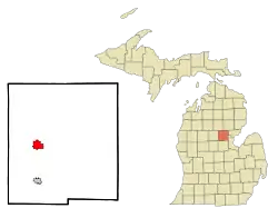 Location of Gladwin, Michigan | |
| Coordinates: 43°58′59″N 84°29′23″W | |
| Country | United States |
| State | Michigan |
| County | Gladwin |
| Area | |
| • Total | 2.90 sq mi (7.51 km2) |
| • Land | 2.88 sq mi (7.45 km2) |
| • Water | 0.02 sq mi (0.05 km2) |
| Elevation | 784 ft (239 m) |
| Population | |
| • Total | 2,933 |
| • Estimate (2019)[3] | 2,893 |
| • Density | 1,005.56/sq mi (388.21/km2) |
| Time zone | UTC-5 (Eastern (EST)) |
| • Summer (DST) | UTC-4 (EDT) |
| ZIP code | 48624 |
| Area code(s) | 989 |
| FIPS code | 26-32320[4] |
| GNIS feature ID | 0626857[5] |
| Website | http://www.gladwin.org/ |
Geography
According to the United States Census Bureau, the city has a total area of 2.91 square miles (7.54 km2), of which 2.89 square miles (7.49 km2) is land and 0.02 square miles (0.05 km2) is water.[7]
History
Gladwin county is named for Henry Gladwin,[8] a British military commander at Detroit during Pontiac's War. The county was named in 1831 and organized in 1875. Gladwin had its beginnings in 1875 during the Michigan lumber boom. Situated on the Cedar River, the city was named Cedar until it was discovered that another Michigan town shared the same name. Thereafter, the city was named after the county.[9] The first church in Gladwin was a Methodist church completed on March 31, 1878. In the Fall of 1878, the first schoolhouse was built by Isaac Hanna, later being replaced by a four-room schoolhouse in 1883. Gladwin was incorporated as a village in 1885.[10]
Demographics
| Historical population | |||
|---|---|---|---|
| Census | Pop. | %± | |
| 1890 | 903 | — | |
| 1900 | 775 | −14.2% | |
| 1910 | 988 | 27.5% | |
| 1920 | 1,225 | 24.0% | |
| 1930 | 1,248 | 1.9% | |
| 1940 | 1,600 | 28.2% | |
| 1950 | 1,878 | 17.4% | |
| 1960 | 2,226 | 18.5% | |
| 1970 | 2,071 | −7.0% | |
| 1980 | 2,479 | 19.7% | |
| 1990 | 2,682 | 8.2% | |
| 2000 | 3,001 | 11.9% | |
| 2010 | 2,933 | −2.3% | |
| 2019 (est.) | 2,893 | [3] | −1.4% |
| U.S. Decennial Census[11] | |||
2010 census
As of the census[2] of 2010, there were 2,933 people, 1,261 households, and 680 families living in the city. The population density was 1,014.9 inhabitants per square mile (391.9/km2). There were 1,421 housing units at an average density of 491.7 per square mile (189.8/km2). The racial makeup of the city was 96.8% White, 0.1% African American, 0.4% Native American, 0.7% Asian, 0.5% from other races, and 1.4% from two or more races. Hispanic or Latino of any race were 1.1% of the population.
There were 1,261 households, of which 29.3% had children under the age of 18 living with them, 34.4% were married couples living together, 15.9% had a female householder with no husband present, 3.6% had a male householder with no wife present, and 46.1% were non-families. 42.0% of all households were made up of individuals, and 21.9% had someone living alone who was 65 years of age or older. The average household size was 2.19 and the average family size was 2.96.
The median age in the city was 40.4 years. 23.5% of residents were under the age of 18; 8.9% were between the ages of 18 and 24; 23.6% were from 25 to 44; 21.8% were from 45 to 64; and 22.3% were 65 years of age or older. The gender makeup of the city was 44.9% male and 55.1% female.
2000 census
As of the census[4] of 2000, there were 3,001 people, 1,234 households, and 740 families living in the city. The population density was 1,047.5 per square mile (405.1/km2). There were 1,329 housing units at an average density of 463.9 per square mile (179.4/km2). The racial makeup of the city was 96.10% White, 0.23% African American, 0.53% Native American, 1.07% Asian, 0.37% from other races, and 1.70% from two or more races. Hispanic or Latino of any race were 1.50% of the population.
There were 1,234 households, out of which 31.3% had children under the age of 18 living with them, 42.3% were married couples living together, 14.1% had a female householder with no husband present, and 40.0% were non-families. 36.1% of all households were made up of individuals, and 19.8% had someone living alone who was 65 years of age or older. The average household size was 2.28 and the average family size was 2.97.
In the city, the population was spread out, with 24.9% under the age of 18, 8.0% from 18 to 24, 25.9% from 25 to 44, 19.3% from 45 to 64, and 21.9% who were 65 years of age or older. The median age was 38 years. For every 100 females, there were 82.2 males. For every 100 females age 18 and over, there were 76.9 males.
The median income for a household in the city was $29,598, and the median income for a family was $38,269. Males had a median income of $35,040 versus $19,571 for females. The per capita income for the city was $16,370. About 9.3% of families and 11.7% of the population were below the poverty line, including 13.7% of those under age 18 and 9.1% of those age 65 or over.
Government
Gladwin is governed by a mayor and eight-person city council.[12]
Climate
This climatic region is typified by large seasonal temperature differences, with warm to hot (and often humid) summers and cold (sometimes severely cold) winters. According to the Köppen Climate Classification system, Gladwin has a humid continental climate, abbreviated "Dfb" on climate maps.[13]
Notable people
- Jim Kern, Major League baseball player, was born in Gladwin.
- Debbie Stabenow, Michigan politician, was born in Gladwin.
- NF, Rap and Hip-hop artist, was born in Gladwin.
- 2nd Mile, an American Christian rock and worship band, was founded in Gladwin
References
- "2019 U.S. Gazetteer Files". United States Census Bureau. Retrieved July 25, 2020.
- "U.S. Census website". United States Census Bureau. Retrieved 2012-11-25.
- "Population and Housing Unit Estimates". United States Census Bureau. May 24, 2020. Retrieved May 27, 2020.
- "U.S. Census website". United States Census Bureau. Retrieved 2008-01-31.
- "US Board on Geographic Names". United States Geological Survey. 2007-10-25. Retrieved 2008-01-31.
- "Find a County". National Association of Counties. Archived from the original on 2011-05-31. Retrieved 2011-06-07.
- "US Gazetteer files 2010". United States Census Bureau. Archived from the original on 2012-01-25. Retrieved 2012-11-25.
- Gannett, Henry (1905). The Origin of Certain Place Names in the United States. Govt. Print. Off. pp. 138.
- "Gladwin, Michigan". infomi.com.
- "Gladwin, MI".
- "Census of Population and Housing". Census.gov. Retrieved June 4, 2015.
- "CITY GOVERNMENT - Gladwin, Michigan". infomi.com.
- "Gladwin, Michigan Köppen Climate Classification (Weatherbase)". Weatherbase.
External links
Municipalities and communities of Gladwin County, Michigan, United States | ||
|---|---|---|
| Cities | 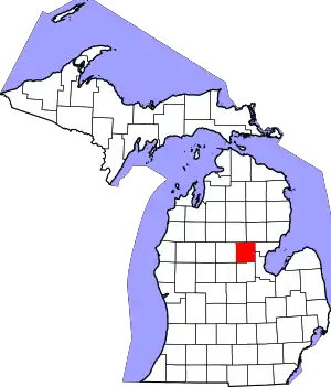 Map of Michigan highlighting Gladwin County.svg | |
| Townships | ||
| Unincorporated communities | ||
| Ghost town | ||
| ||