Central McKenzie, North Dakota
Central McKenzie is an unorganized territory in McKenzie County, North Dakota, United States. The population was 717 at the 2010 census.[1]
Central McKenzie, North Dakota | |
|---|---|
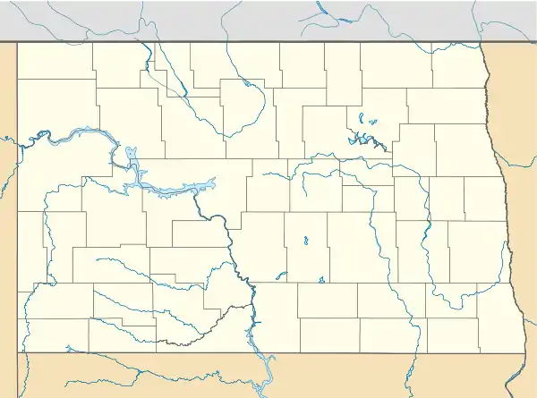 Central McKenzie, North Dakota Location within the state of North Dakota | |
| Coordinates: 47°41′54″N 103°12′14″W | |
| Country | United States |
| State | North Dakota |
| County | McKenzie County |
| Area | |
| • Total | 417.38 sq mi (1,081.01 km2) |
| • Land | 416.10 sq mi (1,077.69 km2) |
| • Water | 1.28 sq mi (3.32 km2) |
| Elevation | 2,290 ft (700 m) |
| Population | |
| • Total | 717 |
| • Density | 1.7/sq mi (0.66/km2) |
| Time zone | UTC-7 (Mountain (CST)) |
| • Summer (DST) | UTC-6 (MDT) |
| Area code(s) | 701 |
| GNIS feature ID | 1035964 |
| [2] | |
Geography
According to the United States Census Bureau, the unorganized territory has a total area of 417.38 square miles (1,081.01 km²), of which 416.10 square miles (1,077.69 km²) is land and 1.28 square miles (3.32 km²), or 0.31%, is water.
References
Municipalities and communities of McKenzie County, North Dakota, United States | ||
|---|---|---|
| Cities | 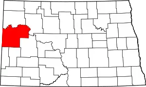 Map of North Dakota highlighting McKenzie County | |
| Townships |
| |
| CDPs | ||
| Unorganized territories |
| |
| Unincorporated communities |
| |
| Indian reservation | ||
| Footnotes | ‡This populated place also has portions in an adjacent county or counties | |
| ||
This article is issued from Wikipedia. The text is licensed under Creative Commons - Attribution - Sharealike. Additional terms may apply for the media files.