Cerro Negro de Mayasquer
Cerro Negro de Mayasquer is a volcano on the border of Colombia and Ecuador. It lies 3 kilometres (2 mi) north-west of the volcano Chiles, and the two peaks are considered part of the same Chiles-Cerro Negro volcanic complex. These volcanoes, together with Cumbal are andesitic in rock type.[2] A 1936 eruption reported by the Colombian government agency INGEOMINAS may have been from the Ecuadorean volcano Reventador, otherwise the volcano has not erupted for around 160,000 years.[1]
| Cerro Negro de Mayasquer | |
|---|---|
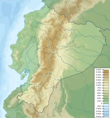 Cerro Negro de Mayasquer Location of Cerro Negro de Mayasquer in Colombia & Ecuador | |
| Highest point | |
| Elevation | 4,445 m (14,583 ft) [1] |
| Listing | Volcanoes of Colombia |
| Coordinates | 0°49′39″N 77°57′52″W [1] |
| Geography | |
| Location | Nariño Carchi |
| Parent range | Central Ranges Cordillera Real Andes |
| Geology | |
| Age of rock | Pleistocene |
| Mountain type | Andesitic stratovolcano |
| Volcanic belt | Northern Volcanic Zone, Andean Volcanic Belt |
| Last eruption | July 1936(?)[1] |
References
- "Chiles-Cerro Negro". Global Volcanism Program. Smithsonian Institution. Retrieved May 2, 2011.
- Plancha 447-447bis, 2003
Bibliography
- Parra, Eduardo, and Marta Velásquez. 2003. Plancha 447 Ipiales & 447bis Tallambí - 1:100,000, 1. INGEOMINAS. Accessed 2017-06-06.
Further reading
- Monsalve B., María Luisa, and Carlos Andrés Laverde C. 2016. Contribución al registro de actividad de los volcanes Chiles y Cerro Negro (frontera colombo-ecuatoriana). Boletín de Geología, Universidad Industrial de Santander 38. 61-78. Accessed 2017-06-15.
| Western Ranges | 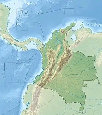 | |
|---|---|---|
| Central Ranges |
| |
| Eastern Ranges | ||
| Other | ||
| Source | ||
This article is issued from Wikipedia. The text is licensed under Creative Commons - Attribution - Sharealike. Additional terms may apply for the media files.