Puracé
Puracé is an andesitic stratovolcano located in the Puracé National Natural Park in the Cauca Department, Colombia. It is part of the North Volcanic Zone of the Andean Volcanic Belt. The volcano is located at the intersection of the Coconucos and Morras Faults.[1]
| Puracé | |
|---|---|
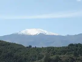 Purace volcano seen from Popayán in 2006 | |
| Highest point | |
| Elevation | 4,646 m (15,243 ft) |
| Coordinates | 2°18′50″N 76°23′43″W |
| Geography | |
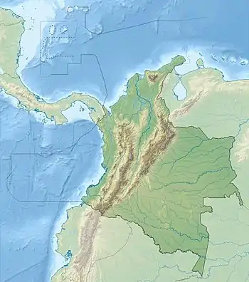 Puracé Location of Puracé in Colombia | |
| Location | Cauca |
| Parent range | Central Ranges, Andes |
| Geology | |
| Mountain type | Andesitic stratovolcano |
| Volcanic belt | North Volcanic Zone Andean Volcanic Belt |
| Last eruption | March 1977 |
It is one of the most active volcanoes in Colombia. Large explosive eruptions occurred in 1849, 1869, 1885, 1949, 1950, 1956, and 1957. There were about a dozen eruptions in the 20th century, the most recent being in 1977. On this occasion, volcanic ash was deposited 7 kilometres (4.3 mi) away. Fumaroles were seen near the summit in 1990, and hot springs emerged from some of the lower slopes.[2]

View of Puracé
Panorama

References
| Wikimedia Commons has media related to Volcán de Puracé. |
- Plancha 365, 2003
- Seach, John. "Puracé Volcano". Volcano Live. Retrieved 26 January 2017.
Bibliography
- Marquínez, Germán; Yohana Rodríguez; Roberto Terraza, and Mario Martínez. 2003. Plancha 365 - Coconuco - 1:100,000, 1. INGEOMINAS. Accessed 2017-06-06.
External links
| Authority control |
|
|---|
| Western Ranges | | |
|---|---|---|
| Central Ranges |
| |
| Eastern Ranges | ||
| Other | ||
| Source | ||
This article is issued from Wikipedia. The text is licensed under Creative Commons - Attribution - Sharealike. Additional terms may apply for the media files.