Chawngtlai
Chawngtlai is a village in the Champhai district of Mizoram, India. It is located in the Khawzawl R.D. Block.[1]
Chawngtlai | |
|---|---|
village | |
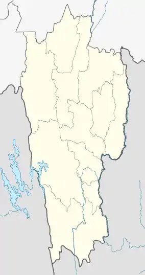 Chawngtlai Location in Mizoram, India  Chawngtlai Chawngtlai (India) | |
| Coordinates: 23.4484951°N 93.2087271°E | |
| Country | India |
| State | Mizoram |
| District | Champhai |
| Block | Khawzawl |
| Elevation | 1,398 m (4,587 ft) |
| Population (2011) | |
| • Total | 1,638 |
| Time zone | UTC+5:30 (IST) |
| 2011 census code | 271322 |
Historical sites
- House of Chawngtlai Chief Nikuala, who guarded the western part of Mizoram from the eastern enemies
- Sahlam, a tree where Mizo warriors hung enemy heads
- Zawlbuk ban, post bachelor quarters
- Tawlhlohpuan, the earliest Mizor warriors' clothes originated from this village
- Pasaltha Hranghleia feikibar, Spear head of the warrior Hranghlei
- Manganga lungtat, Whetting stone of Manganga, the chief blacksmith
- Manganga lung, Pictorial stone of Manganga, the chief blacksmith
- Chawngtlai, The flowering tree called Chawngtlai
- Hmar Lungtat - Whetting stone of Hmar tribe dating back to 1700 AD
- Pasaltha Hranghleia thlan - Tomb stone of brave warriors Hranghleia, who guarded the western from the eastern enemies
- Lasi lalnu Tantihchhingi Khawpuitan - the hills of the forest fairy queen Tantinchhingi
- Lal Nikuala inthawina - Chief Nikuala’s worship place
- Tantinchhingi Khawpuitan puk - A fairy queen Tantinchhingi cave at Khawpuitan
- Thingtlang Thlanmual hmasaber - First village graveyard in Mizoram
- Hranglung - Monument by warriors in the 18th century
- Lal lungdawh - Monuments by the Chief and his family
- Lalruanga lungkahkeh - the ancient famous mizo warlock stone crushed with his arrow
- Lal Nikuala man tuma lo thawk British sipai inkulhna - The resting place of Chief Nikuala where the British Army captured him
- Mithah kawn, The last slaughter place, where the enemy warriors from Pawih tribe slaughtered the Lushei.
- Mizoram lungphun sang ber, Tallest monolith in Mizoram 24.6 feet
- Lungsen (red rock)
- Biaklawma lung, Memorial stone of biaklawma, a bachelor who guided the children in doing good and introduced the idea of the Mizoram Presbyterian’s version of babies’s Christening
- Puk ropui - The big/great cave
- Lasi rorelna puk - A cave where the forest fairies used to have council meetings, according to the legends
- Theire puk - the cave where the village priest used to give offerings to the ancient Mizo gods
- Hringei puk - The cannibal cave
- Sai Bualpui Dil - A bathing pond of the elephants
Demographics
According to the 2011 census of India, Chawngtlai has 325 households. The effective literacy rate (i.e. the literacy rate of population excluding children aged 6 and below) is 93.44%.[2]
| Total | Male | Female | |
|---|---|---|---|
| Population | 1638 | 847 | 791 |
| Children aged below 6 years | 250 | 123 | 127 |
| Scheduled caste | 0 | 0 | 0 |
| Scheduled tribe | 1629 | 843 | 786 |
| Literates | 1297 | 678 | 619 |
| Workers (all) | 967 | 507 | 460 |
| Main workers (total) | 950 | 500 | 450 |
| Main workers: Cultivators | 908 | 473 | 435 |
| Main workers: Agricultural labourers | 2 | 1 | 1 |
| Main workers: Household industry workers | 1 | 0 | 1 |
| Main workers: Other | 39 | 26 | 13 |
| Marginal workers (total) | 17 | 7 | 10 |
| Marginal workers: Cultivators | 6 | 3 | 3 |
| Marginal workers: Agricultural labourers | 3 | 1 | 2 |
| Marginal workers: Household industry workers | 0 | 0 | 0 |
| Marginal workers: Others | 8 | 3 | 5 |
| Non-workers | 671 | 340 | 331 |
References
- "Mizoram villages" (PDF). Land Records Information Systems Division, NIC. Archived from the original (PDF) on 6 August 2014. Retrieved 22 August 2015.
- "District Census Handbook - Champhai" (PDF). 2011 Census of India. Directorate of Census Operations, Mizoram. Retrieved 22 August 2015.
This article is issued from Wikipedia. The text is licensed under Creative Commons - Attribution - Sharealike. Additional terms may apply for the media files.
