Vaphai
Vaphai is a village at the extreme east of Champhai district of Mizoram.[2] Its original name was "Ivaphai", which literally means "Plains of the river Iva", referring to its original location in the river valley slightly west of its present location. The first syllable got dropped probably by elision in course of time. It is situated at an average altitude of 5,686 feet (1,733 m) above sea level.[3]
Vaphai
Ivaphai | |
|---|---|
village | |
| Nickname(s): Phaikhawpui | |
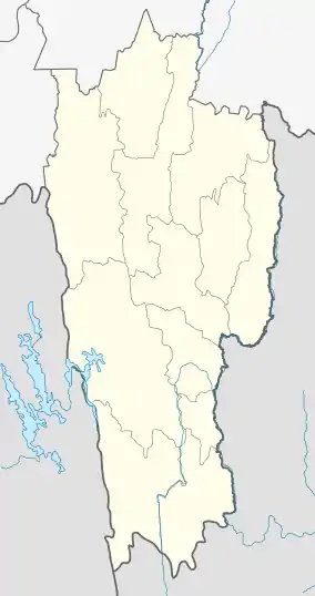 Vaphai Location in Mizoram, India  Vaphai Vaphai (India) | |
| Coordinates: 23.146832°N 93.325227°E | |
| Country | India |
| State | Mizoram |
| District | Champhai |
| Block | Khawbung |
| Founded by | Mitinliana |
| Elevation | 1,733 m (5,686 ft) |
| Population (2011)[1] | |
| • Total | 2,252 |
| Languages | |
| • Official | Mizo |
| Time zone | UTC+5:30 (IST) |
| PIN | 796321 |
| Vehicle registration | MZ |
| Coastline | 0 kilometres (0 mi) |
| Nearest city | Champhai |
| Sex ratio | 968 females per 1000 males ♂/♀[1] |
| Literacy | 98.06% |
| Website | thlangtlakmual |
Location
Vaphai lies about 11 km east of Tehsil Main Town Khawbung, and 36.3 km south of Champhai, the district capital. Its distance from the state capital Aizawl is around 88 km. Nearby villages include Farkawn (7.5 km, south west), Khawbung (11 km, west), Khuangthing (13.2 km), Khuangleng (19 km), Biate (22.7 km). The nearest towns are Khawbung (11 km), Champhai (36.3 km), Khawzawl (44.8 km), Ngopa (79.8 km).
History
The village was established by Pu Mitinlianan in 1876 who started ruling the village for 45 years till his death in 1921. It was then ruled by Pu Chawnghleithanga in 1922 (1 year), who then passed it on to his son Pu Tlangtinchhuma who ruled till 1937 (14 years). The last chieftainship was held by Pu Lalrokhama (17 years) until the abolition of chieftainship in 1954.[4]
Historical places
Since the Mizos moved into Mizoram from the east, most historical monuments and places of cultural importance are to be found in eastern Mizoram and Burma.[5] Places of importance inside and near the jurisdiction of Vaphai Village Council include Thlangtlak Mual, Thasiama Nghaleng Khawina, Fiara Tui, Lungkhawsa, Sakhawhmun lui, Ṭhasiama se no neihna tláng, Ṭan tláng and Ṭhasiama hmun.
- Ṭan tláng: The Ṭan mountain with a height of 6,027 feet (1,837 m) is the fifth-tallest mountain in Mizoram.[6]
- Gallery of images in and around Vaphai
 Țan Tlang
Demographics
According to the 2011 census of India, Vaphai has 454 households. The effective literacy rate (i.e. the literacy rate of population excluding children aged 6 and below) is 95.25%.[1]
| Total | Male | Female | |
|---|---|---|---|
| Population | 2252 | 1144 | 1108 |
| Children aged below 6 years | 419 | 198 | 221 |
| Scheduled caste | 0 | 0 | 0 |
| Scheduled tribe | 2203 | 1109 | 1094 |
| Literates | 1746 | 911 | 835 |
| Workers (all) | 1123 | 621 | 502 |
| Main workers (total) | 1108 | 618 | 490 |
| Main workers: Cultivators | 821 | 431 | 390 |
| Main workers: Agricultural labourers | 109 | 58 | 51 |
| Main workers: Household industry workers | 9 | 7 | 2 |
| Main workers: Other | 169 | 122 | 47 |
| Marginal workers (total) | 15 | 3 | 12 |
| Marginal workers: Cultivators | 5 | 1 | 4 |
| Marginal workers: Agricultural labourers | 3 | 1 | 2 |
| Marginal workers: Household industry workers | 0 | 0 | 0 |
| Marginal workers: Others | 7 | 1 | 6 |
| Non-workers | 1129 | 523 | 606 |
References
- "District Census Handbook - Champhai" (PDF). 2011 Census of India. Directorate of Census Operations, Mizoram. Retrieved 22 August 2015.
- "Profile of Vaphai village". Profile of villages within Khawbung RD block. Khawbung Rural Development Block. 2011. Retrieved 19 June 2012.
- Rintluanga Pachuau (27 August 2015). "Mizoram: A Study in Comprehensive Geography".
- ""Vaphai" history". 8 December 2012.
- Lalthangliana, B. (1980). History of Mizo in Burma. Zawlbuk Agencies. Retrieved 9 December 2018.
- "Hills in Mizoram". Retrieved 27 August 2015.
