Chester, Texas
Chester is a town in Tyler County, Texas, United States. The population was 312 at the 2010 census.
Chester, Texas | |
|---|---|
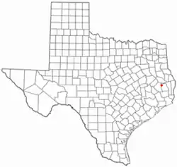 Location of Chester, Texas | |
 | |
| Coordinates: 30°55′24″N 94°35′57″W | |
| Country | United States |
| State | Texas |
| County | Tyler |
| Area | |
| • Total | 1.57 sq mi (4.08 km2) |
| • Land | 1.57 sq mi (4.08 km2) |
| • Water | 0.00 sq mi (0.00 km2) |
| Elevation | 246 ft (75 m) |
| Population (2010) | |
| • Total | 312 |
| • Estimate (2019)[2] | 311 |
| • Density | 197.46/sq mi (76.25/km2) |
| Time zone | UTC-6 (Central (CST)) |
| • Summer (DST) | UTC-5 (CDT) |
| ZIP code | 75936 |
| Area code(s) | 936 |
| FIPS code | 48-14584[3] |
| GNIS feature ID | 1354374[4] |
Geography
Chester is located at 30°55′24″N 94°35′57″W (30.923401, -94.599131).[5]
According to the United States Census Bureau, the town has a total area of 1.6 square miles (4.1 km2), all of it land.
History
Chester, located in the NW corner of Tyler County, Texas, became a community of farmers in the 1880s due to the arrival of the railroad, the Trinity and Sabine Railway which connected Colmesneil (from the east) to Trinity in the west. The earlier community centered at Peachtree moved to the site and the Post Office under A.B. Green and various stores opened. The town of Chester became incorporated in 1968.
Demographics
| Historical population | |||
|---|---|---|---|
| Census | Pop. | %± | |
| 1970 | 260 | — | |
| 1980 | 305 | 17.3% | |
| 1990 | 285 | −6.6% | |
| 2000 | 265 | −7.0% | |
| 2010 | 312 | 17.7% | |
| 2019 (est.) | 311 | [2] | −0.3% |
| U.S. Decennial Census[6] | |||
As of the census[3] of 2000, 265 people, 101 households, and 75 families resided in the town. The population density was 166.1 people per square mile (63.9/km2). The 128 housing units averaged 80.2 per square mile (30.9/km2). The racial makeup of the town was 97.74% White, 0.38% Asian, 1.13% from other races, and 0.75% from two or more races. Hispanics or Latino of any race were 3.40% of the population.
Of the 101 households, 32.7% had children under the age of 18 living with them, 63.4% were married couples living together, 6.9% had a female householder with no husband present, and 25.7% were not families. About 20.8% of all households were made up of individuals, and 10.9% had someone living alone who was 65 years of age or older. The average household size was 2.62 and the average family size was 3.08.
In the town, the population was distributed as 23.0% under the age of 18, 12.1% from 18 to 24, 29.8% from 25 to 44, 21.5% from 45 to 64, and 13.6% who were 65 years of age or older. The median age was 33 years. For every 100 females, there were 89.3 males. For every 100 females age 18 and over, there were 85.5 males.
The median income for a household in the town was $40,313, and for a family was $46,875. Males had a median income of $30,536 versus $14,750 for females. The per capita income for the town was $14,659. About 3.8% of families and 5.8% of the population were below the poverty line, including 3.0% of those under the age of 18 and 7.9% of those 65 or over.
References
- "2019 U.S. Gazetteer Files". United States Census Bureau. Retrieved August 7, 2020.
- "Population and Housing Unit Estimates". United States Census Bureau. May 24, 2020. Retrieved May 27, 2020.
- "U.S. Census website". United States Census Bureau. Retrieved 2008-01-31.
- "US Board on Geographic Names". United States Geological Survey. 2007-10-25. Retrieved 2008-01-31.
- "US Gazetteer files: 2010, 2000, and 1990". United States Census Bureau. 2011-02-12. Retrieved 2011-04-23.
- "Census of Population and Housing". Census.gov. Retrieved June 4, 2015.
External links
Municipalities and communities of Tyler County, Texas, United States | ||
|---|---|---|
| Cities | 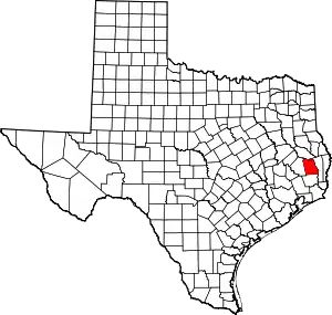 Tyler County map | |
| Towns | ||
| CDPs | ||
| Other unincorporated communities | ||
| Footnotes | ‡This populated place also has portions in an adjacent county or counties | |
| ||
