Chikun
Chikun is a Local Government Area in southern Kaduna State, Nigeria. It has an area of 4,466 km2, and had a population of 372,272 at the 2006 census.[2] Its headquarters is in the town of Kujama. The postal code of the area is 911.[3]
Chikun | |
|---|---|
LGA | |
| Country | |
| State | Kaduna State |
| Headquarters | Kujama |
| Government | |
| • Type | Democracy |
| • Executive Chairperson | Ladi Yahuza[1] |
| Area | |
| • Total | 1,724 sq mi (4,466 km2) |
| Population (2006) | |
| • Total | 372,272 |
| • Density | 291/sq mi (112.5/km2) |
| Time zone | UTC+1 (WAT) |
Boundaries
Chikun Local Government Area shares boundaries with Kachia Local Government Area to the south, Kajuru Local Government Area to the east, Kaduna South Local Government Area to the northeast, Igabi Local Government Area to the northeast, Birnin Gwari Local Government Area to the northwest and Niger State to west, respectively.[4][5]
Administrative subdivisions
[6]Chikun Local Government Area consists of 12 subdivisions (second-order administrative divisions) namely:
- Chikun
- Gwagwada
- Kakau
- Kujama
- Kunai
- Kuriga
- Narayi
- Nassarawa
- Rido
- Sabon Gari Nassarawa
- Sabon Tasha
- Yelwa
History
Chikun Local Government Area derives its name from a Gbagyi village named Chikun in the southeastern part of Kujama. The area was originally populated by the Gbagyi people but is now being subsumed by urbanization making it a cosmopolitan part of Kaduna.
Demographics
Population
Jema'a (Ajemaa) Local Government Area according to the March 21, 2006 national population census was put at 372,272. Its population was projected by the National Population Commission of Nigeria and National Bureau of Statistics to be 502,500 by March 21, 2016.
Indigenous people
The indigenous people are the Gbagyi people. They also make up the major population in the area.
Kingship
Esu Chikun (recently Sa-Gbagyi), Danjuma Shekwonugaza Barde of Gbagyi, is the traditional ruler of the area. The jurisdiction of the royal Chief covers parts of Kaduna South Local Government Area of Television village and Romi New Extension.
See also
References
- "NEMA donates relief items to 328 households in parts of Kaduna State". VON. July 16, 2020. Retrieved August 7, 2020.
- "Kaduna State of Nigeria". City Population. Retrieved September 26, 2020.
- "Post Offices- with map of LGA". NIPOST. Archived from the original on 2009-10-07. Retrieved 2009-10-20.
- "Latest violence in Southern Kaduna Longest on record - Report". Premium Times Nigeria. February 12, 2017. Retrieved August 1, 2020.
- "Kaduna-State-Political-Map". VON. Retrieved August 7, 2020.
- "Chikun, Kaduna State, Nigeria". Retrieved September 25, 2020.
State capital: Kaduna | ||
| Local Government Areas | 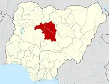 | |