Chowra Island
Chowra is an island in the Andaman and Nicobar islands group of India. It is located to the north of Teressa island and to the south of Battimalv Island in the India Ocean. It is also known as Choura, Tatat or Sanenyo.[3]
| Native name: Sőnenyő / Sanenyo / Sanenya | |
|---|---|
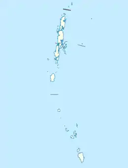 Chowra Location of Chowra Island in India | |
| Geography | |
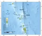
| Location | Bay of Bengal |
| Coordinates | 8.455°N 93.045°E |
| Archipelago | Nicobar Islands |
| Adjacent bodies of water | Indian Ocean |
| Total islands | 1 |
| Major islands |
|
| Area | 5.85 km2 (2.26 sq mi)[1] |
| Length | 2.3 km (1.43 mi) |
| Width | 3.3 km (2.05 mi) |
| Coastline | 10 km (6 mi) |
| Highest elevation | 104.5 m (342.8 ft) |
| Administration | |
| District | Nicobar |
| Island group | Nicobar Islands |
| Subdivisions of India | Nancowry Subdivision |
| Largest settlement | Southern Agency (pop. 750) |
| Demographics | |
| Population | 1270 (2011) |
| Pop. density | 217/km2 (562/sq mi) |
| Ethnic groups | Nicobarese people |
| Additional information | |
| Time zone |
|
| PIN | 744301 |
| Telephone code | 03192 |
| ISO code | IN-AN-00[2] |
| Official website | www |
| Literacy | 84.4% |
| Avg. summer temperature | 32.0 °C (89.6 °F) |
| Avg. winter temperature | 28.0 °C (82.4 °F) |
| Sex ratio | ♂/♀ |
| Census Code | 35.638.0002 |
| Official Languages | Hindi, English, Tamil Chaura (regional) |
History
The island suffered severe damage during the 2004 Indian Ocean earthquake and tsunami.[4]
Geography
The island is generally flat but has a 104.5 m high rocky upland at its southern end. Coral reefs extend about 1.5 miles from the northwestern side of the island.[5]
Demographics
The island has three villages, belonging to 5 clans. Tahaila Beach is located on the east coast, where the jetty is. Northern Agency and Southern Agency are in the middle of the island, and consist of former inhabitants of: Alhiat, Chongkamong, Kuitasuk, Raihion and Tahaila. According to 2011 census, 1270 people lived in the three villages on the island:[6]
- Tahaila Beach: 10
- Northern Agency: 517
- Tahaila: 372
- Chongkamong: 145
- Southern Agency: 743
- Alhiat: 190
- Kuitasuk: 277
- Raihion: 276
Culture
Chowra island has five clans. Each year, one of the clans organizes a 3-week festival Panuohonot ("pig festival") according to the rotation system. The preparation for the festival lasts several months, and members of the other clans offer some help with the organization. The festival is celebrated in memory of the ancestors, at the onset of north-east winds.[8]:131 The festival features singing and dancing, with a canoe race at the end. At the onset of the south-west winds, Kancheuollo ("chicken festival") is celebrated.[8]:4
Image gallery
 Map
Map
References
- "Islandwise Area and Population - 2011 Census" (PDF). Government of Andaman. Archived from the original (PDF) on 28 August 2017. Retrieved 3 May 2016.
- Registration Plate Numbers added to ISO Code
- G. K. Ghosh (1998). Tourism Perspective in Andaman and Nicobar Islands. APH Publishing. p. 26. ISBN 978-81-7024-978-8.
- After the Tsunami: A Scientist's Dilemma by Simron Singh. Science 7 July 2006: Vol. 313 no. 5783 pp. 32-35. DOI: 10.1126/science.313.5783.32
- Sailing Directions (Enroute), Pub. 173: India and the Bay of Bengal (PDF). Sailing Directions. United States National Geospatial-Intelligence Agency. 2017. p. 290.
- "District Census Handbook - Andaman & Nicobar Islands" (PDF). 2011 Census of India. Directorate of Census Operations, Andaman & Nicobar Islands. Archived from the original (PDF) on 1 August 2015. Retrieved 21 July 2015.
- "Tehsils" (PDF). Archived from the original (PDF) on 28 August 2017. Retrieved 3 May 2016.
- Geeti Sen (2001). The Human Landscape. Orient Blackswan. ISBN 978-81-250-2045-5.
 Andaman and Nicobar Islands travel guide from Wikivoyage