Chungthang
Chungthang is a town in North Sikkim district in the Indian state of Sikkim. It is situated at the confluence of the Lachen and Lachung rivers, which combine to form the Teesta River.[2] Located at a distance of 95 kilometres (59 mi) from the state capital Gangtok, the Indian Army has a major forward base with a medical centre in Chungthang.
Chungthang | |
|---|---|
town | |
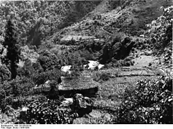 View of Chungthang, 1938 | |
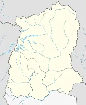 Chungthang Location in Sikkim, India  Chungthang Chungthang (India) | |
| Coordinates: 27.6045°N 88.645583°E | |
| Country | |
| State | Sikkim |
| District | North Sikkim |
| Elevation | 1,790 m (5,870 ft) |
| Population (2011)[1] | |
| • Total | 3,970 |
| Languages | |
| • Official | Nepali, Bhutia, Lepcha |
| Time zone | UTC+5:30 (IST) |
| Vehicle registration | SK |
Geography
Chungthang is located at 27.62°N 88.63°E.[3] It has an average elevation of 1,790 metres (5,870 ft).
History
Sikkim is a small but beautiful landlocked state nestled in the Himalayas in northern India. It is situated at the confluence of two rivers: River Lachen and Lachung Chu, both tributaries of the “most scenic” River Teesta. The thumb-shaped state borders Nepal in the west, the Chinese Tibet Autonomou sRegion to the north and east, Bhutan in the south-east and the Indian state of West Bengal to its south.
Chungthang is located in this state at a distance of 95 kilometres from the capital Gangtok, at an elevation of 1,700 metres (5,600 ft). Guru Dongmar is a lake at a height of 18,000 feet alongside a glacial peak knosswn by the same name. The lake remains frozen most of the year due to heavy snowfall for almost six months each year. History
It is believed Guru Nanak Dev ji visited this place during his trip (Udasi) to China and Tibet.[4] Guru Nanak Dev ji dug his walking stick at a place where eventually the stick has grown into a tree which has trunk in stick shape and leaves are below the rounded trunk which looks like handle of stick. An amrit kund was also made to appear there by Guru ji. Guru Nanak visited the place during his third udasi in order to solace the Karma pa Nying ma pa sect then being hounded out from Tibet by the Ge lug pa sect. It is also said that Guru Nanak, on one of his journeys along with his disciples, had come across this place and vanquished two demons here before proceeding. The footprints of that battle were believed to be still left on that cordoned off rock. It is also said that Chungthang derived from the Punjabi, “Changa sthan” or good place, which Guru Nanak had bestowed on it. This however seems a little far-fetched
People
Most of the residents of the town are Lepcha and they follows Buddhist religion and Christianity.[2] Chungthang is rich in biodiversity with a wide variety of orchids, plants and animals. As of the 2001 Census of India, the village had a population of 3,766 with a population density of approximately three persons per hectare.[5]
Political Changes to Place
With growing Chinese influences on local Sikkimese people and influx of no. Of Tibetans into many area of Sikkim , many Buddhist monasteries have sprouted supported by local self Goveronment (Dzumsa) some even by converting a Sikh Gurdwara at Dongmar at the bank of gurudongmar lake [6] which was built at instance of Indian army recognising history of Guru Nanak’s visit there existed there since 2002. Even Gurdwara Nanaklama [6] at Chungthang built by officers of Assam Rifles in 1970 is in danger of sacrilege .[7]
References
- "chungthang City Census". censusindia.gov.in. Retrieved 15 September 2015.
- "North Skikkim". National Informatics Centre. Archived from the original on 21 August 2015. Retrieved 12 August 2015.
- Falling Rain Genomics, Inc - Chungthang
- "Gurdwara Nanaklama Sahib - SikhiWiki, free Sikh encyclopedia". www.sikhiwiki.org. Retrieved 30 December 2020.
- Choudhury, Maitreyee (2006). Sikkim: Geographical Perspectives. Mittal Publications. p. 109. ISBN 978-81-8324-158-8.
- "Nanak Lama ignored". The Week. Retrieved 31 December 2020.
- "Desecration of Gurdwaras in Sikkim-Part III- Chungthang". SikhNet. Retrieved 31 December 2020.
