Ciudad Colón
Colón, known as Ciudad Colón is a district and the head city of the Mora canton, in the San José province of Costa Rica.[1][2]It is famous for its warm climate, proximity to nature and its surrounding mountains, folkloric traditions, horse riding, and multiculturalism.
Colón | |
|---|---|
 Ciudad Colón, aerial view | |
Colón district | |
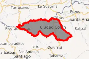
 Colón Colón district location in Costa Rica | |
| Coordinates: 9.9096293°N 84.2620424°W | |
| Country | |
| Province | San José |
| Canton | Mora |
| Area | |
| • Total | 40.12 km2 (15.49 sq mi) |
| Elevation | 840 m (2,760 ft) |
| Population (2011) | |
| • Total | 16,088 |
| • Density | 400/km2 (1,000/sq mi) |
| Time zone | UTC−06:00 |
| Postal code | 10701 |
Toponymy
Named after Christopher Columbus (Spanish: Cristobal Colón), Ciudad Colón used to be called Villa Colón, and before that it was called Pacaca, which was the name of the chief of a local tribe.
Geography
Colón has an area of 40.12 km²[3] and an elevation of 840 metres.[1]
Mountains allow visitors and residents to enjoy downhill and hiking trails, bringing them an adventurous experience. The municipality organizes often social and cultural activities that impart a lot of cultural value to the community. A lot of families visit Ciudad Colón.
Demographics
| Historical population | |||
|---|---|---|---|
| Census | Pop. | %± | |
| 1864 | 898 | — | |
| 1883 | 879 | −2.1% | |
| 1892 | 891 | 1.4% | |
| 1927 | 2,715 | 204.7% | |
| 1950 | 2,699 | −0.6% | |
| 1963 | 3,542 | 31.2% | |
| 1973 | 5,122 | 44.6% | |
| 1984 | 7,361 | 43.7% | |
| 2000 | 13,477 | 83.1% | |
| 2011 | 16,088 | 19.4% | |
|
Instituto Nacional de Estadística y Censos[4] |
|||
For the 2011 census, Colón had a population of 16,088 inhabitants. [6]
Colón can be considered as cosmopolitan as Santa Ana or Escazu, but in terms of amenities and services available, it is considered a typical small Costa Rican town. The cost of living is lower than in Santa Ana or Escazu. There are two major supermarkets that meet the needs and requirements of expatriates and dozens of other small stores, banks and pharmacies. There are no upscale bars or restaurants but there are many local venues catering to food and entertainment. Ciudad Colón is particularly suitable for outdoor activities such as horse riding, mountainboarding, biking, running and hiking.
Locations
Located some 6 km out into the hills is the United Nations University for Peace. Over 200 students from all over the world pursue their master's degrees in a wide variety of academic disciplines, such as international peace studies, conflict resolution and settlement of disputes, human rights and natural resources management. The vast majority of students reside in Ciudad Colón, which provides the town with distinctive feel.
Despite its small size, people from over 60 nationalities live in Ciudad Colon at any given time, making it one of the most multi-cultural towns in the whole world. Most of this expatriate population comprises students and faculty members from the University for Peace. Ciudad Colon is at the foothills of the mountain where the University for Peace sits nicely perched.
Close to the town is Quitirrisí, an indigenous reserve in the Central Valley very well known for the residents' handcraft abilities.
Transportation
Road transportation
The district is covered by the following road routes:
References
- "Declara oficial para efectos administrativos, la aprobación de la División Territorial Administrativa de la República N°41548-MGP". Sistema Costarricense de Información Jurídica (in Spanish). 19 March 2019. Retrieved 26 September 2020.
- División Territorial Administrativa de la República de Costa Rica (PDF) (in Spanish). Editorial Digital de la Imprenta Nacional. 8 March 2017. ISBN 978-9977-58-477-5.
- "Área en kilómetros cuadrados, según provincia, cantón y distrito administrativo". Instituto Nacional de Estadística y Censos (in Spanish). Retrieved 26 September 2020.
- "Instituto Nacional de Estadística y Censos" (in Spanish).
- "Sistema de Consulta de a Bases de Datos Estadísticas". Centro Centroamericano de Población (in Spanish).
- "Censo. 2011. Población total por zona y sexo, según provincia, cantón y distrito". Instituto Nacional de Estadística y Censos (in Spanish). Retrieved 26 September 2020.