Tibás
Tibás is the thirteenth canton in the province of San José in Costa Rica. [2][3] The head city of the canton is San Juan.
Tibás | |
|---|---|
 Flag  Seal | |
Tibás canton | |
 Tibás Tibás canton location in Costa Rica | |
| Coordinates: 9.9574805°N 84.0810853°W | |
| Country | |
| Province | San José |
| Creation | 26 June 1914[1] |
| Head city | San Juan |
| Districts | |
| Government | |
| • Type | Municipality |
| • Body | Municipalidad de Tibás |
| Area | |
| • Total | 8.15 km2 (3.15 sq mi) |
| Elevation | 1,140 m (3,740 ft) |
| Population (2011) | |
| • Total | 64,842 |
| • Density | 8,000/km2 (21,000/sq mi) |
| Time zone | UTC−06:00 |
| Canton code | 113 |
| Website | {{URL|example.com|optional display text}} |
History
Tibás was created on 26 June 1914 by decree 31.[3] It was formerly known as San Juan del Murciélago and was meant to be the capital of the country, at least according to ex-president Braulio Carrillo,[4] this is the reason the town was originally designed with such a neat array of perfectly aligned blocks, cut by the streets running from North to South and the avenues from East to West.
Geography
Tibás has an area of 8.15 km²[5] and a mean elevation of 1,140 metres.[2]
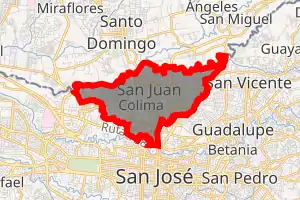
The canton forms a northern suburb of the national capital city of San José. It is triangular in shape, with the Virilla River as its northern boundary. The Quebrada Rivera, a canyon, establishes the southwestern limit of the canton and also a portion of the southeastern boundary.
Districts
The canton of Tibás is subdivided into the following districts:
Demographics
| Historical population | |||
|---|---|---|---|
| Census | Pop. | %± | |
| 1927 | 4,579 | — | |
| 1950 | 10,594 | 131.4% | |
| 1963 | 23,946 | 126.0% | |
| 1973 | 35,602 | 48.7% | |
| 1984 | 57,693 | 62.0% | |
| 2000 | 72,074 | 24.9% | |
| 2011 | 64,842 | −10.0% | |
|
Instituto Nacional de Estadística y Censos[6] |
|||
For the 2011 census, Tibás had a population of 64,842 inhabitants. [8]
Tibás includes both industrial and residential neighborhoods and is home of a popular football team in Costa Rica, Deportivo Saprissa and its stadium Estadio Ricardo Saprissa.
Transportation
Road transportation
The canton is covered by the following road routes:
Rail transportation
The Interurbano Line operated by Incofer goes through this canton.
References
- Hernández, Hermógenes (1985). Costa Rica: evolución territorial y principales censos de población 1502 - 1984 (in Spanish) (1 ed.). San José: Editorial Universidad Estatal a Distancia. pp. 164–173. ISBN 9977-64-243-5. Retrieved 5 October 2020.
- "Declara oficial para efectos administrativos, la aprobación de la División Territorial Administrativa de la República N°41548-MGP". Sistema Costarricense de Información Jurídica (in Spanish). 19 March 2019. Retrieved 26 September 2020.
- División Territorial Administrativa de la República de Costa Rica (PDF) (in Spanish). Editorial Digital de la Imprenta Nacional. 8 March 2017. ISBN 978-9977-58-477-5.
- "Historia del Cantón de Tibás". Tibás. Retrieved 2015-09-04.
- "Área en kilómetros cuadrados, según provincia, cantón y distrito administrativo". Instituto Nacional de Estadística y Censos (in Spanish). Retrieved 26 September 2020.
- "Instituto Nacional de Estadística y Censos" (in Spanish).
- "Sistema de Consulta de a Bases de Datos Estadísticas". Centro Centroamericano de Población (in Spanish).
- "Censo. 2011. Población total por zona y sexo, según provincia, cantón y distrito". Instituto Nacional de Estadística y Censos (in Spanish). Retrieved 26 September 2020.
