Civitella San Paolo
Civitella San Paolo is a comune (municipality) in the Metropolitan City of Rome in the Italian region of Lazio, located about 35 kilometres (22 mi) north of Rome.
Civitella San Paolo | |
|---|---|
| Comune di Civitella San Paolo | |
Location of Civitella San Paolo 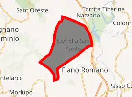
| |
 Civitella San Paolo Location of Civitella San Paolo in Italy 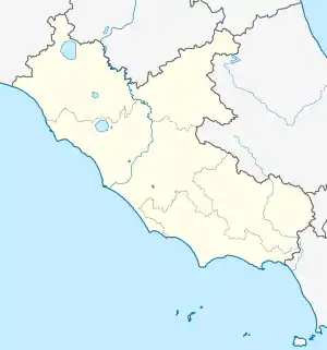 Civitella San Paolo Civitella San Paolo (Lazio) | |
| Coordinates: 42°12′N 12°35′E | |
| Country | Italy |
| Region | Lazio |
| Metropolitan city | Rome (RM) |
| Government | |
| • Mayor | Basilio Rocco Stefani |
| Area | |
| • Total | 20.53 km2 (7.93 sq mi) |
| Elevation | 195 m (640 ft) |
| Population (30 June 2017)[2] | |
| • Total | 2,048 |
| • Density | 100/km2 (260/sq mi) |
| Time zone | UTC+1 (CET) |
| • Summer (DST) | UTC+2 (CEST) |
| Postal code | 00060 |
| Dialing code | 0765 |
| Patron saint | St. James |
| Saint day | 20 March |
| Website | Official website |
Physical geography
Territory
The municipal territory of Civitella San Paolo borders the municipalities of Capena to the south, Fiano Romano to the east, Sant'Oreste and Rignano Flaminio to the west, and Ponzano Romano and Nazzano to the north. It is about forty-five kilometers from Rome, ten from Capena, and seven from Fiano Romano.
The territory, mainly hilly, reaches its maximum altitude with the 288 m of the hill of Monte Cucolo.[3]
References
- "Superficie di Comuni Province e Regioni italiane al 9 ottobre 2011". Istat. Retrieved 16 March 2019.
- All demographics and other statistics: Italian statistical institute Istat.
- "Cartografia della Regione Lazio". Unknown parameter
|urlarchivio=ignored (|archive-url=suggested) (help); Unknown parameter|accesso=ignored (|access-date=suggested) (help); Unknown parameter|dataarchivio=ignored (|archive-date=suggested) (help); Unknown parameter|urlmorto=ignored (|url-status=suggested) (help)
| Authority control |
|---|
This article is issued from Wikipedia. The text is licensed under Creative Commons - Attribution - Sharealike. Additional terms may apply for the media files.