Civitavecchia
Civitavecchia (pronounced [ˌtʃivitaˈvɛkkja]; meaning "ancient town") is a city and comune of the Metropolitan City of Rome in the central Italian region of Lazio. A sea port on the Tyrrhenian Sea, it is located 60 kilometres (37 miles) west-north-west of the center of Rome. The harbour is formed by two piers and a breakwater, on which stands a lighthouse. Civitavecchia had a population of around 53,000 as of 2015.
Civitavecchia | |
|---|---|
| Città di Civitavecchia | |
 Civitavecchia fort and harbour | |
 Coat of arms | |
.svg.png.webp) Location of Civitavecchia in the Metropolitan City of Rome Capital | |
Location of Civitavecchia 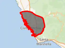
| |
 Civitavecchia Location of Civitavecchia in Italy 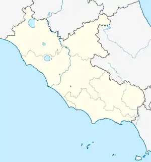 Civitavecchia Civitavecchia (Lazio) | |
| Coordinates: 42°06′N 11°48′E | |
| Country | Italy |
| Region | Lazio |
| Metropolitan city | Rome (RM) |
| Frazioni | Aurelia, La Scaglia |
| Government | |
| • Mayor | Antonio Cozzolino (M5S) |
| Area | |
| • Total | 71.95 km2 (27.78 sq mi) |
| Elevation | 4 m (13 ft) |
| Population (31 August 2015)[2] | |
| • Total | 53,027 |
| • Density | 740/km2 (1,900/sq mi) |
| Demonym(s) | Civitavecchiesi |
| Time zone | UTC+1 (CET) |
| • Summer (DST) | UTC+2 (CEST) |
| Postal code | 00053 |
| Dialing code | 0766 |
| Patron saint | Saint Fermina |
| Saint day | 28 April |
| Website | www |
History
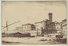
The modern city was built over a pre-existing Etruscan settlement.
The harbour was constructed by the Emperor Trajan at the beginning of the 2nd century. The first occurrence of the name Centum Cellae is from a letter by Pliny the Younger (AD 107). The origin of the name is disputed: it has been suggested that it could refer to the centum ("hundred") halls of the villa of the emperor.
In the early Middle Ages (530s), Centumcellae was a Byzantine stronghold. It became part of the Papal States in 728. As the port was raided by the Saracens in 813–814, 828, 846 and finally in 876, a new settlement in a more secure place was therefore built by order of Pope Leo VII as soon as 854. The Popes gave the settlement as a fief to several local lords, including the Count Ranieri of Civitacastellana and the Abbey of Farfa, and the Di Vico, who held Centumcellae in 1431. In that year, pope Eugene IV sent an army under cardinal Giovanni Vitelleschi and several condottieri (Niccolò Fortebraccio, Ranuccio Farnese and Menicuccio dell'Aquila among them) to recapture the place, which, after the payment of 4,000 florins, became thenceforth a full Papal possession, led by a vicar and a treasurer.
The place became a free port under Pope Innocent XII in 1696 and by the modern era was the main port of Rome. The French Empire occupied it in 1806. On 16 April 1859 the Rome and Civitavecchia Rail Road was opened for service.
The Papal troops opened the gates of the fortress to the Italian general Nino Bixio in 1870. This permanently removed the port from papal control.
During World War II, Allied bombings severely damaged Civitavecchia, and caused civilian casualties.[3]
Economy
Civitavecchia is today a major cruise and ferry port, the main starting point for sea connection from central Italy to Sardinia, Sicily, Malta, Tunis and Barcelona. Fishing has a secondary importance.
The city is also the seat of two thermal power stations. The conversion of one of them to coal has raised the population's protests, as it is feared it could create heavy pollution.
Main sights
The massive Forte Michelangelo was first commissioned from Donato Bramante by Pope Julius II, to defend the port of Rome. The upper part of the "maschio" tower, however, was designed by Michelangelo, whose name is generally applied to the fortress. North of the city at Ficoncella are the Terme Taurine baths frequented by Romans and still popular with the Civitavecchiesi. The modern name stems from the common fig plants among the various pools. And also next to the town is the location of the cruise ship docks. All major cruise lines start and end their cruises at this location, and others stop for shore excursion days that allow guests to see Rome and Vatican sights, which are ninety minutes away.
Geography
Climate
Civitavecchia experiences a Mediterranean climate (Köppen climate classification Csa).
| Climate data for Civitavecchia | |||||||||||||
|---|---|---|---|---|---|---|---|---|---|---|---|---|---|
| Month | Jan | Feb | Mar | Apr | May | Jun | Jul | Aug | Sep | Oct | Nov | Dec | Year |
| Average high °C (°F) | 12.8 (55.0) |
13.1 (55.6) |
14.6 (58.3) |
16.7 (62.1) |
20.3 (68.5) |
23.6 (74.5) |
26.5 (79.7) |
27.0 (80.6) |
24.9 (76.8) |
21.4 (70.5) |
17.0 (62.6) |
13.9 (57.0) |
19.3 (66.8) |
| Average low °C (°F) | 7.1 (44.8) |
7.4 (45.3) |
8.5 (47.3) |
10.6 (51.1) |
14.3 (57.7) |
17.5 (63.5) |
20.3 (68.5) |
20.5 (68.9) |
18.5 (65.3) |
15.2 (59.4) |
11.1 (52.0) |
8.1 (46.6) |
13.3 (55.9) |
| Average precipitation mm (inches) | 94 (3.7) |
71 (2.8) |
51 (2.0) |
53 (2.1) |
43 (1.7) |
18 (.7) |
10 (.4) |
25 (1) |
56 (2.2) |
84 (3.3) |
89 (3.5) |
71 (2.8) |
670 (26.2) |
| Source: [4] | |||||||||||||
Transport
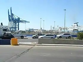
The Port of Civitavecchia, also known as "Port of Rome",[5] is an important hub for the maritime transport in Italy, for goods and passengers. Part of the "Motorways of the Sea"[6] it is linked to several Mediterranean ports and represents one of the main links between Italian mainland to Sardinia.
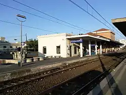
Civitavecchia railway station, opened in 1859, is the western terminus of the Rome–Civitavecchia railway, which forms part of the Pisa–Livorno–Rome railway. A short line linking the town center to the harbour survived until the early 2000s.[7] It counted two stations: Civitavecchia Marittima, serving the port, and Civitavecchia Viale della Vittoria.
Civitavecchia is served by the A12, an unconnected motorway linking Rome to Genoa and by the State highway SS1 Via Aurelia, which also links the two stretches. The town is also interested by a project regarding a new motorway, the Civitavecchia-Venice or New Romea,[8] nowadays completed as a dual carriageway between Viterbo and Ravenna (via Terni, Perugia and Cesena) and commonly known in Italy as the Orte-Ravenna.
Education
The commune has multiple preschools,[9] primary schools,[10] junior high schools,[11] and high schools.[12] Polo Universitario di Civitavecchia is located in the city.
Twin towns and sister cities
Civitavecchia is twinned with:
 Amelia, Italy
 Bethlehem, Palestinian Authority, since 2000[13][14][15]
 Ishinomaki, Japan
 Nantong, China
People
- Manuele Blasi (b. 1980), football player
- Silvio Branco (b. 1966), professional boxer
- Andrea Casali (1705–1784), Rococo painter
- Alessio De Sio (1968), journalist, city mayor from 2001 to 2005, director of communication of "Hitachi" Rail Italy ex 'AnsaldoBreda"
- Pasquale Lattanzi (b. 1950), former football player
- Giancarlo Peris (b. 1941), former track athlete
- Roberto Petito (b. 1971), road bicycle racer
- Giulio Saraudi (1938–2005), boxer
- Eugenio Scalfari (b. 1924), journalist, founder of la Repubblica
- Emiliano Sciarra (b. 1971), game designer[16]
- Roldano Simeoni (b. 1948), former water polo player
- Vittorio Tamagnini (1910–1981), boxer
- persona a caso;) (2021),ciao
See also
- Civitavecchia Calcio
- Civitavecchia di Arpino
References
- "Superficie di Comuni Province e Regioni italiane al 9 ottobre 2011". Istat. Retrieved 16 March 2019.
- "Popolazione Residente al 1° Gennaio 2018". Istat. Retrieved 16 March 2019.
- http://www.portofrome.it/history-of-civitavecchia/?lang=en
- "Civitavecchia historic weather averages in Italy". Intellicast. Retrieved 3 June 2009.
- (in Italian) Port of Civitavecchia website
- Infos at R.A.M. website (search the list of ports) Archived April 19, 2011, at the Wayback Machine
- (in Italian) Historical infos and pictures about the Civitavecchia-Cv. Marittima rail line
- (in Italian) Article at ANAS website
- "Scuole dell'Infanzia Archived 2014-12-21 at the Wayback Machine." Commune of Civitavecchia. Retrieved on December 21, 2014.
- "Scuole elementari Archived 2014-12-21 at the Wayback Machine." Commune of Civitavecchia. Retrieved on December 21, 2014.
- "Scuola media inferiore Archived 2014-12-21 at the Wayback Machine." Commune of Civitavecchia. Retrieved on December 21, 2014.
- "Scuole medie superiori Archived 2014-12-21 at the Wayback Machine." Commune of Civitavecchia. Retrieved on December 21, 2014.
- "Twinning with Palestine". The Britain - Palestine Twinning Network. Archived from the original on 2012-06-28. Retrieved 2008-11-29.
- The City of Bethlehem has signed a twinning agreements with the following cities Bethlehem Municipality.
- "::Bethlehem Municipality::". www.bethlehem-city.org. Archived from the original on 2010-07-24. Retrieved 2009-10-10.
- https://boardgamegeek.com/boardgamedesigner/1581/emiliano-sciarra
External links
| Wikimedia Commons has media related to Civitavecchia. |
| Wikivoyage has a travel guide for Civitavecchia. |