Clinton Field
Clinton Field (FAA LID: I66) is a public use airport located four nautical miles (7 km) northwest of the central business district of Wilmington, a city in Clinton County, Ohio, United States. It is owned by the Clinton County Board of Commissioners.[1] This airport is included in the FAA's National Plan of Integrated Airport Systems (2009-2013), which categorizes it as a general aviation facility.[2]
Clinton Field | |||||||||||
|---|---|---|---|---|---|---|---|---|---|---|---|
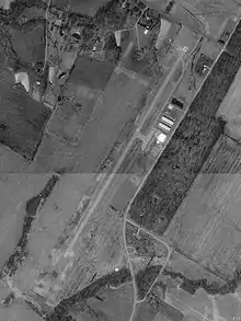 USGS aerial image as of 22 March 1994 | |||||||||||
| Summary | |||||||||||
| Airport type | Public | ||||||||||
| Owner | Clinton County Board of Commissioners | ||||||||||
| Serves | Clinton County, Ohio | ||||||||||
| Location | Wilmington, Ohio | ||||||||||
| Elevation AMSL | 1,033 ft / 315 m | ||||||||||
| Coordinates | 39°30′09″N 083°51′48″W | ||||||||||
| Map | |||||||||||
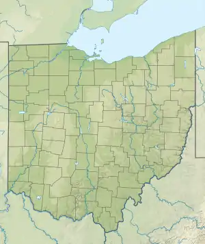 I66 Location of airport in Ohio/United States  I66 I66 (the United States) | |||||||||||
| Runways | |||||||||||
| |||||||||||
| Statistics (2006) | |||||||||||
| |||||||||||
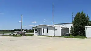
Facilities and aircraft
Clinton Field covers an area of 47 acres (19 ha) at an elevation of 1,033 feet (315 m) above mean sea level. It has one runway designated 3/21 with an asphalt surface measuring 3,579 by 65 feet (1,091 x 20 m). During May through September the airport is attended from 08:00 to 20:00. During October through April it is attended from 08:00 to 17:00. The fixed-base operator (FBO) is closed Thanksgiving, Christmas and Easter.[1]
For the 12-month period ending September 9, 2019, the airport had 27,860 aircraft operations, an average of 74 per day: 97% general aviation, 2% air taxi and less than 1% military. At that time there were 27 aircraft based at this airport.[1]
References
- FAA Airport Form 5010 for I66 PDF. Federal Aviation Administration. effective 27 Aug 2009.
- FAA National Plan of Integrated Airport Systems: 2009-2013. Federal Aviation Administration. Published 1 Oct 2008.
External links
- GW Aviation, the fixed-base operator (FBO)
- FAA Terminal Procedures for I66, effective January 28, 2021
- Resources for this airport:
- FAA airport information for I66
- AirNav airport information for I66
- FlightAware airport information and live flight tracker
- SkyVector aeronautical chart for I66