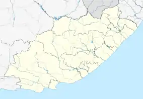
Cofimvaba
Cofimvaba is a town in Chris Hani District Municipality in the Eastern Cape province of South Africa.[2]
Cofimvaba | |
|---|---|
 Cofimvaba  Cofimvaba  Cofimvaba | |
| Coordinates: 32°0′9″S 27°34′50″E | |
| Country | South Africa |
| Province | Eastern Cape |
| District | Chris Hani |
| Municipality | Intsika Yethu |
| Area | |
| • Total | 21.19 km2 (8.18 sq mi) |
| Population (2011)[1] | |
| • Total | 8,783 |
| • Density | 410/km2 (1,100/sq mi) |
| Racial makeup (2011) | |
| • Black African | 98.3% |
| • Coloured | 0.5% |
| • Indian/Asian | 0.3% |
| • White | 0.5% |
| • Other | 0.5% |
| First languages (2011) | |
| • Xhosa | 93.1% |
| • English | 2.6% |
| • Other | 4.3% |
| Time zone | UTC+2 (SAST) |
| PO box | 5380 |
| Area code | 047 |
The village is 79 km east of Queenstown on the route to Butterworth, in Thembuland. Probably named after the nearby stream which, after rains, froths turbulently and resembles milk. The name is also said to be derived from cofa, ‘press’, mvaba, ‘milk-bag’ (of goat-skin), done to break lumps of sour milk. Another explanation is that the sound of the water gurgling over the rocks is reminiscent of the splashing of milk in the bag when shaken.[3]
The village of Cofimvaba was probably established in 1877 when the magisterial seat for Thembuland, (which had originally been located at St Marks), was transferred to a more accessible location. Chris Hani was born in Cofimvaba.
There is a hospital in Cofimvaba called Cofimvaba Hospital. There are also two high schools in town, St. James High School and Cofimvaba High School.
References
- "Main Place Cofimvaba". Census 2011.
- "Eastern Cape Development Corporation". Eastern Cape Development Corporation. Archived from the original on 2010-04-14. Retrieved 2012-08-31.
- "Dictionary of Southern African Place Names (Public Domain)". Human Science Research Council. p. 120.
Municipalities and communities of Chris Hani District Municipality, Eastern Cape | ||
|---|---|---|
District seat: Queenstown | ||
| Intsika Yethu | .svg.png.webp) Chris Hani District within South Africa | |
| Enoch Mgijima | ||
| Engcobo | ||
| Emalahleni | ||
| Inxuba Yethemba | ||
| Sakhisizwe | ||
