Colón, La Libertad
Colón is a municipality in the La Libertad department of El Salvador.
Colón, La Libertad | |
|---|---|
Municipality | |
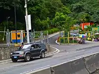
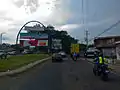
 The entrance to Colón via the Pan-American Highway | |
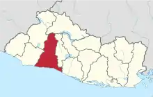
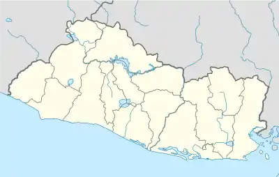 Colón, La Libertad Location in El Salvador | |
| Coordinates: 13°43′N 89°22′W | |
| Country | |
| Department | La Libertad |
| Area | |
| • Total | 32.45 sq mi (84.05 km2) |
| Elevation | 1,870 ft (570 m) |
| Population | |
| • Total | 96,989 |
| Time zone | UTC-6 (CST) |
Colón is surrounded by the municipalities of Santa Tecla, Quezaltepeque, San Juan Opico, Ciudad Arce, and Sacacoyo y Talnique. The municipality was previously known as El Guarumal, and was made a town on 20 August 1886, and a village (villa) on 24 July 1986.
Cantons
The municipality is bordered by various cantons:
- Botoncillal
- Cobanal
- Cuyagualo
- El Capulín
- El Limón
- El Manguito
- Entre Ríos
- Hacienda Nueva
- Las Angosturas
- Las Brisas
- Las Moras
- Lourdes
Tourism
Colón has Los Chorros (a bathing resort) which was destroyed in the 2001 earthquake, but reopened in March 2008.
Security
The city was considered to be one of the most dangerous in the country, reporting various homicides and notorious activity of gangs, locally called maras, however; due to recent reinforcement of security measurement applied by Nayib Bukele's administration, activity of gangs and homicides index have dropped dramatically since June 2019