La Libertad, La Libertad
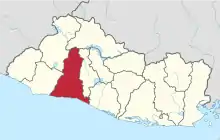
La Libertad «Liberty» is a municipality in the La Libertad Department of El Salvador. It had a population of 35,997 inhabitants in 2007 according to the official census of that year.[1] It is one of the main tourist attractions in the country.
La Libertad
La Libertad | |
|---|---|
Municipality | |
 La Libertad Location in El Salvador | |
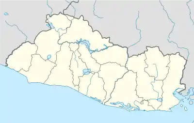
| Coordinates: 13°29′N 89°19′W | |
| Country | |
| Department | La Libertad |
| Government | |
| • Mayor | Miguel Jiménez (ARENA) |
| Elevation | 100 ft (30 m) |
| Population | |
| • Urban | 35,997 |
| • Metro | 45,007 |
| Postal code | 1511 |
History
In 1770 this area was referred to by Pedro Cortes, the Archbishop of Guatemala (1776–1779), as the "hacienda Tepeahua", one of the largest estates in the parish of San Jacinto. The region was known as Tepeahua, a name derived from a Nahuatl expression meaning "mountain of the oak trees", before the Congress of the Federal Republic of Central America authorized the name "Puerto de La Libertad" (Port of Freedom) on February 24, 1824. The national assembly chartered commercial trade on the Pacific coast in 1831, and the first steamboat arrived at La Libertad on June 7, 1857.
La Libertad was incorporated as a village by an Executive decree of July 19, 1858, which was approved by the Congress on February 11, 1859. This was done to relieve the community's excessive dependence on the town of Huizúcar, located at a considerable distance and connected by bad roads.
The town became part of the department of La Libertad on January 28, 1865, and by 1869 had a population of 266 inhabitants. On May 4, 1867, the Salvadoran government awarded the contract for construction of an iron pier, which opened on October 7, 1869.[2] Prior to this, barges were unloaded by securing them with mooring lines. The Salvadoran government enfranchised La Libertad as a villa (town) on March 10, 1874, and as a ciudad (city) on 23 August 1957. The telegraph line between San Salvador and the port was inaugurated on April 27, 1870.
The municipality covers an area of 162 km² and its highest elevation is 10m above sea level. The local economy is based on agriculture and the service sector.[3] The fiestas patronales (patron saint festivals) are celebrated in December in honor of the Immaculate Conception.
Tourism
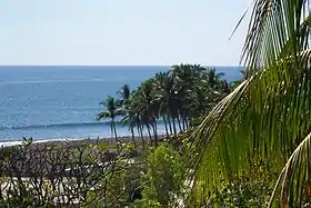
El Puerto de La Libertad is one of the most representative tourist destinations in El Salvador.[3] The resort includes a boardwalk, restaurants and an amphitheater, while small seafood markets and craft shops are located at the wharf. Construction of the first phase of the work was inaugurated on January 6, 2006,[4] and completed in early 2010.[5]
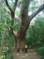
Other beaches located in the municipality include Las Flores, San Diego, El Obispo, La Paz and El Majahual.[6] Among the area's highlights is the Parque Nacional Walter Thilo Deininger (Walter Thilo Deininger National Park), situated on the Coastal Highway (CA-2) near Playa San Diego, going east from La Libertad towards the El Salvador International Airport. The Deiningers were the first German immigrants to settle in the La Libertad department. They established dairies, cattle ranches and coffee plantations.
Surfing

La Libertad has one of the best right hand point breaks in Central America, and is El Salvador's surf capital, with surf shops, board rentals and repair shops. Punta Roca (Rock Point) hosts regional and international surfing championships. It is known for its fast and hollow waves, many of which break for 100–200 yards (90–180m). As recently as the 1970s only a few local surfers ventured there, until it was discovered by a few internationally recognized surfers, including Gerry Lopez, who traveled there frequently. He encouraged a new cadre of locals to adopt the sport. El Salvador went through a civil war in the 1980s, and getting to Punta Roca became dangerous. This slowed the influx of visitors, and resulted in a scarcity of surf boards for the locals, whose only means of obtaining a surf board was by travelers leaving them behind in exchange for guidance and accommodations. The well-known local surfer, "Yepi", was one of the first in his generation to take a leadership role in popularizing the sport among Salvadorans. Other local surfers have helped spread surfing's popularity throughout the country by offering custom surf tours to tourists and other visitors.
The main break extends from La Punta to the township, a distance of about 800m, although single rides do not normally connect the sections through the whole distance. There are three main sections: the top of the point is a hollow and fast wave called "La Punta". The middle section is in front of the cemetery. The inside cove, fronting the town's restaurants, is called "La Paz"; this section is good for longboarding. On a good day, when the swell is 6 to 8 feet high (Hawaiian scale), the upper part of the point produces the best waves, allowing a ride of about 300m or more. It is relatively easy to "drop in" on the long, fast, and powerful walls, which turn into hollow barrels on the best days. The main takeoff is close to a dangerous rock which often sticks out of the water, and has caused injuries. Surfing is good on all tides, although low tide probably produces more barreled waves. The wave form of this break is unusual in that it often breaks at a slight angle to the shoreline, hitting it slightly squarely, creating powerful and fast walls. It can be difficult to get outside in large swells, and the rocky shoreline is notorious for its difficult entry.
Further down the point are a few other breaks, including next to the cemetery and in the town itself. These are less crowded and can produce waist-high waves on occasions, but the world-class section of the point is far outside of town.
Other surf spots in the region include: Conchalio, La Paz, San Diego, EL Zunzal, La Bocana, and El Zonte.[7]
The Pier

El Puerto de La Libertad was the first port built in El Salvador. It has evolved into a fishing boat port, a farmers market, and a tourist attraction. Two newer ports in the country have replaced it economically, La Union and Puerto de Acajutla. The original pier was built in 1869, but over time the structure deteriorated and was replaced by a modern structure, which underwent a major renovation in 2003. Fishing boats are lowered into the ocean by a crane located at its end. Local fishermen sell their catch of the day here; seafood on display includes a variety of fish such as snapper, tuna, and rays, as well as squid, shrimp, lobster, blue crabs (popularly known as "jaibas"), clams, and scallops. During the 2001 series of earthquakes the pier was partially damaged; the damaged section was reconstructed and reinforced.[7]
Transportation
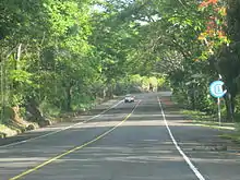
Several freeways connect the city of La Libertad with the rest of the country, among these are:
- CA-4 or Carretera al Puerto - Connects to San Salvador
- CA-2 or El Litoral - Connects to Sonsonate, Zacatecoluca, Ahuachapán, and to the international airport.
Other freeways and roads connecting with La Libertad non-directly are:
- CA-5 - detour to CA-2 connects to San Salvador
- CA-11 - detour to CA-2 connects to San Julian, El Salvador
- CA-12 - detour to CA-2 connects to Acajutla, Santa Ana & Sonsonate
- CA-15 - detour to CA-2 connects to Ahuchapan
- CA-6 - detour to CA-2 connects to Santa Cruz, El Salvador
References
- "DIRECCION GENERAL DE ESTADISTICA Y CENSOS - DIGESTYC". Digestyc.gob.sv. Retrieved 29 August 2019.
- Francisco J. Monterey (1978): Historia de El Salvador, Anotaciones Cronológicas, p. 348. Editorial Universitaria: San Salvador.
- ACUA: PUERTO LA LIBERTAD Archived 2010-09-29 at the Wayback Machine.
- El Diario de Hoy: Arranca complejo turístico de La Libertad.
- La Prensa Gráfica: El puerto de La Libertad con nuevo rostro.
- Puerto La Libertad: Las Playas Archived 2013-08-15 at the Wayback Machine.
- "El Puerto de La Libertad - Otro desperdicio". Hunnapuh - Comentarios.
| Wikimedia Commons has media related to La Libertad, La Libertad. |
