Colorado, Pococí
Colorado is a district of the Pococí canton, in the Limón province of Costa Rica.[1][2] It is at the northeastern border of Costa Rica where it meets Nicaragua and the Caribbean Sea.
Colorado | |
|---|---|
Colorado district | |
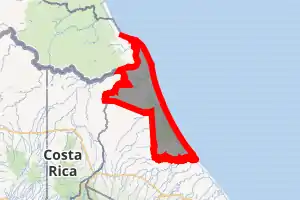
 Colorado Colorado district location in Costa Rica | |
| Coordinates: 10.613232°N 83.5932461°W | |
| Country | |
| Province | Limón |
| Canton | Pococí |
| Creation | 2 July 1971 |
| Area | |
| • Total | 1,158.91 km2 (447.46 sq mi) |
| Elevation | 5 m (16 ft) |
| Population (2011) | |
| • Total | 3,985 |
| • Density | 3.4/km2 (8.9/sq mi) |
| Time zone | UTC−06:00 |
| Postal code | 70206 |
Its main population center is Barra del Colorado, located at an altitude of 5 msnm, on the banks of the Colorado River, an important distributary of the San Juan border river.
History
Colorado was created on 2 July 1971 by Decreto Ejecutivo 1825-G. Segregated from Guápiles.[2]
Geography
Colorado has an area of 1,158.91 km² which corresponds to about 48% of the cantonal area [3] and an elevation of 5 metres.[1]
Within the limits of the district is the Calero Island (151.6 km², the largest in the country). Another important and near fluvial island is the Brava Island (44.4 km²).
The territory of the district is a continuation of the alluvial plains of the north of the country. With small elevations isolated like the hills Coronel, Cocorí and Tortuguero (of 119 masl).
Colorado basically consists of protected wildlife areas, in particular it is located there, the Barra del Colorado Wildlife Refuge and the Tortuguero National Park.
Hydrography
An intense and permanent pluvial activity precipitates of 5,500 to 6,000 mm of water per year, flooding the plain, already saturated by the waters of the rivers San Juan, Colorado and Chirripó in its northern limit. To the south, the main rivers are the Suerre, Jiménez and Parismina, which feed the artificial channel of Tortuguero.
The water covers much of the district, in the form of rivers, pipes, canals, lagoons or marshes.
Demographics
| Historical population | |||
|---|---|---|---|
| Census | Pop. | %± | |
| 1973 | 1,007 | — | |
| 1984 | 885 | −12.1% | |
| 2000 | 3,482 | 293.4% | |
| 2011 | 3,985 | 14.4% | |
|
Instituto Nacional de Estadística y Censos[4] |
|||
For the 2011 census, Colorado had a population of 3,985 inhabitants, it has one of the lowest demographic densities at the national level. [6]
Settlements
The district is made up of the following population centers:
- Neighborhoods (Barrios): Barra del Colorado Este
- Villages (Poblados): Aragón, Buenavista, Malanga, San Gerardo, Tortuguero
Transportation
The communication with the zone is essentially fluvial or aerial, due to the little development of the terrestrial routes.
Road transportation
The district is covered by the following road routes:
Canals
A 78 km long river canal connects the southern boundary of Barra del Colorado with the Port of Moin along the Caribbean Sea coast.
Airport
Climate
Barra del Colorado has a very wet tropical rainforest climate (Af) with heavy rainfall from February to April and very heavy to extremely heavy rainfall in the remaining months.
| Climate data for Barra del Colorado | |||||||||||||
|---|---|---|---|---|---|---|---|---|---|---|---|---|---|
| Month | Jan | Feb | Mar | Apr | May | Jun | Jul | Aug | Sep | Oct | Nov | Dec | Year |
| Average high °C (°F) | 29.8 (85.6) |
30.4 (86.7) |
31.6 (88.9) |
31.9 (89.4) |
31.6 (88.9) |
30.5 (86.9) |
30.5 (86.9) |
30.1 (86.2) |
30.2 (86.4) |
30.1 (86.2) |
29.1 (84.4) |
29.1 (84.4) |
30.4 (86.7) |
| Daily mean °C (°F) | 25.6 (78.1) |
26.1 (79.0) |
27.2 (81.0) |
27.8 (82.0) |
27.5 (81.5) |
26.6 (79.9) |
26.9 (80.4) |
26.4 (79.5) |
26.1 (79.0) |
26.0 (78.8) |
25.4 (77.7) |
25.2 (77.4) |
26.4 (79.5) |
| Average low °C (°F) | 21.5 (70.7) |
21.9 (71.4) |
22.9 (73.2) |
23.7 (74.7) |
23.4 (74.1) |
22.7 (72.9) |
23.3 (73.9) |
22.7 (72.9) |
22.0 (71.6) |
21.9 (71.4) |
21.7 (71.1) |
21.4 (70.5) |
22.4 (72.4) |
| Average precipitation mm (inches) | 500 (19.7) |
285 (11.2) |
184 (7.2) |
269 (10.6) |
375 (14.8) |
459 (18.1) |
749 (29.5) |
538 (21.2) |
341 (13.4) |
472 (18.6) |
711 (28.0) |
751 (29.6) |
5,634 (221.9) |
| Source: Climate-Data.org[7] | |||||||||||||
References
- "Declara oficial para efectos administrativos, la aprobación de la División Territorial Administrativa de la República N°41548-MGP". Sistema Costarricense de Información Jurídica (in Spanish). 19 March 2019. Retrieved 26 September 2020.
- División Territorial Administrativa de la República de Costa Rica (PDF) (in Spanish). Editorial Digital de la Imprenta Nacional. 8 March 2017. ISBN 978-9977-58-477-5.
- "Área en kilómetros cuadrados, según provincia, cantón y distrito administrativo". Instituto Nacional de Estadística y Censos (in Spanish). Retrieved 26 September 2020.
- "Instituto Nacional de Estadística y Censos" (in Spanish).
- "Sistema de Consulta de a Bases de Datos Estadísticas". Centro Centroamericano de Población (in Spanish).
- "Censo. 2011. Población total por zona y sexo, según provincia, cantón y distrito". Instituto Nacional de Estadística y Censos (in Spanish). Retrieved 26 September 2020.
- "Climate: Barra del Colorado". Climate-Data.org. Retrieved July 27, 2020.