Guápiles, Pococí
Guápiles is a district of the Pococí canton, in the Limón province of Costa Rica.[1][2]
Guápiles | |
|---|---|
Guápiles district | |
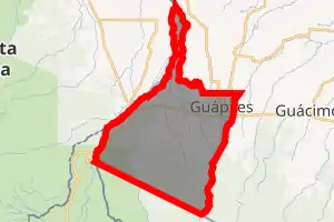
 Guápiles Guápiles district location in Costa Rica | |
| Coordinates: 10.2070395°N 83.8580852°W | |
| Country | |
| Province | Limón |
| Canton | Pococí |
| Creation | 19 September 1911 |
| Area | |
| • Total | 222.63 km2 (85.96 sq mi) |
| Elevation | 262 m (860 ft) |
| Population (2011) | |
| • Total | 36,469 |
| • Density | 160/km2 (420/sq mi) |
| Time zone | UTC−06:00 |
| Postal code | 70201 |
Toponymy
The origin of the name of Guápiles seems to come from the two rivers that run to both sides of the population, since they are said that they are "Guapes" (Twins). Whereas Pococí, name of the canton, corresponds to the name of the native cacique that inhabited this place to the arrival of the Spaniards. Other caciques that inhabited the region were Camaquiri and Cocorí mentioned in historical primers and national Literature.
History
Guápiles was created on 19 September 1911 by Ley 12.[2]
Geography
Guápiles has an area of 222.63 km²[3] and an elevation of 262 metres.[1]
Guápiles is settled to an altitude of 268[4] meters and is considered the main door of entrance to the Costa Rican Caribbean.
Demographics
| Historical population | |||
|---|---|---|---|
| Census | Pop. | %± | |
| 1927 | 1,236 | — | |
| 1950 | 4,636 | 275.1% | |
| 1963 | 7,616 | 64.3% | |
| 1973 | 7,297 | −4.2% | |
| 1984 | 11,216 | 53.7% | |
| 2000 | 27,368 | 144.0% | |
| 2011 | 36,469 | 33.3% | |
|
Instituto Nacional de Estadística y Censos[5] |
|||
For the 2011 census, Guápiles had a population of 36,469 inhabitants. [7]
Locations
The head city is Guápiles, one of the majors outside of the Central Valley (Costa Rica). It is 64 km to the northeast of the capital city of Costa Rica, on the route 32. The city of Limón is to 99 km to the east.
The population centers of the district are:
- City: Guápiles
- Neighborhoods (Barrios): Cecilia, Diamantes, Emilia, Floresta, Coopevigua (1,2,3), Garabito, Palmera, Los Sauces, La Urba, Toro Amarillo
- Villages (Poblados): Blanco, Calle Ángeles, Calle Gobierno, Corinto, Flores, Marina, Prado (part), Rancho Redondo, San Rafael
Economic activity
At present (as in the rest of the Caribbean zone), the main economic activities are agricultural sector: banana and pineapple, sowing of basic grains and livestock activity.
There are regions of great tourist interest for the beauty of the landscape.
Transportation
Road transportation
The district is covered by the following road routes:
References
- "Declara oficial para efectos administrativos, la aprobación de la División Territorial Administrativa de la República N°41548-MGP". Sistema Costarricense de Información Jurídica (in Spanish). 19 March 2019. Retrieved 26 September 2020.
- División Territorial Administrativa de la República de Costa Rica (PDF) (in Spanish). Editorial Digital de la Imprenta Nacional. 8 March 2017. ISBN 978-9977-58-477-5.
- "Área en kilómetros cuadrados, según provincia, cantón y distrito administrativo". Instituto Nacional de Estadística y Censos (in Spanish). Retrieved 26 September 2020.
- "Rural Territorial Development Plan of Pococí" (pdf). INDER.
- "Instituto Nacional de Estadística y Censos" (in Spanish).
- "Sistema de Consulta de a Bases de Datos Estadísticas". Centro Centroamericano de Población (in Spanish).
- "Censo. 2011. Población total por zona y sexo, según provincia, cantón y distrito". Instituto Nacional de Estadística y Censos (in Spanish). Retrieved 26 September 2020.