Colorado State Highway 330
State Highway 330 (SH 330) is a state highway in Mesa County, Colorado. SH 330's western terminus is at SH 65 north of Mesa, and the eastern terminus is at Grove Creek Road in Collbran.
| ||||
|---|---|---|---|---|
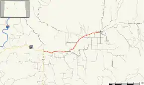 Map of Mesa County in western Colorado with SH 330 highlighted in red | ||||
| Route information | ||||
| Maintained by CDOT | ||||
| Length | 11.395 mi[1] (18.338 km) | |||
| Major junctions | ||||
| West end | ||||
| East end | Grove Creek Road in Collbran | |||
| Location | ||||
| Counties | Mesa | |||
| Highway system | ||||
Colorado State Highways
| ||||

Route description
SH 330 runs 11.4 miles (18.3 km), starting at a junction with SH 65, heading east past Molina and ending at Grove Creek Rd. in Collbran. In 1995, the estimated traffic volume was 1050 vehicles per day near Molina and 1650 vehicles per day near Plateau City.[2]
Major intersections
The entire route is in Mesa County.
| Location | mi | km | Destinations | Notes | |
|---|---|---|---|---|---|
| | 0.000 | 0.000 | Western terminus | ||
| Collbran | 11.395 | 18.338 | Grove Creek Road | Eastern terminus | |
| 1.000 mi = 1.609 km; 1.000 km = 0.621 mi | |||||
References
- "Segment list for SH 330". Retrieved 2011-01-22.
- United States. Bureau of Land Management (1998). Plateau Creek Pipeline Replacement Project: Environmental Impact Statement. Northwestern University. pp. 3–22.
External links
This article is issued from Wikipedia. The text is licensed under Creative Commons - Attribution - Sharealike. Additional terms may apply for the media files.